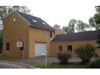
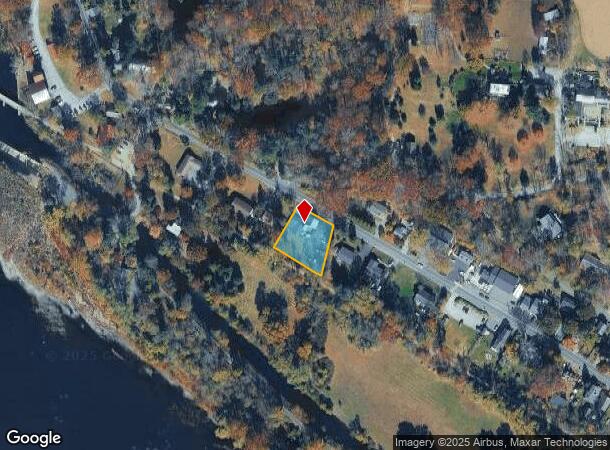
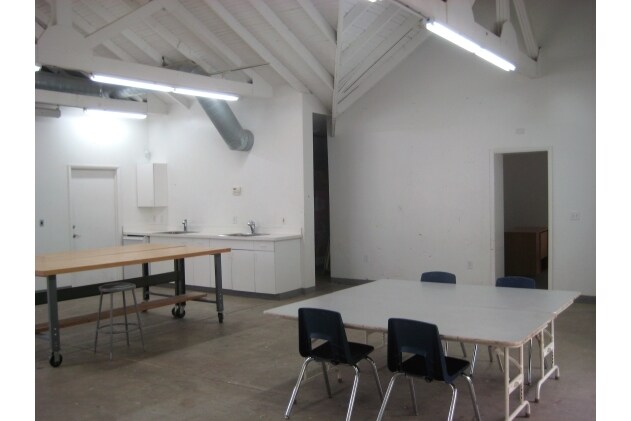
Property Record
21 Risler St, Stockton, NJ 08559
NEARBY LISTINGS FOR SALE OR LEASE
Property Detail
21 Risler St
23-00005-0000-00005
Hunterdon
Commercialnec
New Jersey
AE
5
42017C0211J
0.59 AC
2024
Hunterdon
2025
Northern New Jersey
011600
Newark, NJ-PA
3,649 SF
DEMOGRAPHICS near 21 Risler St
1 Mile
3 Mile
5 Mile
2024 Total Population
741
5,015
21,184
2029 Population
742
4,956
21,105
Pop Growth 2024-2029
+ 0.13%
(1.18%)
(0.37%)
Average Age
49
48
48
2024 Total Households
331
2,095
9,204
HH Growth 2024-2029
+ 0.30%
(1.15%)
(0.26%)
Median Household Inc
$125,490
$137,761
$132,598
Avg Household Size
2.20
2.40
2.30
2024 Avg HH Vehicles
2.00
2.00
2.00
Median Home Value
$438,297
$662,650
$643,210
Median Year Built
1959
1973
1974
Nearby Places
Map Layers
Map Styles
 Street
 Aerial
- Restaurants
- Banks
- Shops
- Fitness
- Groceries
PUBLIC TRANSPORTATION
AIRPORT
Trenton Mercer
DRIVE
WALK
Distance
Trenton Mercer
28 min
17.0 mi
Lehigh Valley International
DRIVE
WALK
Distance
Lehigh Valley International
71 min
39.2 mi
Freight Ports
Port of Philadelphia
DRIVE
WALK
Distance
Port of Philadelphia
59 min
34.0 mi
SALE & LEASE HISTORY
LISTING DATE
SALE/LEASE

May 30, 2018
For Sale
Nearby Properties
Address
Land Use
TOTAL SIZE
Lot Size
Zoning
Address
Land Use
TOTAL SIZE
Lot Size
Zoning
10,746 SF
1.68 AC
FP
Address
Land Use
TOTAL SIZE
Lot Size
Zoning
14,429 SF
2.20 AC
COM
Address
Land Use
TOTAL SIZE
Lot Size
Zoning
39,390 SF
1.80 AC
R-2
Address
Land Use
TOTAL SIZE
Lot Size
Zoning
100 AC
I-2
Address
Land Use
TOTAL SIZE
Lot Size
Zoning
6,851 SF
8.55 AC
RL
Address
Land Use
TOTAL SIZE
Lot Size
Zoning
8,340 SF
1 AC
A-1
Address
Land Use
TOTAL SIZE
Lot Size
Zoning
12,391 SF
1 AC
A-1
Address
Land Use
TOTAL SIZE
Lot Size
Zoning
4,510 SF
9.27 AC
R140
Address
Land Use
TOTAL SIZE
Lot Size
Zoning
3,403 SF
1.95 AC
COM
Address
Land Use
TOTAL SIZE
Lot Size
Zoning
14,645 SF
0.66 AC
COM
Address
Land Use
TOTAL SIZE
Lot Size
Zoning
10,291 SF
1.70 AC
A-1
Address
Land Use
TOTAL SIZE
Lot Size
Zoning
13,119 SF
6 AC
A-1
Address
Land Use
TOTAL SIZE
Lot Size
Zoning
158.87 AC
A-1
Address
Land Use
TOTAL SIZE
Lot Size
Zoning
5,262 SF
0.58 AC
CR
Address
Land Use
TOTAL SIZE
Lot Size
Zoning
9,942 SF
1.85 AC
CR
Address
Land Use
TOTAL SIZE
Lot Size
Zoning
5,396 SF
1 AC
A-1
Address
Land Use
TOTAL SIZE
Lot Size
Zoning
141.26 AC
A-2
Address
Land Use
TOTAL SIZE
Lot Size
Zoning
8,749 SF
9.60 AC
A-1
Address
Land Use
TOTAL SIZE
Lot Size
Zoning
9,930 SF
0.63 AC
R110
Address
Land Use
TOTAL SIZE
Lot Size
Zoning
1,560 SF
3.15 AC
PL
Address
Land Use
TOTAL SIZE
Lot Size
Zoning
7,590 SF
1 AC
A-1
Address
Land Use
TOTAL SIZE
Lot Size
Zoning
4,882 SF
4 AC
A-2
Address
Land Use
TOTAL SIZE
Lot Size
Zoning
5,424 SF
1 AC
A-2
Address
Land Use
TOTAL SIZE
Lot Size
Zoning
6.09 AC
PL
Address
Land Use
TOTAL SIZE
Lot Size
Zoning
16,171 SF
0.73 AC
COM
Address
Land Use
TOTAL SIZE
Lot Size
Zoning
1,496 SF
2.56 AC
COM
Address
Land Use
TOTAL SIZE
Lot Size
Zoning
8,901 SF
12.71 AC
V-2
Address
Land Use
TOTAL SIZE
Lot Size
Zoning
5,976 SF
0.72 AC
R115
Address
Land Use
TOTAL SIZE
Lot Size
Zoning
7,762 SF
1 AC
A-1
Address
Land Use
TOTAL SIZE
Lot Size
Zoning
5,675 SF
3 AC
A-1
The World's #1 Commercial Real Estate Marketplace
Connect with us
© 2025 CoStar Group
The information above has been obtained from sources believed reliable. While we do not doubt its accuracy we have not verified it and make no guarantee, warranty or representation about it. It is your responsibility to independently confirm its accuracy and completeness. Any projections, opinions, assumptions, or estimates used are for example only and do not represent the current or future performance of the property. The value of this transaction to you depends on tax and other factors which should be evaluated by your tax, financial, and legal advisors. You and your advisors should conduct a careful, independent investigation of the property to determine to your satisfaction the suitability of the property for your needs.