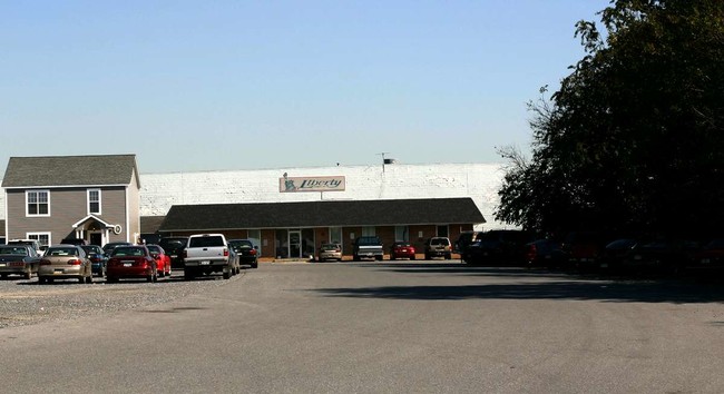
Property Record
21 S Groffdale Rd, Leola, PA 17540

NEARBY LISTINGS FOR SALE OR LEASE
Property Detail
21 S Groffdale Rd
Lancaster, PA
A
360-25894-0-0000
21 S GROFFDALE RD
Lightindustrial
Lancaster
X
Pennsylvania
42071C0385F
20
2024
19.60 AC
2025
Lancaster County
013102
Philadelphia
109,396 SF
DEMOGRAPHICS near 21 S Groffdale Rd
1 Mile
3 Mile
5 Mile
2024 Total Population
1,502
12,303
34,056
2029 Population
1,503
12,345
34,086
Pop Growth 2024-2029
+ 0.07%
+ 0.34%
+ 0.09%
Average Age
38
39
39
2024 Total Households
480
4,355
11,753
HH Growth 2024-2029
0.00%
+ 0.48%
+ 0.26%
Median Household Inc
$85,681
$68,986
$74,386
Avg Household Size
3.00
2.70
2.80
2024 Avg HH Vehicles
2.00
2.00
2.00
Median Home Value
$276,495
$245,759
$282,438
Median Year Built
1975
1972
1976
Nearby Places
Map Layers
Map Styles
 Street
 Aerial
- Restaurants
- Banks
- Shops
- Fitness
- Groceries
PUBLIC TRANSPORTATION
AIRPORT
Harrisburg International
DRIVE
WALK
Distance
Harrisburg International
59 min
40.9 mi
Freight Ports
Port Newark Container Terminal
DRIVE
WALK
Distance
Port Newark Container Terminal
83 min
45.3 mi
Nearby Properties
Address
Land Use
TOTAL SIZE
Lot Size
Zoning
Address
Land Use
TOTAL SIZE
Lot Size
Zoning
2,615,989 SF
147.50 AC
I
Address
Land Use
TOTAL SIZE
Lot Size
Zoning
678,098 SF
40.91 AC
Address
Land Use
TOTAL SIZE
Lot Size
Zoning
137,682 SF
8.73 AC
R-2
Address
Land Use
TOTAL SIZE
Lot Size
Zoning
232,238 SF
74.26 AC
M
Address
Land Use
TOTAL SIZE
Lot Size
Zoning
90,944 SF
8.92 AC
Address
Land Use
TOTAL SIZE
Lot Size
Zoning
83,852 SF
11.59 AC
I
Address
Land Use
TOTAL SIZE
Lot Size
Zoning
148,232 SF
10.61 AC
I
Address
Land Use
TOTAL SIZE
Lot Size
Zoning
148,917 SF
9.85 AC
C-2
Address
Land Use
TOTAL SIZE
Lot Size
Zoning
48,827 SF
7.60 AC
GC
Address
Land Use
TOTAL SIZE
Lot Size
Zoning
112,160 SF
8.20 AC
M
Address
Land Use
TOTAL SIZE
Lot Size
Zoning
133,788 SF
10.10 AC
I
Address
Land Use
TOTAL SIZE
Lot Size
Zoning
129,024 SF
15.80 AC
M
Address
Land Use
TOTAL SIZE
Lot Size
Zoning
64,363 SF
9.10 AC
C
Address
Land Use
TOTAL SIZE
Lot Size
Zoning
112,433 SF
14.60 AC
Address
Land Use
TOTAL SIZE
Lot Size
Zoning
66,473 SF
4.40 AC
I
Address
Land Use
TOTAL SIZE
Lot Size
Zoning
67,400 SF
9.50 AC
I
Address
Land Use
TOTAL SIZE
Lot Size
Zoning
96,870 SF
10.98 AC
I
Address
Land Use
TOTAL SIZE
Lot Size
Zoning
9,387 SF
16.55 AC
Address
Land Use
TOTAL SIZE
Lot Size
Zoning
117,436 SF
2 AC
C
Address
Land Use
TOTAL SIZE
Lot Size
Zoning
106,542 SF
19.30 AC
I
Address
Land Use
TOTAL SIZE
Lot Size
Zoning
106,816 SF
8.50 AC
R-2
Address
Land Use
TOTAL SIZE
Lot Size
Zoning
96,536 SF
15.10 AC
I
Address
Land Use
TOTAL SIZE
Lot Size
Zoning
70,190 SF
10.28 AC
I
Address
Land Use
TOTAL SIZE
Lot Size
Zoning
98,586 SF
9.60 AC
I
Address
Land Use
TOTAL SIZE
Lot Size
Zoning
108,675 SF
30.53 AC
I
Address
Land Use
TOTAL SIZE
Lot Size
Zoning
47,041 SF
11.20 AC
R-2
Address
Land Use
TOTAL SIZE
Lot Size
Zoning
27,136 SF
3.40 AC
Address
Land Use
TOTAL SIZE
Lot Size
Zoning
60,568 SF
8.80 AC
I
Address
Land Use
TOTAL SIZE
Lot Size
Zoning
56,220 SF
19.18 AC
The World's #1 Commercial Real Estate Marketplace
Connect with us
© 2026 CoStar Group
The information above has been obtained from sources believed reliable. While we do not doubt its accuracy we have not verified it and make no guarantee, warranty or representation about it. It is your responsibility to independently confirm its accuracy and completeness. Any projections, opinions, assumptions, or estimates used are for example only and do not represent the current or future performance of the property. The value of this transaction to you depends on tax and other factors which should be evaluated by your tax, financial, and legal advisors. You and your advisors should conduct a careful, independent investigation of the property to determine to your satisfaction the suitability of the property for your needs.