Property Record
21 Thomas J Rhodes Indust Dr, Trenton, NJ 08619


NEARBY LISTINGS FOR SALE OR LEASE
Property Detail
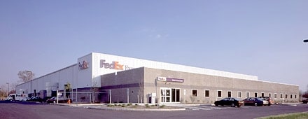
21 Thomas J Rhodes Indust Dr
03-01520-0000-00011-04
Mercer
Vacantlandnec
New Jersey
X
11.4
34021C0143F
11.70 AC
2024
Trenton/295
2025
Northern New Jersey
002904
Trenton, NJ
DEMOGRAPHICS near 21 Thomas J Rhodes Indust Dr
1 Mile
3 Mile
5 Mile
2024 Total Population
3,555
49,647
197,902
2029 Population
3,464
48,843
194,936
Pop Growth 2024-2029
(2.56%)
(1.62%)
(1.50%)
Average Age
45
43
40
2024 Total Households
1,360
19,371
73,231
HH Growth 2024-2029
(2.72%)
(1.76%)
(1.56%)
Median Household Inc
$105,535
$110,051
$90,132
Avg Household Size
2.50
2.50
2.60
2024 Avg HH Vehicles
2.00
2.00
2.00
Median Home Value
$353,698
$317,500
$294,648
Median Year Built
1975
1969
1967
Nearby Places
Map Layers
Map Styles
 Street
 Aerial
- Restaurants
- Banks
- Shops
- Fitness
- Groceries
PUBLIC TRANSPORTATION
COMMUTER RAIL
Hamilton (Northeast Corridor Line - NJ Transit Commuter Rail (NJ Transit))
DRIVE
WALK
Distance
Hamilton (Northeast Corridor Line - NJ Transit Commuter Rail (NJ Transit))
7 min
2.5 mi
Trenton Transit Center (NJT) (Northeast Corridor Line - NJ Transit Commuter Rail (NJ Transit), River LINE - River LINE (River LINE))
DRIVE
WALK
Distance
Trenton Transit Center (NJT) (Northeast Corridor Line - NJ Transit Commuter Rail (NJ Transit), River LINE - River LINE (River LINE))
15 min
6.2 mi
AIRPORT
Trenton Mercer
DRIVE
WALK
Distance
Trenton Mercer
20 min
10.8 mi
Freight Ports
South Jersey Port
DRIVE
WALK
Distance
South Jersey Port
53 min
39.4 mi
SALE & LEASE HISTORY
LISTING DATE
SALE/LEASE

Sep 23, 2016
For Sale
Nearby Properties
Address
Land Use
TOTAL SIZE
Lot Size
Zoning
Address
Land Use
TOTAL SIZE
Lot Size
Zoning
40.83 AC
E
Address
Land Use
TOTAL SIZE
Lot Size
Zoning
73.11 AC
RD-2
Address
Land Use
TOTAL SIZE
Lot Size
Zoning
42.56 AC
RC
Address
Land Use
TOTAL SIZE
Lot Size
Zoning
19.63 AC
MX
Address
Land Use
TOTAL SIZE
Lot Size
Zoning
39.03 AC
HC
Address
Land Use
TOTAL SIZE
Lot Size
Zoning
42.53 AC
R-4B
Address
Land Use
TOTAL SIZE
Lot Size
Zoning
70.44 AC
MX-1
Address
Land Use
TOTAL SIZE
Lot Size
Zoning
Address
Land Use
TOTAL SIZE
Lot Size
Zoning
31.27 AC
LI
Address
Land Use
TOTAL SIZE
Lot Size
Zoning
56.45 AC
EGI
Address
Land Use
TOTAL SIZE
Lot Size
Zoning
27.13 AC
MX
Address
Land Use
TOTAL SIZE
Lot Size
Zoning
17.84 AC
HC
Address
Land Use
TOTAL SIZE
Lot Size
Zoning
Address
Land Use
TOTAL SIZE
Lot Size
Zoning
44.83 AC
I
Address
Land Use
TOTAL SIZE
Lot Size
Zoning
13.75 AC
R4B
Address
Land Use
TOTAL SIZE
Lot Size
Zoning
21.17 AC
I
Address
Land Use
TOTAL SIZE
Lot Size
Zoning
16.45 AC
I-2
Address
Land Use
TOTAL SIZE
Lot Size
Zoning
27.50 AC
R7
Address
Land Use
TOTAL SIZE
Lot Size
Zoning
Address
Land Use
TOTAL SIZE
Lot Size
Zoning
47.84 AC
HC
Address
Land Use
TOTAL SIZE
Lot Size
Zoning
Address
Land Use
TOTAL SIZE
Lot Size
Zoning
28.36 AC
E
Address
Land Use
TOTAL SIZE
Lot Size
Zoning
Address
Land Use
TOTAL SIZE
Lot Size
Zoning
95.98 AC
ROM1
Address
Land Use
TOTAL SIZE
Lot Size
Zoning
21.31 AC
RD-2
Address
Land Use
TOTAL SIZE
Lot Size
Zoning
Address
Land Use
TOTAL SIZE
Lot Size
Zoning
Address
Land Use
TOTAL SIZE
Lot Size
Zoning
9.31 AC
HC
Address
Land Use
TOTAL SIZE
Lot Size
Zoning
16.62 AC
Address
Land Use
TOTAL SIZE
Lot Size
Zoning
12.17 AC
AT
The World's #1 Commercial Real Estate Marketplace
Connect with us
© 2025 CoStar Group
The information above has been obtained from sources believed reliable. While we do not doubt its accuracy we have not verified it and make no guarantee, warranty or representation about it. It is your responsibility to independently confirm its accuracy and completeness. Any projections, opinions, assumptions, or estimates used are for example only and do not represent the current or future performance of the property. The value of this transaction to you depends on tax and other factors which should be evaluated by your tax, financial, and legal advisors. You and your advisors should conduct a careful, independent investigation of the property to determine to your satisfaction the suitability of the property for your needs.