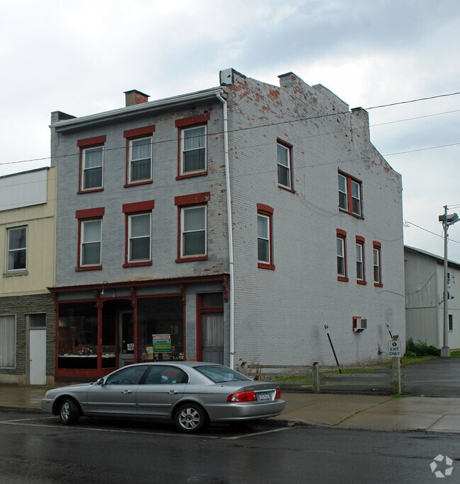
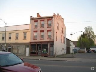
Property Record
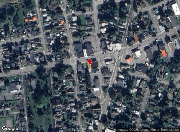
21 W Main St, Mohawk, NY 13407
NEARBY LISTINGS FOR SALE OR LEASE
Property Detail
21 W Main St
Utica-Rome, NY
21 W MAIN ST S COM 23X56
212803-120-047-0005-057-000-0000
Herkimer
Commercialofficeresidentialmixeduse
New York
2025
57.000
2024
0.03 AC
010501
Herkimer County
3,300 SF
Utica/Rome
DEMOGRAPHICS near 21 W Main St
1 Mile
3 Mile
5 Mile
2024 Total Population
2,846
20,823
26,608
2029 Population
2,812
20,647
26,334
Pop Growth 2024-2029
(1.19%)
(0.85%)
(1.03%)
Average Age
42
42
42
2024 Total Households
1,244
8,802
11,265
HH Growth 2024-2029
(1.37%)
(0.81%)
(1.04%)
Median Household Inc
$67,966
$60,637
$60,263
Avg Household Size
2.20
2.20
2.20
2024 Avg HH Vehicles
2.00
2.00
2.00
Median Home Value
$89,032
$96,497
$105,316
Median Year Built
1947
1948
1948
Nearby Places
- Restaurants
- Banks
- Shops
- Fitness
- Groceries
Nearby Properties
Address
Land Use
TOTAL SIZE
Lot Size
Zoning
Address
Land Use
TOTAL SIZE
Lot Size
Zoning
272,335 SF
32.50 AC
RA
Address
Land Use
TOTAL SIZE
Lot Size
Zoning
93,840 SF
2.20 AC
C3
Address
Land Use
TOTAL SIZE
Lot Size
Zoning
151,309 SF
11.50 AC
R3
Address
Land Use
TOTAL SIZE
Lot Size
Zoning
90,636 SF
2.10 AC
C
Address
Land Use
TOTAL SIZE
Lot Size
Zoning
1 AC
GB
Address
Land Use
TOTAL SIZE
Lot Size
Zoning
208,087 SF
18.72 AC
C2
Address
Land Use
TOTAL SIZE
Lot Size
Zoning
122,210 SF
12.50 AC
I1
Address
Land Use
TOTAL SIZE
Lot Size
Zoning
206,440 SF
6.60 AC
R
Address
Land Use
TOTAL SIZE
Lot Size
Zoning
139,863 SF
16.90 AC
Address
Land Use
TOTAL SIZE
Lot Size
Zoning
80,065 SF
19.86 AC
R1
Address
Land Use
TOTAL SIZE
Lot Size
Zoning
19,680 SF
1.10 AC
R3
Address
Land Use
TOTAL SIZE
Lot Size
Zoning
267,566 SF
22.40 AC
M1
Address
Land Use
TOTAL SIZE
Lot Size
Zoning
81,816 SF
1.50 AC
R3
Address
Land Use
TOTAL SIZE
Lot Size
Zoning
77,493 SF
9.70 AC
R3
Address
Land Use
TOTAL SIZE
Lot Size
Zoning
77,280 SF
1.80 AC
PS
Address
Land Use
TOTAL SIZE
Lot Size
Zoning
82,165 SF
4.70 AC
R
Address
Land Use
TOTAL SIZE
Lot Size
Zoning
56,530 SF
10.50 AC
C1
Address
Land Use
TOTAL SIZE
Lot Size
Zoning
98,801 SF
59 AC
R2
Address
Land Use
TOTAL SIZE
Lot Size
Zoning
26,799 SF
1.50 AC
R3
Address
Land Use
TOTAL SIZE
Lot Size
Zoning
24,960 SF
3.10 AC
PS
Address
Land Use
TOTAL SIZE
Lot Size
Zoning
1,503 SF
3.49 AC
C
Address
Land Use
TOTAL SIZE
Lot Size
Zoning
2,662 SF
3.90 AC
C
Address
Land Use
TOTAL SIZE
Lot Size
Zoning
48,893 SF
1.50 AC
C
Address
Land Use
TOTAL SIZE
Lot Size
Zoning
80,832 SF
1.91 AC
B1
Address
Land Use
TOTAL SIZE
Lot Size
Zoning
66,560 SF
1.90 AC
PS
Address
Land Use
TOTAL SIZE
Lot Size
Zoning
14,841 SF
1.67 AC
C2
Address
Land Use
TOTAL SIZE
Lot Size
Zoning
8,526 SF
15.12 AC
PS
Address
Land Use
TOTAL SIZE
Lot Size
Zoning
19,500 SF
0.80 AC
R2
Address
Land Use
TOTAL SIZE
Lot Size
Zoning
1,620 SF
15.80 AC
R
Address
Land Use
TOTAL SIZE
Lot Size
Zoning
18,050 SF
0.56 AC
C3
The World's #1 Commercial Real Estate Marketplace
Connect with us
© 2025 CoStar Group
The information above has been obtained from sources believed reliable. While we do not doubt its accuracy we have not verified it and make no guarantee, warranty or representation about it. It is your responsibility to independently confirm its accuracy and completeness. Any projections, opinions, assumptions, or estimates used are for example only and do not represent the current or future performance of the property. The value of this transaction to you depends on tax and other factors which should be evaluated by your tax, financial, and legal advisors. You and your advisors should conduct a careful, independent investigation of the property to determine to your satisfaction the suitability of the property for your needs.