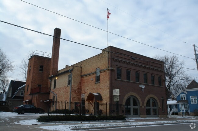
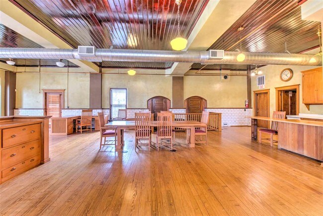
Property Record
21 W New York Ave, Oshkosh, WI 54901
NEARBY LISTINGS FOR SALE OR LEASE
Property Detail
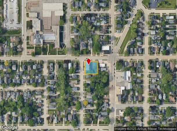
21 W New York Ave
Oshkosh-Neenah, WI
Suhls Addition
10-07740000
LOTS 19 & 20 BLK 1 SUHLS ADDN
Commercialnec
Winnebago
X
Wisconsin
55139C0220E
19,20
2024
0.33 AC
2024
Appleton/Oshkosh
000502
Other Market Areas
7,844 SF
DEMOGRAPHICS near 21 W New York Ave
1 Mile
3 Mile
5 Mile
2024 Total Population
19,354
58,198
76,038
2029 Population
19,348
58,430
76,339
Pop Growth 2024-2029
(0.03%)
+ 0.40%
+ 0.40%
Average Age
34
39
39
2024 Total Households
7,434
24,352
31,591
HH Growth 2024-2029
+ 0.23%
+ 0.67%
+ 0.61%
Median Household Inc
$50,905
$54,156
$59,388
Avg Household Size
2.20
2.10
2.20
2024 Avg HH Vehicles
2.00
2.00
2.00
Median Home Value
$139,173
$153,320
$171,792
Median Year Built
1949
1965
1972
Nearby Places
Map Layers
Map Styles
 Street
 Aerial
- Restaurants
- Banks
- Shops
- Fitness
- Groceries
PUBLIC TRANSPORTATION
AIRPORT
Appleton International
DRIVE
WALK
Distance
Appleton International
29 min
19.8 mi
Green Bay/Austin Straubel International
DRIVE
WALK
Distance
Green Bay/Austin Straubel International
59 min
47.6 mi
SALE & LEASE HISTORY
LISTING DATE
SALE/LEASE

Feb 02, 2018
For Sale
Nearby Properties
Address
Land Use
TOTAL SIZE
Lot Size
Zoning
Address
Land Use
TOTAL SIZE
Lot Size
Zoning
32.81 AC
CBPPD
Address
Land Use
TOTAL SIZE
Lot Size
Zoning
7.74 AC
Address
Land Use
TOTAL SIZE
Lot Size
Zoning
208,278 SF
22.77 AC
C2
Address
Land Use
TOTAL SIZE
Lot Size
Zoning
255,080 SF
21.29 AC
MR-12
Address
Land Use
TOTAL SIZE
Lot Size
Zoning
552,602 SF
7.28 AC
M3
Address
Land Use
TOTAL SIZE
Lot Size
Zoning
128,951 SF
4.95 AC
R1
Address
Land Use
TOTAL SIZE
Lot Size
Zoning
485,007 SF
41.76 AC
M3
Address
Land Use
TOTAL SIZE
Lot Size
Zoning
195,847 SF
4.66 AC
UMU-PD
Address
Land Use
TOTAL SIZE
Lot Size
Zoning
14.77 AC
SMU-PD
Address
Land Use
TOTAL SIZE
Lot Size
Zoning
2.29 AC
RMUPDRFO
Address
Land Use
TOTAL SIZE
Lot Size
Zoning
70,672 SF
4.97 AC
Address
Land Use
TOTAL SIZE
Lot Size
Zoning
161,640 SF
18.54 AC
C-2PD
Address
Land Use
TOTAL SIZE
Lot Size
Zoning
70,335 SF
16 AC
HI
Address
Land Use
TOTAL SIZE
Lot Size
Zoning
2.63 AC
RMU-PD-RFO
Address
Land Use
TOTAL SIZE
Lot Size
Zoning
2.40 AC
CBP-PD
Address
Land Use
TOTAL SIZE
Lot Size
Zoning
152,505 SF
6.54 AC
MR-20-RFO
Address
Land Use
TOTAL SIZE
Lot Size
Zoning
136,368 SF
10.24 AC
C-2PD
Address
Land Use
TOTAL SIZE
Lot Size
Zoning
84,363 SF
10.97 AC
C-2PD
Address
Land Use
TOTAL SIZE
Lot Size
Zoning
53,998 SF
3.63 AC
C2
Address
Land Use
TOTAL SIZE
Lot Size
Zoning
175,906 SF
11.60 AC
MR-20
Address
Land Use
TOTAL SIZE
Lot Size
Zoning
1.78 AC
C3
Address
Land Use
TOTAL SIZE
Lot Size
Zoning
107,778 SF
8.57 AC
SMUPD
Address
Land Use
TOTAL SIZE
Lot Size
Zoning
25,456 SF
1.74 AC
R1;SINGLE
Address
Land Use
TOTAL SIZE
Lot Size
Zoning
9.86 AC
MR-12
Address
Land Use
TOTAL SIZE
Lot Size
Zoning
92,958 SF
1.02 AC
C2
Address
Land Use
TOTAL SIZE
Lot Size
Zoning
128,951 SF
1.15 AC
R1;SINGLE
Address
Land Use
TOTAL SIZE
Lot Size
Zoning
80,118 SF
7.88 AC
C2
Address
Land Use
TOTAL SIZE
Lot Size
Zoning
34,340 SF
8.56 AC
C2
Address
Land Use
TOTAL SIZE
Lot Size
Zoning
140,296 SF
13.58 AC
C-2
Address
Land Use
TOTAL SIZE
Lot Size
Zoning
101,011 SF
16.53 AC
C3
The World's #1 Commercial Real Estate Marketplace
Connect with us
© 2025 CoStar Group
The information above has been obtained from sources believed reliable. While we do not doubt its accuracy we have not verified it and make no guarantee, warranty or representation about it. It is your responsibility to independently confirm its accuracy and completeness. Any projections, opinions, assumptions, or estimates used are for example only and do not represent the current or future performance of the property. The value of this transaction to you depends on tax and other factors which should be evaluated by your tax, financial, and legal advisors. You and your advisors should conduct a careful, independent investigation of the property to determine to your satisfaction the suitability of the property for your needs.