Property Record
21 Warehouse Rd, Harrisonburg, VA 22801
NEARBY LISTINGS FOR SALE OR LEASE
Property Detail
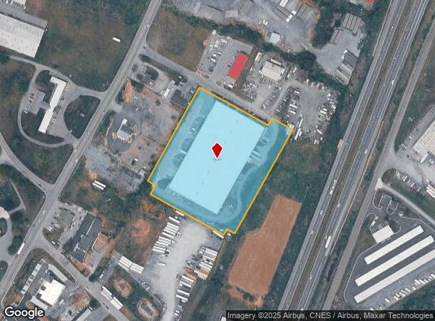
21 Warehouse Rd
108-C-3
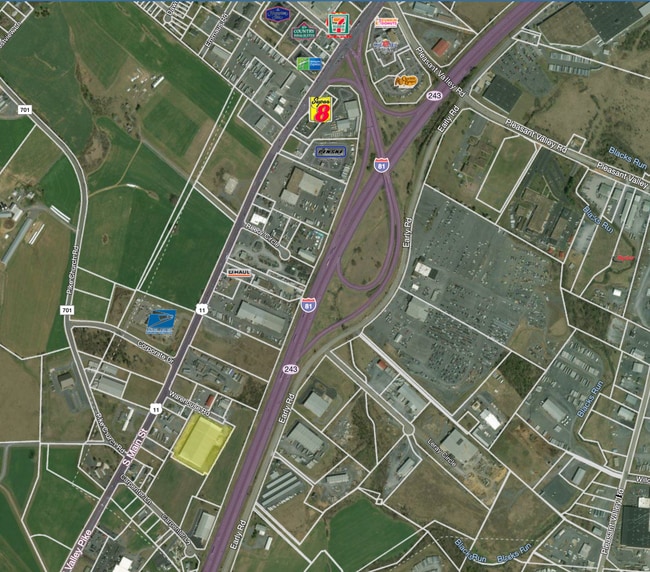
Map Of The Rockingham Center
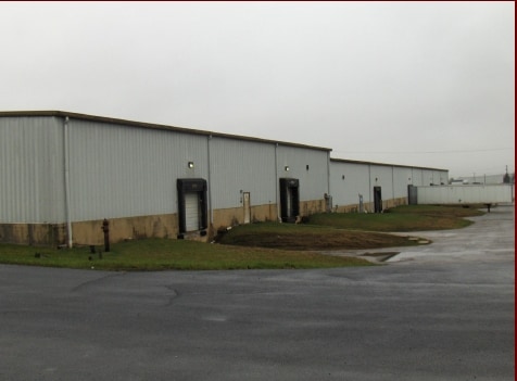
Warehouse
COMMERCIAL DISTRICT 5 SS WAREHOUSE RD
X
Harrisonburg
51165C0393D
Virginia
2024
5.12 AC
2025
Staunton & Harrisonburg
000203
Other Market Areas
102,000 SF
Harrisonburg, VA
DEMOGRAPHICS near 21 Warehouse Rd
1 Mile
3 Mile
5 Mile
2024 Total Population
618
18,724
66,443
2029 Population
646
19,097
67,092
Pop Growth 2024-2029
+ 4.53%
+ 1.99%
+ 0.98%
Average Age
35
36
35
2024 Total Households
197
7,096
22,595
HH Growth 2024-2029
+ 4.57%
+ 1.97%
+ 1.15%
Median Household Inc
$72,631
$62,650
$64,317
Avg Household Size
2.90
2.50
2.50
2024 Avg HH Vehicles
2.00
2.00
2.00
Median Home Value
$294,999
$276,831
$301,609
Median Year Built
1993
1995
1991
Nearby Places
Map Layers
Map Styles
 Street
 Aerial
- Restaurants
- Banks
- Shops
- Fitness
- Groceries
PUBLIC TRANSPORTATION
AIRPORT
Charlottesville-Albemarle
DRIVE
WALK
Distance
Charlottesville-Albemarle
72 min
49.6 mi
SALE & LEASE HISTORY
LISTING DATE
SALE/LEASE

Sep 25, 2016
For Lease
Jun 03, 2021
For Lease
Nearby Properties
Address
Land Use
TOTAL SIZE
Lot Size
Zoning
Address
Land Use
TOTAL SIZE
Lot Size
Zoning
126,552 SF
49.87 AC
GENERAL BU
Address
Land Use
TOTAL SIZE
Lot Size
Zoning
57.92 AC
I1
Address
Land Use
TOTAL SIZE
Lot Size
Zoning
199.08 AC
I1
Address
Land Use
TOTAL SIZE
Lot Size
Zoning
11.56 AC
B1
Address
Land Use
TOTAL SIZE
Lot Size
Zoning
260,792 SF
27.98 AC
P1
Address
Land Use
TOTAL SIZE
Lot Size
Zoning
225,359 SF
33.32 AC
I1
Address
Land Use
TOTAL SIZE
Lot Size
Zoning
11.11 AC
R3
Address
Land Use
TOTAL SIZE
Lot Size
Zoning
6.10 AC
PMF
Address
Land Use
TOTAL SIZE
Lot Size
Zoning
130,426 SF
19.11 AC
R1
Address
Land Use
TOTAL SIZE
Lot Size
Zoning
16.52 AC
TOWN
Address
Land Use
TOTAL SIZE
Lot Size
Zoning
295,543 SF
33.23 AC
I1
Address
Land Use
TOTAL SIZE
Lot Size
Zoning
9,440 SF
17.31 AC
R3
Address
Land Use
TOTAL SIZE
Lot Size
Zoning
905,215 SF
26.54 AC
M1
Address
Land Use
TOTAL SIZE
Lot Size
Zoning
15,432 SF
132 AC
MULTI DWEL
Address
Land Use
TOTAL SIZE
Lot Size
Zoning
13,578 SF
180 AC
HIGH DENSI
Address
Land Use
TOTAL SIZE
Lot Size
Zoning
15,432 SF
108 AC
MULTI DWEL
Address
Land Use
TOTAL SIZE
Lot Size
Zoning
25,020 SF
3.80 AC
COMMERCIAL
Address
Land Use
TOTAL SIZE
Lot Size
Zoning
13,986 SF
9.87 AC
R3
Address
Land Use
TOTAL SIZE
Lot Size
Zoning
84,000 SF
17 AC
GENERAL IN
Address
Land Use
TOTAL SIZE
Lot Size
Zoning
153,180 SF
19.26 AC
B1
Address
Land Use
TOTAL SIZE
Lot Size
Zoning
348,800 SF
26.90 AC
I1
Address
Land Use
TOTAL SIZE
Lot Size
Zoning
172,194 SF
4.24 AC
B1
Address
Land Use
TOTAL SIZE
Lot Size
Zoning
2,145 SF
2.71 AC
PMF
Address
Land Use
TOTAL SIZE
Lot Size
Zoning
21.42 AC
I1
Address
Land Use
TOTAL SIZE
Lot Size
Zoning
4.82 AC
B1
Address
Land Use
TOTAL SIZE
Lot Size
Zoning
3,876 SF
8.86 AC
R3
Address
Land Use
TOTAL SIZE
Lot Size
Zoning
73,000 SF
22.26 AC
SINGLE FAM
Address
Land Use
TOTAL SIZE
Lot Size
Zoning
15.50 AC
GENERAL IN
Address
Land Use
TOTAL SIZE
Lot Size
Zoning
74,032 SF
20.64 AC
R3
Address
Land Use
TOTAL SIZE
Lot Size
Zoning
172,510 SF
12.96 AC
GENERAL IN
The World's #1 Commercial Real Estate Marketplace
Connect with us
© 2026 CoStar Group
The information above has been obtained from sources believed reliable. While we do not doubt its accuracy we have not verified it and make no guarantee, warranty or representation about it. It is your responsibility to independently confirm its accuracy and completeness. Any projections, opinions, assumptions, or estimates used are for example only and do not represent the current or future performance of the property. The value of this transaction to you depends on tax and other factors which should be evaluated by your tax, financial, and legal advisors. You and your advisors should conduct a careful, independent investigation of the property to determine to your satisfaction the suitability of the property for your needs.