Property Record
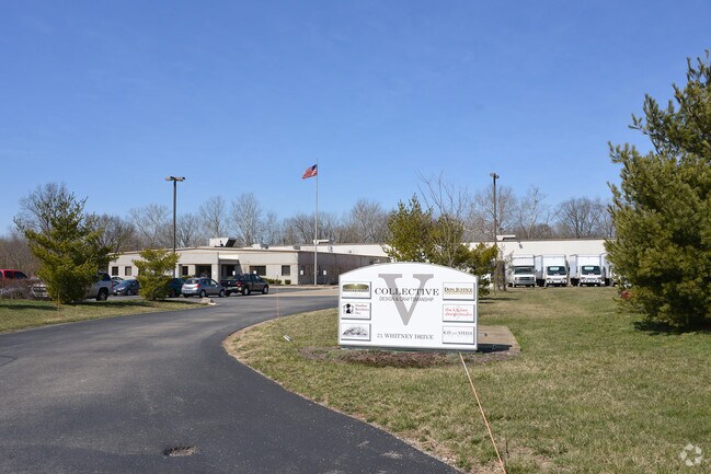
21 Whitney Dr, Milford, OH 45150


NEARBY LISTINGS FOR SALE OR LEASE
Property Detail
21 Whitney Dr
19-24-10F-091
Park 50 Subdivision Section 1
Manufacturinglight
SEE 192410F091T ABATED
AE
Clermont
39025C0117G
Ohio
2024
9.54 AC
2024
East
040600
Cincinnati/Dayton
36,770 SF
Cincinnati, OH-KY-IN
DEMOGRAPHICS near 21 Whitney Dr
1 Mile
3 Mile
5 Mile
2024 Total Population
569
31,228
78,551
2029 Population
577
31,898
80,237
Pop Growth 2024-2029
+ 1.41%
+ 2.15%
+ 2.15%
Average Age
41
42
41
2024 Total Households
194
12,450
31,194
HH Growth 2024-2029
+ 1.55%
+ 2.26%
+ 2.27%
Median Household Inc
$148,437
$80,352
$75,862
Avg Household Size
2.90
2.40
2.50
2024 Avg HH Vehicles
3.00
2.00
2.00
Median Home Value
$313,750
$247,441
$240,620
Median Year Built
1992
1977
1981
Nearby Places
Map Layers
Map Styles
 Street
 Aerial
- Restaurants
- Banks
- Shops
- Fitness
- Groceries
PUBLIC TRANSPORTATION
AIRPORT
Cincinnati/Northern Kentucky International
DRIVE
WALK
Distance
Cincinnati/Northern Kentucky International
34 min
30.5 mi
Nearby Properties
Address
Land Use
TOTAL SIZE
Lot Size
Zoning
Address
Land Use
TOTAL SIZE
Lot Size
Zoning
315,096 SF
9.48 AC
Address
Land Use
TOTAL SIZE
Lot Size
Zoning
2,555 SF
23.68 AC
Address
Land Use
TOTAL SIZE
Lot Size
Zoning
43,511 SF
12.36 AC
Address
Land Use
TOTAL SIZE
Lot Size
Zoning
6,432 SF
16.37 AC
Address
Land Use
TOTAL SIZE
Lot Size
Zoning
10.89 AC
Address
Land Use
TOTAL SIZE
Lot Size
Zoning
Address
Land Use
TOTAL SIZE
Lot Size
Zoning
220,050 SF
33 AC
Address
Land Use
TOTAL SIZE
Lot Size
Zoning
221,360 SF
34.62 AC
Address
Land Use
TOTAL SIZE
Lot Size
Zoning
20,432 SF
20.32 AC
Address
Land Use
TOTAL SIZE
Lot Size
Zoning
53,033 SF
17.48 AC
Address
Land Use
TOTAL SIZE
Lot Size
Zoning
75,944 SF
4.09 AC
Address
Land Use
TOTAL SIZE
Lot Size
Zoning
13.89 AC
Address
Land Use
TOTAL SIZE
Lot Size
Zoning
31,200 SF
3.92 AC
Address
Land Use
TOTAL SIZE
Lot Size
Zoning
4,800 SF
3.41 AC
Address
Land Use
TOTAL SIZE
Lot Size
Zoning
32,024 SF
3.24 AC
Address
Land Use
TOTAL SIZE
Lot Size
Zoning
Address
Land Use
TOTAL SIZE
Lot Size
Zoning
26,878 SF
14.94 AC
Address
Land Use
TOTAL SIZE
Lot Size
Zoning
74,252 SF
20.47 AC
Address
Land Use
TOTAL SIZE
Lot Size
Zoning
36,380 SF
5.45 AC
Address
Land Use
TOTAL SIZE
Lot Size
Zoning
7,000 SF
0.18 AC
M1
Address
Land Use
TOTAL SIZE
Lot Size
Zoning
50,720 SF
6.29 AC
Address
Land Use
TOTAL SIZE
Lot Size
Zoning
86,550 SF
7.13 AC
Address
Land Use
TOTAL SIZE
Lot Size
Zoning
1,748 SF
9.23 AC
Address
Land Use
TOTAL SIZE
Lot Size
Zoning
7,192 SF
19.87 AC
Address
Land Use
TOTAL SIZE
Lot Size
Zoning
110,569 SF
7.88 AC
Address
Land Use
TOTAL SIZE
Lot Size
Zoning
11,706 SF
1.96 AC
Address
Land Use
TOTAL SIZE
Lot Size
Zoning
39,257 SF
11.54 AC
Address
Land Use
TOTAL SIZE
Lot Size
Zoning
62.89 AC
Address
Land Use
TOTAL SIZE
Lot Size
Zoning
21,732 SF
9.41 AC
Address
Land Use
TOTAL SIZE
Lot Size
Zoning
126,837 SF
11.70 AC
The World's #1 Commercial Real Estate Marketplace
Connect with us
© 2025 CoStar Group
The information above has been obtained from sources believed reliable. While we do not doubt its accuracy we have not verified it and make no guarantee, warranty or representation about it. It is your responsibility to independently confirm its accuracy and completeness. Any projections, opinions, assumptions, or estimates used are for example only and do not represent the current or future performance of the property. The value of this transaction to you depends on tax and other factors which should be evaluated by your tax, financial, and legal advisors. You and your advisors should conduct a careful, independent investigation of the property to determine to your satisfaction the suitability of the property for your needs.