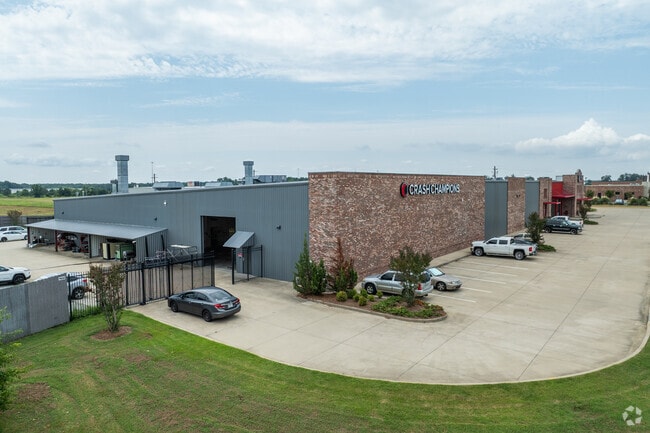
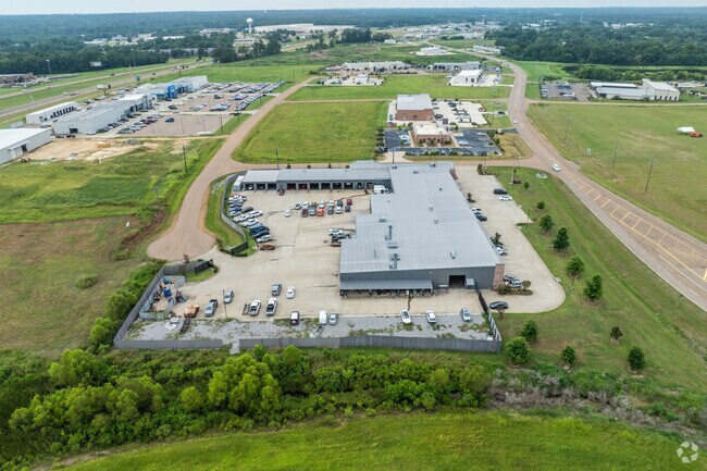
Property Record
210 Autobahn Loop, Gluckstadt, MS 39110

Property Detail
210 Autobahn Loop
082E-21 -016/17
3.85 AC IN NE1/4 NW1/4
Realpropertynec
Madison
C2
Mississippi
B and X Area of moderate flood hazard, usually the area between the limits of the 100-year and 500-year floods.
3.85 AC
2025
Outlying Madison County
2025
Jackson
030401
Jackson, MS
39,350 SF
NEARBY LISTINGS FOR SALE OR LEASE
DEMOGRAPHICS near 210 Autobahn Loop
1 mile
3 mile
5 mile
2025 Total Population
357
12,556
42,414
2030 Population
376
13,188
44,417
Pop Growth 2025-2030
+ 5.32%
+ 5.03%
+ 4.72%
Average Age
35
36
38
2025 Total Households
132
4,541
15,496
HH Growth 2025-2030
+ 5.30%
+ 5.29%
+ 4.99%
Median Household Inc
$93,382
$103,550
$107,321
Avg Household Size
2.60
2.70
2.70
2025 Avg HH Vehicles
2.00
2.00
2.00
Median Home Value
$357,446
$361,649
$383,855
Median Year Built
2010
2008
2003
Nearby Places
Map Layers
Map Styles
 Street
 Aerial
Transit
 Traffic
 Biking
Places
Listings with unknown addresses are not visible on the map
- Restaurants
- Banks
- Shops
- Fitness
- Groceries
PUBLIC TRANSPORTATION
AIRPORT
Jackson-Medgar Wiley Evers International
Drive
Walk
Distance
Jackson-Medgar Wiley Evers International
38 min
24.7 mi
Freight Ports
Port of Greater Baton Rouge
Drive
Walk
Distance
Port of Greater Baton Rouge
220 min
194.6 mi
Nearby Properties
Address
Land Use
TOTAL SIZE
Lot Size
Zoning
Address
Land Use
TOTAL SIZE
Lot Size
Zoning
15,932 SF
55 AC
Address
Land Use
TOTAL SIZE
Lot Size
Zoning
12,302 SF
24.10 AC
I2
Address
Land Use
TOTAL SIZE
Lot Size
Zoning
14,400 SF
35 AC
I1
Address
Land Use
TOTAL SIZE
Lot Size
Zoning
25,063 SF
12 AC
Address
Land Use
TOTAL SIZE
Lot Size
Zoning
75,000 SF
43.55 AC
I2
Address
Land Use
TOTAL SIZE
Lot Size
Zoning
15,959 SF
37.15 AC
I1
Address
Land Use
TOTAL SIZE
Lot Size
Zoning
29,237 SF
49.20 AC
C2
Address
Land Use
TOTAL SIZE
Lot Size
Zoning
3,178 SF
74.38 AC
I2
Address
Land Use
TOTAL SIZE
Lot Size
Zoning
95,809 SF
19.56 AC
I1
Address
Land Use
TOTAL SIZE
Lot Size
Zoning
4,000 SF
15.29 AC
I1
Address
Land Use
TOTAL SIZE
Lot Size
Zoning
111,243 SF
42.30 AC
I2
Address
Land Use
TOTAL SIZE
Lot Size
Zoning
9,788 SF
59 AC
R1
Address
Land Use
TOTAL SIZE
Lot Size
Zoning
241,061 SF
17.10 AC
I2
Address
Land Use
TOTAL SIZE
Lot Size
Zoning
4,620 SF
3.06 AC
C2
Address
Land Use
TOTAL SIZE
Lot Size
Zoning
50,691 SF
10 AC
Address
Land Use
TOTAL SIZE
Lot Size
Zoning
97,616 SF
12.30 AC
I1
Address
Land Use
TOTAL SIZE
Lot Size
Zoning
185,680 SF
Address
Land Use
TOTAL SIZE
Lot Size
Zoning
31,020 SF
6.40 AC
Address
Land Use
TOTAL SIZE
Lot Size
Zoning
3,000 SF
4.30 AC
Address
Land Use
TOTAL SIZE
Lot Size
Zoning
36,467 SF
5.31 AC
Address
Land Use
TOTAL SIZE
Lot Size
Zoning
4,818 SF
5 AC
I1
Address
Land Use
TOTAL SIZE
Lot Size
Zoning
6,344 SF
15.46 AC
I1
Address
Land Use
TOTAL SIZE
Lot Size
Zoning
2,213 SF
1.26 AC
C2
Address
Land Use
TOTAL SIZE
Lot Size
Zoning
100,221 SF
13.97 AC
I1
Address
Land Use
TOTAL SIZE
Lot Size
Zoning
100,124 SF
20.70 AC
I1
Address
Land Use
TOTAL SIZE
Lot Size
Zoning
32,136 SF
3.32 AC
C2
Address
Land Use
TOTAL SIZE
Lot Size
Zoning
9,594 SF
10.24 AC
C2
Address
Land Use
TOTAL SIZE
Lot Size
Zoning
21,835 SF
7.70 AC
Address
Land Use
TOTAL SIZE
Lot Size
Zoning
21,835 SF
7.70 AC
The World's #1 Commercial Real Estate Marketplace
Connect with us
© 2026 CoStar Group
The information above has been obtained from sources believed reliable. While we do not doubt its accuracy we have not verified it and make no guarantee, warranty or representation about it. It is your responsibility to independently confirm its accuracy and completeness. Any projections, opinions, assumptions, or estimates used are for example only and do not represent the current or future performance of the property. The value of this transaction to you depends on tax and other factors which should be evaluated by your tax, financial, and legal advisors. You and your advisors should conduct a careful, independent investigation of the property to determine to your satisfaction the suitability of the property for your needs.