Property Record
210 Ken Pratt Blvd, Longmont, CO 80501

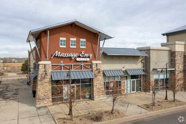

Property Detail
210 Ken Pratt Blvd
Boulder, CO
LOT 3 BLOCK 1 HARVEST JUNCTION NORTH
1315100-48-003
BOULDER
Commercialnec
Colorado
AE The base floodplain where base flood elevations are provided. AE Zones are now used on new format FIRMs instead of A1-A30 Zones.
3
2024
14.67 AC
2025
Longmont
013211
Denver
133,569 SF
NEARBY LISTINGS FOR SALE OR LEASE
DEMOGRAPHICS near 210 Ken Pratt Blvd
1 mile
3 mile
5 mile
2025 Total Population
8,527
69,155
106,369
2030 Population
8,582
69,236
106,636
Pop Growth 2025-2030
+ 0.65%
+ 0.12%
+ 0.25%
Average Age
38
41
41
2025 Total Households
3,363
27,451
42,347
HH Growth 2025-2030
+ 0.89%
+ 0.21%
+ 0.23%
Median Household Inc
$74,938
$85,118
$90,045
Avg Household Size
2.50
2.40
2.40
2025 Avg HH Vehicles
2.00
2.00
2.00
Median Home Value
$469,088
$597,079
$652,543
Median Year Built
1978
1985
1990
Nearby Places
Map Layers
Map Styles
 Street
 Aerial
Layers
 Traffic
 Biking
Places
Listings with unknown addresses are not visible on the map
- Restaurants
- Banks
- Shops
- Fitness
- Groceries
PUBLIC TRANSPORTATION
AIRPORT
Denver International
Drive
Walk
Distance
Denver International
50 min
43.7 mi
SALE & LEASE HISTORY
LISTING DATE
SALE/LEASE

Sep 25, 2016
For Lease
Aug 31, 2017
For Lease
Nearby Properties
Address
Land Use
TOTAL SIZE
Lot Size
Zoning
Address
Land Use
TOTAL SIZE
Lot Size
Zoning
557,104 SF
44.13 AC
Address
Land Use
TOTAL SIZE
Lot Size
Zoning
304,151 SF
45.04 AC
Address
Land Use
TOTAL SIZE
Lot Size
Zoning
38.30 AC
Address
Land Use
TOTAL SIZE
Lot Size
Zoning
219,393 SF
25.13 AC
Address
Land Use
TOTAL SIZE
Lot Size
Zoning
73.36 AC
A
Address
Land Use
TOTAL SIZE
Lot Size
Zoning
147.27 AC
A
Address
Land Use
TOTAL SIZE
Lot Size
Zoning
1,092 SF
150.73 AC
A
Address
Land Use
TOTAL SIZE
Lot Size
Zoning
146.34 AC
A
Address
Land Use
TOTAL SIZE
Lot Size
Zoning
34,137 SF
19.99 AC
Address
Land Use
TOTAL SIZE
Lot Size
Zoning
75.02 AC
A
Address
Land Use
TOTAL SIZE
Lot Size
Zoning
140.16 AC
A
Address
Land Use
TOTAL SIZE
Lot Size
Zoning
139.01 AC
A
Address
Land Use
TOTAL SIZE
Lot Size
Zoning
68.57 AC
A
Address
Land Use
TOTAL SIZE
Lot Size
Zoning
54.45 AC
Address
Land Use
TOTAL SIZE
Lot Size
Zoning
197,659 SF
34.12 AC
Address
Land Use
TOTAL SIZE
Lot Size
Zoning
45.32 AC
Address
Land Use
TOTAL SIZE
Lot Size
Zoning
465,094 SF
23.57 AC
Address
Land Use
TOTAL SIZE
Lot Size
Zoning
333,909 SF
143.20 AC
Address
Land Use
TOTAL SIZE
Lot Size
Zoning
277,321 SF
14.96 AC
Address
Land Use
TOTAL SIZE
Lot Size
Zoning
33.81 AC
Address
Land Use
TOTAL SIZE
Lot Size
Zoning
152,160 SF
9.02 AC
Address
Land Use
TOTAL SIZE
Lot Size
Zoning
83.57 AC
A
Address
Land Use
TOTAL SIZE
Lot Size
Zoning
107,805 SF
7.45 AC
Address
Land Use
TOTAL SIZE
Lot Size
Zoning
126,408 SF
9.11 AC
Address
Land Use
TOTAL SIZE
Lot Size
Zoning
146,153 SF
13.60 AC
Address
Land Use
TOTAL SIZE
Lot Size
Zoning
135,601 SF
17.30 AC
Address
Land Use
TOTAL SIZE
Lot Size
Zoning
1,000 SF
71.43 AC
A
Address
Land Use
TOTAL SIZE
Lot Size
Zoning
152,160 SF
10.48 AC
Address
Land Use
TOTAL SIZE
Lot Size
Zoning
71.22 AC
A
Address
Land Use
TOTAL SIZE
Lot Size
Zoning
18.42 AC
The World's #1 Commercial Real Estate Marketplace
Connect with us
© 2026 CoStar Group
The information above has been obtained from sources believed reliable. While we do not doubt its accuracy we have not verified it and make no guarantee, warranty or representation about it. It is your responsibility to independently confirm its accuracy and completeness. Any projections, opinions, assumptions, or estimates used are for example only and do not represent the current or future performance of the property. The value of this transaction to you depends on tax and other factors which should be evaluated by your tax, financial, and legal advisors. You and your advisors should conduct a careful, independent investigation of the property to determine to your satisfaction the suitability of the property for your needs.