Property Record
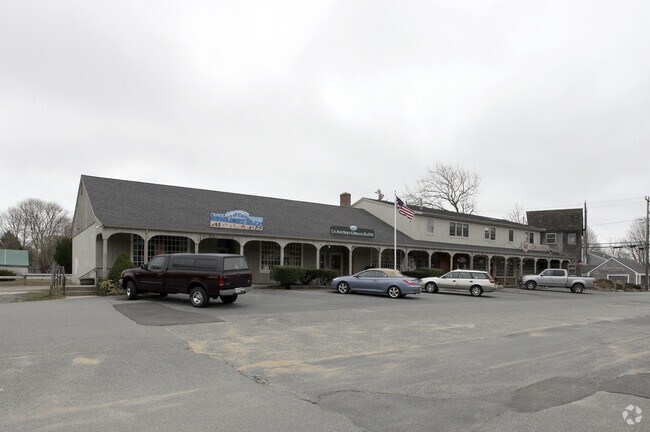
210 Main St, Orleans, MA 02653

NEARBY LISTINGS FOR SALE OR LEASE
Property Detail
210 Main St
Commercialcondominium
Barnstable
X
Massachusetts
25001C0437J
1.0
2025
Other Market Areas
2025
Barnstable Town, MA
010500
ORLE-000350-000068-000070
360 SF
DEMOGRAPHICS near 210 Main St
1 mile
3 mile
5 mile
2024 Total Population
1,499
7,280
14,106
2029 Population
1,491
7,306
14,366
Pop Growth 2024-2029
(0.53%)
+ 0.36%
+ 1.84%
Average Age
57
55
54
2024 Total Households
745
3,524
6,672
HH Growth 2024-2029
(0.81%)
(0.03%)
+ 1.53%
Median Household Inc
$99,038
$87,076
$94,195
Avg Household Size
2.00
2.00
2.00
2024 Avg HH Vehicles
2.00
2.00
2.00
Median Home Value
$896,522
$715,287
$651,528
Median Year Built
1972
1975
1978
Nearby Places
Map Layers
Map Styles
 Street
 Aerial
Transit
 Traffic
 Biking
Places
Listings with unknown addresses are not visible on the map
- Restaurants
- Banks
- Shops
- Fitness
- Groceries
SALE & LEASE HISTORY
LISTING DATE
SALE/LEASE

Jan 01, 2020
For Sale
Nearby Properties
Address
Land Use
TOTAL SIZE
Lot Size
Zoning
Address
Land Use
TOTAL SIZE
Lot Size
Zoning
71,466 SF
12.15 AC
GB
Address
Land Use
TOTAL SIZE
Lot Size
Zoning
90,545 SF
30 AC
R
Address
Land Use
TOTAL SIZE
Lot Size
Zoning
2,872 SF
13.74 AC
R
Address
Land Use
TOTAL SIZE
Lot Size
Zoning
99,086 SF
10.69 AC
GB
Address
Land Use
TOTAL SIZE
Lot Size
Zoning
2,549 SF
109.52 AC
SEASHO
Address
Land Use
TOTAL SIZE
Lot Size
Zoning
105 AC
SEASHO
Address
Land Use
TOTAL SIZE
Lot Size
Zoning
5,482 SF
450 AC
R
Address
Land Use
TOTAL SIZE
Lot Size
Zoning
54,328 SF
23 AC
R
Address
Land Use
TOTAL SIZE
Lot Size
Zoning
30,248 SF
9.48 AC
VILLAG
Address
Land Use
TOTAL SIZE
Lot Size
Zoning
7,384 SF
8.10 AC
R
Address
Land Use
TOTAL SIZE
Lot Size
Zoning
6,420 SF
4.40 AC
R
Address
Land Use
TOTAL SIZE
Lot Size
Zoning
14,406 SF
14.18 AC
GB
Address
Land Use
TOTAL SIZE
Lot Size
Zoning
7,247 SF
2.50 AC
R
Address
Land Use
TOTAL SIZE
Lot Size
Zoning
7,680 SF
10.50 AC
R
Address
Land Use
TOTAL SIZE
Lot Size
Zoning
5,817 SF
5.75 AC
R
Address
Land Use
TOTAL SIZE
Lot Size
Zoning
6,524 SF
2.24 AC
R
Address
Land Use
TOTAL SIZE
Lot Size
Zoning
5,074 SF
1.92 AC
R
Address
Land Use
TOTAL SIZE
Lot Size
Zoning
4,495 SF
1.06 AC
R
Address
Land Use
TOTAL SIZE
Lot Size
Zoning
5,866 SF
3.68 AC
R
Address
Land Use
TOTAL SIZE
Lot Size
Zoning
9,084 SF
1.40 AC
R
Address
Land Use
TOTAL SIZE
Lot Size
Zoning
3,633 SF
1.19 AC
R
Address
Land Use
TOTAL SIZE
Lot Size
Zoning
15,602 SF
1.32 AC
R
Address
Land Use
TOTAL SIZE
Lot Size
Zoning
33,188 SF
9.97 AC
VILLAG
Address
Land Use
TOTAL SIZE
Lot Size
Zoning
4,327 SF
1.31 AC
R
Address
Land Use
TOTAL SIZE
Lot Size
Zoning
5,159 SF
1.86 AC
R
Address
Land Use
TOTAL SIZE
Lot Size
Zoning
4,603 SF
3.45 AC
R
Address
Land Use
TOTAL SIZE
Lot Size
Zoning
7,711 SF
10.10 AC
R
Address
Land Use
TOTAL SIZE
Lot Size
Zoning
3,457 SF
1.33 AC
R
Address
Land Use
TOTAL SIZE
Lot Size
Zoning
6,948 SF
2.95 AC
R
Address
Land Use
TOTAL SIZE
Lot Size
Zoning
4,403 SF
1.90 AC
R
The World's #1 Commercial Real Estate Marketplace
Connect with us
© 2026 CoStar Group
The information above has been obtained from sources believed reliable. While we do not doubt its accuracy we have not verified it and make no guarantee, warranty or representation about it. It is your responsibility to independently confirm its accuracy and completeness. Any projections, opinions, assumptions, or estimates used are for example only and do not represent the current or future performance of the property. The value of this transaction to you depends on tax and other factors which should be evaluated by your tax, financial, and legal advisors. You and your advisors should conduct a careful, independent investigation of the property to determine to your satisfaction the suitability of the property for your needs.