Property Record
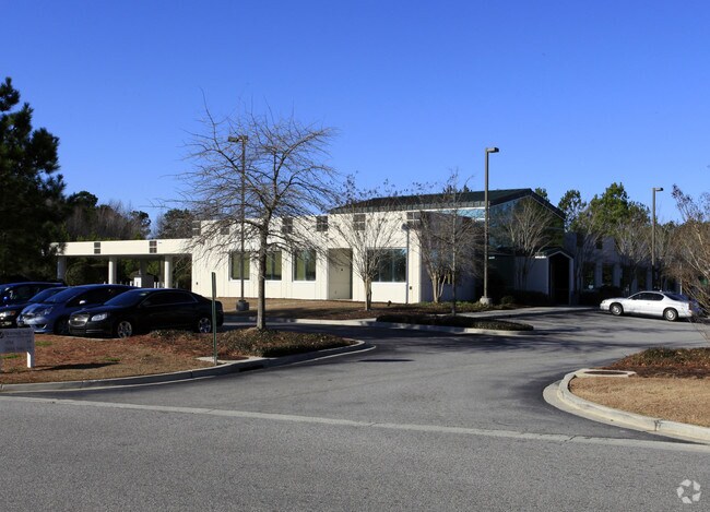
210 Marymeade Dr, Summerville, SC 29483


NEARBY LISTINGS FOR SALE OR LEASE
Property Detail
210 Marymeade Dr
Charleston-North Charleston, SC
Summerville New Area
232-00-02-143
ASSESSMENT DISTRICT: 966BANKSTRACT T
Financialbuilding
Berkeley
ARE
South Carolina
45019C0120K
t
2025
2.94 AC
2025
Outlying Berkeley County
020714
Charleston/N Charleston
7,332 SF
DEMOGRAPHICS near 210 Marymeade Dr
1 Mile
3 Mile
5 Mile
2024 Total Population
7,717
51,454
140,089
2029 Population
8,616
57,889
157,213
Pop Growth 2024-2029
+ 11.65%
+ 12.51%
+ 12.22%
Average Age
39
39
38
2024 Total Households
3,189
19,920
53,312
HH Growth 2024-2029
+ 11.76%
+ 12.44%
+ 12.11%
Median Household Inc
$56,929
$68,465
$69,033
Avg Household Size
2.40
2.50
2.60
2024 Avg HH Vehicles
2.00
2.00
2.00
Median Home Value
$251,164
$249,723
$250,275
Median Year Built
2001
1996
1999
Nearby Places
Map Layers
Map Styles
 Street
 Aerial
- Restaurants
- Banks
- Shops
- Fitness
- Groceries
PUBLIC TRANSPORTATION
AIRPORT
Charleston AFB/International
DRIVE
WALK
Distance
Charleston AFB/International
23 min
15.0 mi
Nearby Properties
Address
Land Use
TOTAL SIZE
Lot Size
Zoning
Address
Land Use
TOTAL SIZE
Lot Size
Zoning
1,019,200 SF
62.32 AC
Address
Land Use
TOTAL SIZE
Lot Size
Zoning
25,014 SF
39.48 AC
BERKELEY C
Address
Land Use
TOTAL SIZE
Lot Size
Zoning
33,687 SF
11.33 AC
SUMMERVILL
Address
Land Use
TOTAL SIZE
Lot Size
Zoning
74,631 SF
11.37 AC
SUMMERVILL
Address
Land Use
TOTAL SIZE
Lot Size
Zoning
40,824 SF
15.54 AC
BERKELEY C
Address
Land Use
TOTAL SIZE
Lot Size
Zoning
30,060 SF
10.48 AC
SUMMERVILL
Address
Land Use
TOTAL SIZE
Lot Size
Zoning
459,160 SF
32.94 AC
Address
Land Use
TOTAL SIZE
Lot Size
Zoning
8,442 SF
16.01 AC
BERKELEY C
Address
Land Use
TOTAL SIZE
Lot Size
Zoning
209,150 SF
5.95 AC
SUMMERVILL
Address
Land Use
TOTAL SIZE
Lot Size
Zoning
430,920 SF
35.26 AC
Address
Land Use
TOTAL SIZE
Lot Size
Zoning
71,044 SF
8.05 AC
BERKELEY C
Address
Land Use
TOTAL SIZE
Lot Size
Zoning
537,680 SF
118.73 AC
BERKELEY C
Address
Land Use
TOTAL SIZE
Lot Size
Zoning
476,280 SF
67.49 AC
BERKELEY C
Address
Land Use
TOTAL SIZE
Lot Size
Zoning
561,582 SF
84.37 AC
BERKELEY C
Address
Land Use
TOTAL SIZE
Lot Size
Zoning
31,425 SF
7.36 AC
SUMMERVILL
Address
Land Use
TOTAL SIZE
Lot Size
Zoning
364,416 SF
56.32 AC
BERKELEY C
Address
Land Use
TOTAL SIZE
Lot Size
Zoning
37,347 SF
12.71 AC
BERKELEY C
Address
Land Use
TOTAL SIZE
Lot Size
Zoning
8,536 SF
6.02 AC
BERKELEY C
Address
Land Use
TOTAL SIZE
Lot Size
Zoning
22,482 SF
9.03 AC
BERKELEY C
Address
Land Use
TOTAL SIZE
Lot Size
Zoning
307,392 SF
45.21 AC
Address
Land Use
TOTAL SIZE
Lot Size
Zoning
4,924 SF
28.08 AC
SUMMERVILL
Address
Land Use
TOTAL SIZE
Lot Size
Zoning
3,534 SF
15.92 AC
SUMMERVILL
Address
Land Use
TOTAL SIZE
Lot Size
Zoning
2,280 SF
16.95 AC
SUMMERVILL
Address
Land Use
TOTAL SIZE
Lot Size
Zoning
23,700 SF
18.10 AC
SUMMERVILL
Address
Land Use
TOTAL SIZE
Lot Size
Zoning
64,874 SF
8.98 AC
BERKELEY C
Address
Land Use
TOTAL SIZE
Lot Size
Zoning
95,150 SF
5.48 AC
SUMMERVILL
Address
Land Use
TOTAL SIZE
Lot Size
Zoning
103,500 SF
6.06 AC
SUMMERVILL
Address
Land Use
TOTAL SIZE
Lot Size
Zoning
65,481 SF
2.08 AC
BERKELEY C
Address
Land Use
TOTAL SIZE
Lot Size
Zoning
136,500 SF
12.89 AC
Address
Land Use
TOTAL SIZE
Lot Size
Zoning
59.03 AC
PUD_SV
The World's #1 Commercial Real Estate Marketplace
Connect with us
© 2025 CoStar Group
The information above has been obtained from sources believed reliable. While we do not doubt its accuracy we have not verified it and make no guarantee, warranty or representation about it. It is your responsibility to independently confirm its accuracy and completeness. Any projections, opinions, assumptions, or estimates used are for example only and do not represent the current or future performance of the property. The value of this transaction to you depends on tax and other factors which should be evaluated by your tax, financial, and legal advisors. You and your advisors should conduct a careful, independent investigation of the property to determine to your satisfaction the suitability of the property for your needs.