Property Record
210 N Polk St, Pineville, NC 28134
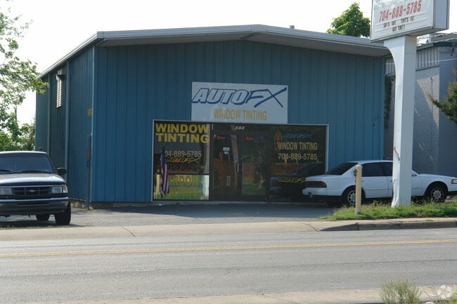
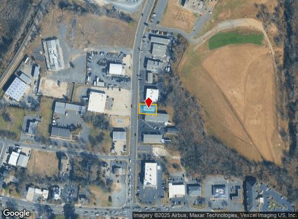
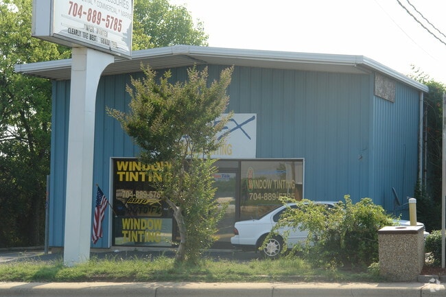
This Property Is For Sale
NEARBY LISTINGS FOR SALE OR LEASE
-
-
-
-
No Photo
-
-
-
-
View all Pineville listings for sale on LoopNet.com
Property Detail
210 N Polk St
207-093-19
E & L Enterprises
Commercialnec
Mecklenburg
X
North Carolina
45057C0009E
19
2024
0.16 AC
2025
Outer Southeast
005829
Charlotte
1,800 SF
Charlotte-Concord-Gastonia, NC-SC
DEMOGRAPHICS near 210 N Polk St
1 Mile
3 Mile
5 Mile
2024 Total Population
5,130
64,389
180,605
2029 Population
5,405
69,022
193,545
Pop Growth 2024-2029
+ 5.36%
+ 7.20%
+ 7.16%
Average Age
40
38
38
2024 Total Households
2,333
27,099
73,114
HH Growth 2024-2029
+ 5.49%
+ 6.96%
+ 7.05%
Median Household Inc
$54,683
$72,098
$87,939
Avg Household Size
2.20
2.30
2.40
2024 Avg HH Vehicles
2.00
2.00
2.00
Median Home Value
$272,925
$330,050
$387,880
Median Year Built
1989
1991
1994
Nearby Places
- Restaurants
- Banks
- Shops
- Fitness
- Groceries
PUBLIC TRANSPORTATION
AIRPORT
Charlotte/Douglas International
DRIVE
WALK
Distance
Charlotte/Douglas International
20 min
11.3 mi
Concord-Padgett Regional
DRIVE
WALK
Distance
Concord-Padgett Regional
42 min
34.2 mi
Freight Ports
North Charleston Terminal
DRIVE
WALK
Distance
North Charleston Terminal
216 min
190.6 mi
Nearby Properties
Address
Land Use
TOTAL SIZE
Lot Size
Zoning
Address
Land Use
TOTAL SIZE
Lot Size
Zoning
922,476 SF
49.91 AC
BP
Address
Land Use
TOTAL SIZE
Lot Size
Zoning
605,976 SF
46.31 AC
R17MF
Address
Land Use
TOTAL SIZE
Lot Size
Zoning
244,692 SF
264.29 AC
I2
Address
Land Use
TOTAL SIZE
Lot Size
Zoning
654,693 SF
51.50 AC
O1
Address
Land Use
TOTAL SIZE
Lot Size
Zoning
646,209 SF
72.24 AC
CC
Address
Land Use
TOTAL SIZE
Lot Size
Zoning
306,928 SF
53.98 AC
Address
Land Use
TOTAL SIZE
Lot Size
Zoning
605,542 SF
586.46 AC
Address
Land Use
TOTAL SIZE
Lot Size
Zoning
430,352 SF
40.09 AC
R12MFCD
Address
Land Use
TOTAL SIZE
Lot Size
Zoning
326,013 SF
25.59 AC
RMF
Address
Land Use
TOTAL SIZE
Lot Size
Zoning
305,449 SF
17.90 AC
R17MFCD
Address
Land Use
TOTAL SIZE
Lot Size
Zoning
381,729 SF
22.37 AC
R17MF
Address
Land Use
TOTAL SIZE
Lot Size
Zoning
1,007,888 SF
55.04 AC
G-I
Address
Land Use
TOTAL SIZE
Lot Size
Zoning
321,129 SF
23.59 AC
MX2
Address
Land Use
TOTAL SIZE
Lot Size
Zoning
452,964 SF
9.19 AC
OCCD
Address
Land Use
TOTAL SIZE
Lot Size
Zoning
324,998 SF
16.60 AC
OICD
Address
Land Use
TOTAL SIZE
Lot Size
Zoning
279,674 SF
18.28 AC
CC
Address
Land Use
TOTAL SIZE
Lot Size
Zoning
518,080 SF
5.44 AC
Address
Land Use
TOTAL SIZE
Lot Size
Zoning
364,274 SF
3.50 AC
CC
Address
Land Use
TOTAL SIZE
Lot Size
Zoning
293,128 SF
22.70 AC
MX2
Address
Land Use
TOTAL SIZE
Lot Size
Zoning
429,918 SF
13.50 AC
O1
Address
Land Use
TOTAL SIZE
Lot Size
Zoning
236,862 SF
30.19 AC
CC
Address
Land Use
TOTAL SIZE
Lot Size
Zoning
380,132 SF
5.97 AC
CC
Address
Land Use
TOTAL SIZE
Lot Size
Zoning
186,651 SF
7.40 AC
CC
Address
Land Use
TOTAL SIZE
Lot Size
Zoning
212,904 SF
58.09 AC
INST
Address
Land Use
TOTAL SIZE
Lot Size
Zoning
549,017 SF
486.09 AC
Address
Land Use
TOTAL SIZE
Lot Size
Zoning
226,768 SF
19.59 AC
RMF
Address
Land Use
TOTAL SIZE
Lot Size
Zoning
294,045 SF
24.31 AC
B4
Address
Land Use
TOTAL SIZE
Lot Size
Zoning
234,912 SF
11.60 AC
R3
Address
Land Use
TOTAL SIZE
Lot Size
Zoning
262,246 SF
51.99 AC
R3
Address
Land Use
TOTAL SIZE
Lot Size
Zoning
221,152 SF
15.87 AC
MX2
The World's #1 Commercial Real Estate Marketplace
Connect with us
© 2025 CoStar Group
The information above has been obtained from sources believed reliable. While we do not doubt its accuracy we have not verified it and make no guarantee, warranty or representation about it. It is your responsibility to independently confirm its accuracy and completeness. Any projections, opinions, assumptions, or estimates used are for example only and do not represent the current or future performance of the property. The value of this transaction to you depends on tax and other factors which should be evaluated by your tax, financial, and legal advisors. You and your advisors should conduct a careful, independent investigation of the property to determine to your satisfaction the suitability of the property for your needs.