Property Record
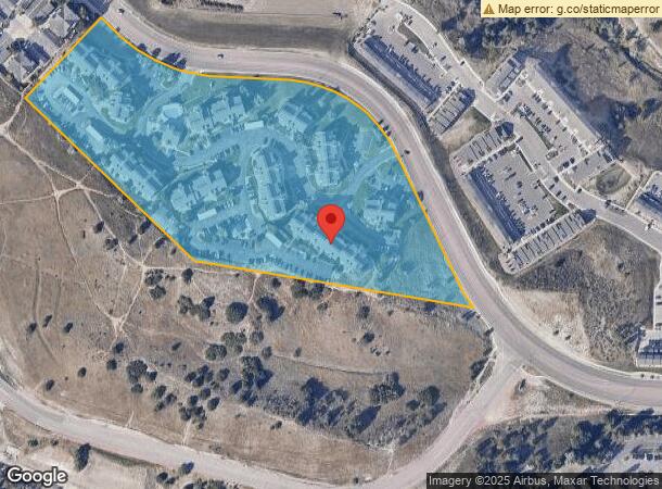
210 Rim View Dr, Colorado Springs, CO 80919

NEARBY LISTINGS FOR SALE OR LEASE
Property Detail
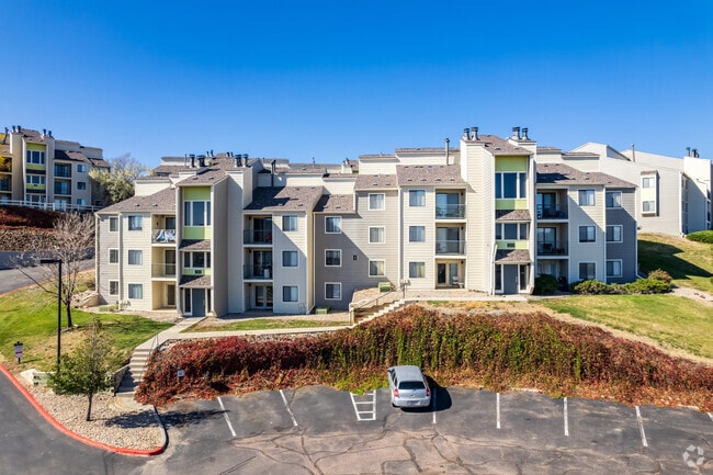
210 Rim View Dr
73134-01-001
Rockrimmon Apartments Fil No 1
Multifamilydwelling
ROCKRIMMON APARTMENTS FIL NO 1 COLO SPGS
X
El Paso
08041C0512G
Colorado
2024
11.62 AC
2025
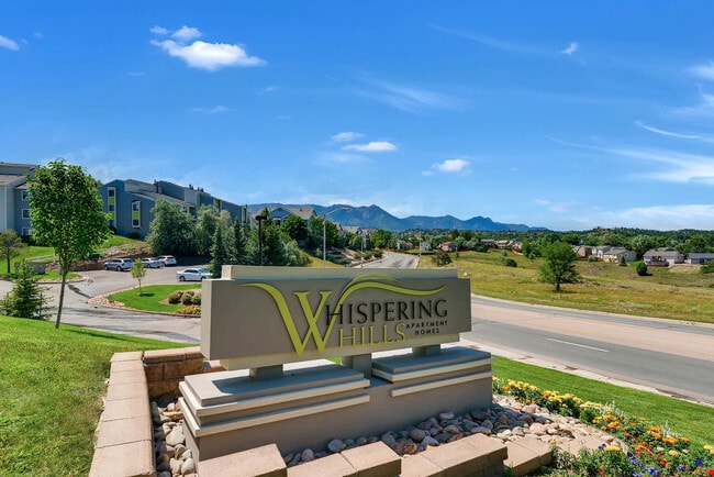
Rockrimmon
003711
Colorado Springs
228,181 SF
Colorado Springs, CO
DEMOGRAPHICS near 210 Rim View Dr
1 Mile
3 Mile
5 Mile
2024 Total Population
9,693
61,100
165,428
2029 Population
10,080
63,635
172,203
Pop Growth 2024-2029
+ 3.99%
+ 4.15%
+ 4.10%
Average Age
40
41
40
2024 Total Households
4,096
25,998
69,240
HH Growth 2024-2029
+ 4.13%
+ 4.36%
+ 4.34%
Median Household Inc
$84,956
$78,240
$75,809
Avg Household Size
2.30
2.30
2.30
2024 Avg HH Vehicles
2.00
2.00
2.00
Median Home Value
$462,827
$444,439
$417,588
Median Year Built
1985
1985
1982
Nearby Places
Map Layers
Map Styles
 Street
 Aerial
- Restaurants
- Banks
- Shops
- Fitness
- Groceries
PUBLIC TRANSPORTATION
AIRPORT
City of Colorado Springs Municipal
DRIVE
WALK
Distance
City of Colorado Springs Municipal
30 min
18.1 mi
Freight Ports
Tulsa Port Of Catoosa
DRIVE
WALK
Distance
Tulsa Port Of Catoosa
741 min
692.8 mi
Nearby Properties
Address
Land Use
TOTAL SIZE
Lot Size
Zoning
Address
Land Use
TOTAL SIZE
Lot Size
Zoning
662,208 SF
14.96 AC
BP
Address
Land Use
TOTAL SIZE
Lot Size
Zoning
62,201 SF
5.68 AC
MX-N
Address
Land Use
TOTAL SIZE
Lot Size
Zoning
409,164 SF
19.26 AC
PUD
Address
Land Use
TOTAL SIZE
Lot Size
Zoning
117,227 SF
12.28 AC
PDZ HS
Address
Land Use
TOTAL SIZE
Lot Size
Zoning
747,294 SF
61.26 AC
BP HS
Address
Land Use
TOTAL SIZE
Lot Size
Zoning
80,802 SF
14.45 AC
PF NNA
Address
Land Use
TOTAL SIZE
Lot Size
Zoning
139,621 SF
403.34 AC
A R-E HS
Address
Land Use
TOTAL SIZE
Lot Size
Zoning
77,655 SF
8.39 AC
MX-N MX-N/
Address
Land Use
TOTAL SIZE
Lot Size
Zoning
113,069 SF
44.99 AC
R-E HS
Address
Land Use
TOTAL SIZE
Lot Size
Zoning
89,592 SF
7.60 AC
R-E CU
Address
Land Use
TOTAL SIZE
Lot Size
Zoning
71,542 SF
10.11 AC
PF
Address
Land Use
TOTAL SIZE
Lot Size
Zoning
134,592 SF
10.09 AC
MX-L LI CU
Address
Land Use
TOTAL SIZE
Lot Size
Zoning
131,696 SF
9.24 AC
MX-M
Address
Land Use
TOTAL SIZE
Lot Size
Zoning
100,930 SF
7.75 AC
BP CU
Address
Land Use
TOTAL SIZE
Lot Size
Zoning
99,488 SF
13.01 AC
PDZ
Address
Land Use
TOTAL SIZE
Lot Size
Zoning
30,757 SF
6.19 AC
MX-N CU HS
Address
Land Use
TOTAL SIZE
Lot Size
Zoning
34,443 SF
5.14 AC
PF
Address
Land Use
TOTAL SIZE
Lot Size
Zoning
49,023 SF
5.68 AC
MX-L NNA
Address
Land Use
TOTAL SIZE
Lot Size
Zoning
53,632 SF
3.42 AC
PF SS
Address
Land Use
TOTAL SIZE
Lot Size
Zoning
158,502 SF
5.73 AC
MX-N HS
Address
Land Use
TOTAL SIZE
Lot Size
Zoning
41,015 SF
0.62 AC
BP
Address
Land Use
TOTAL SIZE
Lot Size
Zoning
23,431 SF
0.17 AC
R-E MX-M P
Address
Land Use
TOTAL SIZE
Lot Size
Zoning
23,324 SF
7.84 AC
MX-N CU
Address
Land Use
TOTAL SIZE
Lot Size
Zoning
301,559 SF
46.67 AC
BP/CR CU H
Address
Land Use
TOTAL SIZE
Lot Size
Zoning
61,098 SF
5.93 AC
LI
Address
Land Use
TOTAL SIZE
Lot Size
Zoning
42,365 SF
3.86 AC
MX-M CU SS
Address
Land Use
TOTAL SIZE
Lot Size
Zoning
49,277 SF
7 AC
MX-L/CR
Address
Land Use
TOTAL SIZE
Lot Size
Zoning
88.37 AC
BP/CR HS C
Address
Land Use
TOTAL SIZE
Lot Size
Zoning
249,958 SF
21.03 AC
BP/CR HS C
Address
Land Use
TOTAL SIZE
Lot Size
Zoning
409,070 SF
17.15 AC
The World's #1 Commercial Real Estate Marketplace
Connect with us
© 2026 CoStar Group
The information above has been obtained from sources believed reliable. While we do not doubt its accuracy we have not verified it and make no guarantee, warranty or representation about it. It is your responsibility to independently confirm its accuracy and completeness. Any projections, opinions, assumptions, or estimates used are for example only and do not represent the current or future performance of the property. The value of this transaction to you depends on tax and other factors which should be evaluated by your tax, financial, and legal advisors. You and your advisors should conduct a careful, independent investigation of the property to determine to your satisfaction the suitability of the property for your needs.