Property Record
210 W North St, Elburn, IL 60119
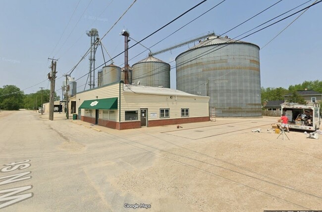

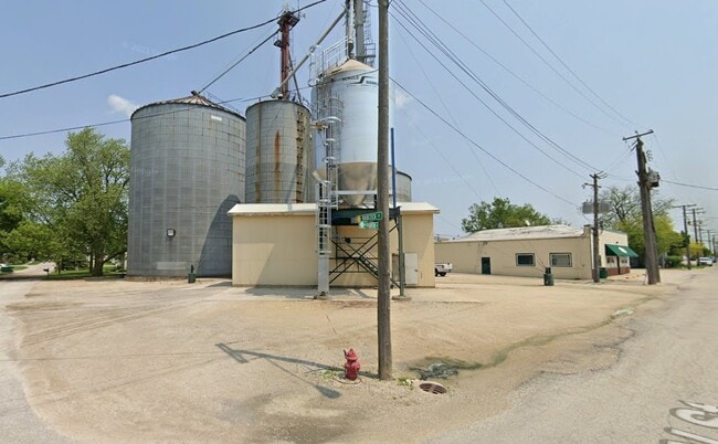
This Property Is For Sale
NEARBY LISTINGS FOR SALE OR LEASE
Property Detail
210 W North St
Chicago-Naperville-Elgin, IL-IN-WI
Gates Add
11-06-239-011
Kane
Commercialnec
Illinois
X
4-6
17089C0250J
0.85 AC
2024
Western East/West Corr
2024
Chicago
854507
DEMOGRAPHICS near 210 W North St
1 Mile
3 Mile
5 Mile
2024 Total Population
3,741
9,219
21,873
2029 Population
3,822
9,343
21,705
Pop Growth 2024-2029
+ 2.17%
+ 1.35%
(0.77%)
Average Age
42
41
41
2024 Total Households
1,418
3,274
7,456
HH Growth 2024-2029
+ 2.19%
+ 1.41%
(0.83%)
Median Household Inc
$89,430
$109,215
$137,881
Avg Household Size
2.60
2.80
2.90
2024 Avg HH Vehicles
2.00
3.00
2.00
Median Home Value
$354,631
$389,639
$451,575
Median Year Built
1990
1990
1992
Nearby Places
Map Layers
Map Styles
 Street
 Aerial
- Restaurants
- Banks
- Shops
- Fitness
- Groceries
PUBLIC TRANSPORTATION
COMMUTER RAIL
Elburn Station (Union Pacific West Line - Northeast Illinois Regional Commuter Railroad (Metra))
DRIVE
WALK
Distance
Elburn Station (Union Pacific West Line - Northeast Illinois Regional Commuter Railroad (Metra))
3 min
15 min
0.8 mi
La Fox Station (Union Pacific West Line - Northeast Illinois Regional Commuter Railroad (Metra))
DRIVE
WALK
Distance
La Fox Station (Union Pacific West Line - Northeast Illinois Regional Commuter Railroad (Metra))
11 min
4.3 mi
AIRPORT
Chicago O'Hare International
DRIVE
WALK
Distance
Chicago O'Hare International
64 min
44.7 mi
Freight Ports
Port Milwaukee
DRIVE
WALK
Distance
Port Milwaukee
143 min
101.0 mi
Nearby Properties
Address
Land Use
TOTAL SIZE
Lot Size
Zoning
Address
Land Use
TOTAL SIZE
Lot Size
Zoning
61,500 SF
7.34 AC
Address
Land Use
TOTAL SIZE
Lot Size
Zoning
49.52 AC
Address
Land Use
TOTAL SIZE
Lot Size
Zoning
Address
Land Use
TOTAL SIZE
Lot Size
Zoning
0.47 AC
Address
Land Use
TOTAL SIZE
Lot Size
Zoning
2.90 AC
Address
Land Use
TOTAL SIZE
Lot Size
Zoning
5.05 AC
Address
Land Use
TOTAL SIZE
Lot Size
Zoning
14,700 SF
1.84 AC
Address
Land Use
TOTAL SIZE
Lot Size
Zoning
Address
Land Use
TOTAL SIZE
Lot Size
Zoning
10,543 SF
1.31 AC
Address
Land Use
TOTAL SIZE
Lot Size
Zoning
Address
Land Use
TOTAL SIZE
Lot Size
Zoning
3.02 AC
Address
Land Use
TOTAL SIZE
Lot Size
Zoning
9.17 AC
Address
Land Use
TOTAL SIZE
Lot Size
Zoning
0.90 AC
Address
Land Use
TOTAL SIZE
Lot Size
Zoning
2.35 AC
Address
Land Use
TOTAL SIZE
Lot Size
Zoning
11,150 SF
1.48 AC
Address
Land Use
TOTAL SIZE
Lot Size
Zoning
17,200 SF
3.32 AC
Address
Land Use
TOTAL SIZE
Lot Size
Zoning
84.18 AC
Address
Land Use
TOTAL SIZE
Lot Size
Zoning
1.98 AC
Address
Land Use
TOTAL SIZE
Lot Size
Zoning
7,000 SF
3.35 AC
Address
Land Use
TOTAL SIZE
Lot Size
Zoning
Address
Land Use
TOTAL SIZE
Lot Size
Zoning
10,076 SF
1.50 AC
Address
Land Use
TOTAL SIZE
Lot Size
Zoning
1.39 AC
Address
Land Use
TOTAL SIZE
Lot Size
Zoning
2.17 AC
Address
Land Use
TOTAL SIZE
Lot Size
Zoning
4.57 AC
Address
Land Use
TOTAL SIZE
Lot Size
Zoning
Address
Land Use
TOTAL SIZE
Lot Size
Zoning
2.10 AC
Address
Land Use
TOTAL SIZE
Lot Size
Zoning
2,520 SF
0.71 AC
Address
Land Use
TOTAL SIZE
Lot Size
Zoning
Address
Land Use
TOTAL SIZE
Lot Size
Zoning
1.69 AC
The World's #1 Commercial Real Estate Marketplace
Connect with us
© 2025 CoStar Group
The information above has been obtained from sources believed reliable. While we do not doubt its accuracy we have not verified it and make no guarantee, warranty or representation about it. It is your responsibility to independently confirm its accuracy and completeness. Any projections, opinions, assumptions, or estimates used are for example only and do not represent the current or future performance of the property. The value of this transaction to you depends on tax and other factors which should be evaluated by your tax, financial, and legal advisors. You and your advisors should conduct a careful, independent investigation of the property to determine to your satisfaction the suitability of the property for your needs.