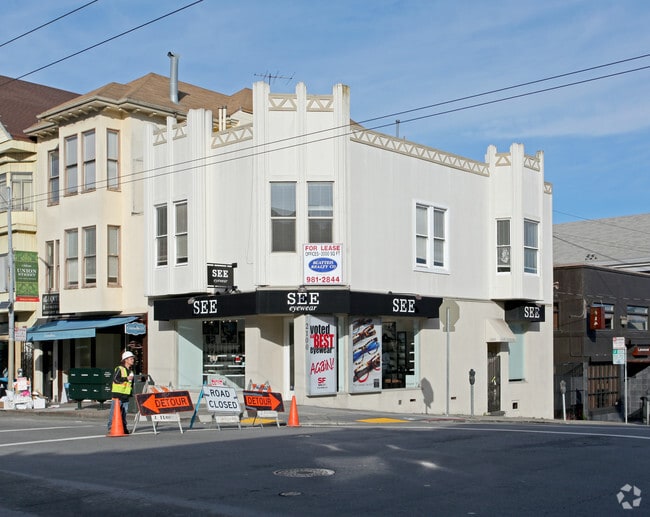
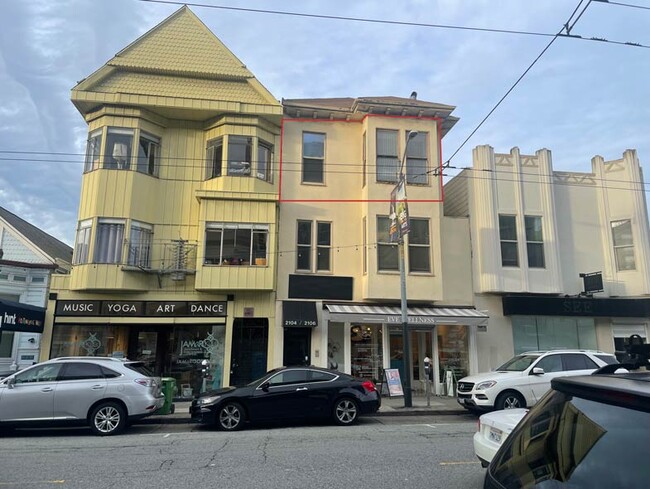
Property Record
2100 Union St, San Francisco, CA 94123
Current Lease Availabilities
NEARBY LISTINGS FOR SALE OR LEASE
Property Detail
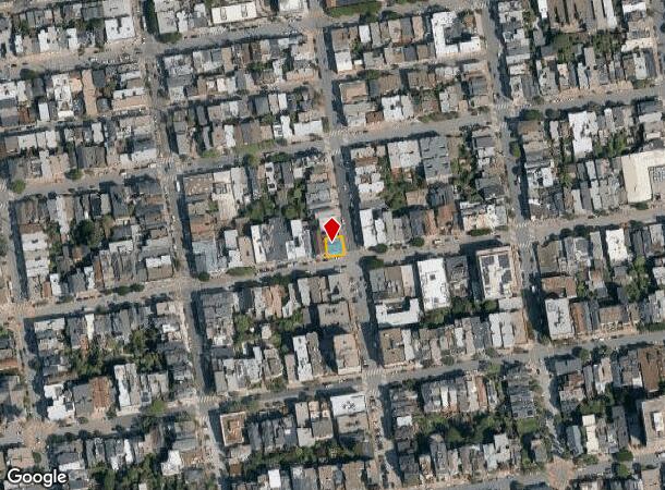
2100 Union St
San Francisco-Redwood City-South San Francisco, CA
Western Add Bl 323
0533-037
San Francisco
Storemultistory
California
2024
37
2025
0.06 AC
013002
West of Van Ness
6,250 SF
San Francisco
DEMOGRAPHICS near 2100 Union St
1 Mile
3 Mile
5 Mile
2024 Total Population
75,844
409,065
654,910
2029 Population
70,582
381,445
607,845
Pop Growth 2024-2029
(6.94%)
(6.75%)
(7.19%)
Average Age
42
42
42
2024 Total Households
40,933
201,062
295,019
HH Growth 2024-2029
(7.50%)
(7.29%)
(7.61%)
Median Household Inc
$162,458
$126,435
$132,797
Avg Household Size
1.80
1.90
2.10
2024 Avg HH Vehicles
1.00
1.00
1.00
Median Home Value
$1,115,635
$1,101,469
$1,108,922
Median Year Built
1948
1949
1948
Nearby Places
Map Layers
Map Styles
 Street
 Aerial
- Restaurants
- Banks
- Shops
- Fitness
- Groceries
PUBLIC TRANSPORTATION
TRANSIT/SUBWAY
Union and Hyde (Powell-Hyde Cable Car - San Francisco Municipal Railway (MUNI Metro))
DRIVE
WALK
Distance
Union and Hyde (Powell-Hyde Cable Car - San Francisco Municipal Railway (MUNI Metro))
2 min
16 min
0.8 mi
Hyde and Filbert (Powell-Hyde Cable Car - San Francisco Municipal Railway (MUNI Metro))
DRIVE
WALK
Distance
Hyde and Filbert (Powell-Hyde Cable Car - San Francisco Municipal Railway (MUNI Metro))
3 min
17 min
0.9 mi
Hyde and Vallejo (Powell-Hyde Cable Car - San Francisco Municipal Railway (MUNI Metro))
DRIVE
WALK
Distance
Hyde and Vallejo (Powell-Hyde Cable Car - San Francisco Municipal Railway (MUNI Metro))
3 min
18 min
1.0 mi
Hyde and Broadway (Powell-Hyde Cable Car - San Francisco Municipal Railway (MUNI Metro))
DRIVE
WALK
Distance
Hyde and Broadway (Powell-Hyde Cable Car - San Francisco Municipal Railway (MUNI Metro))
3 min
20 min
1.0 mi
COMMUTER RAIL
San Francisco 4th & King (Caltrain - Caltrain (Caltrain))
DRIVE
WALK
Distance
San Francisco 4th & King (Caltrain - Caltrain (Caltrain))
9 min
3.3 mi
DRIVE
WALK
Distance
9 min
3.4 mi
AIRPORT
San Francisco International
DRIVE
WALK
Distance
San Francisco International
27 min
15.3 mi
Metro Oakland International
DRIVE
WALK
Distance
Metro Oakland International
35 min
21.3 mi
Norman Y Mineta San Jose International
DRIVE
WALK
Distance
Norman Y Mineta San Jose International
62 min
47.0 mi
Freight Ports
Port of San Francisco
DRIVE
WALK
Distance
Port of San Francisco
6 min
2.4 mi
Nearby Properties
Address
Land Use
TOTAL SIZE
Lot Size
Zoning
Address
Land Use
TOTAL SIZE
Lot Size
Zoning
1,015,000 SF
2.43 AC
RC4
Address
Land Use
TOTAL SIZE
Lot Size
Zoning
764,661 SF
0.67 AC
C3OSD
Address
Land Use
TOTAL SIZE
Lot Size
Zoning
1,471,929 SF
1.93 AC
C3O
Address
Land Use
TOTAL SIZE
Lot Size
Zoning
1,300,000 SF
1.74 AC
C3O
Address
Land Use
TOTAL SIZE
Lot Size
Zoning
1,420,430 SF
1.16 AC
C3OSD
Address
Land Use
TOTAL SIZE
Lot Size
Zoning
1,534,312 SF
2.60 AC
C3O
Address
Land Use
TOTAL SIZE
Lot Size
Zoning
914,037 SF
1.36 AC
C3O
Address
Land Use
TOTAL SIZE
Lot Size
Zoning
717,234 SF
3.47 AC
UMU
Address
Land Use
TOTAL SIZE
Lot Size
Zoning
605,459 SF
0.63 AC
C3O
Address
Land Use
TOTAL SIZE
Lot Size
Zoning
475,791 SF
0.55 AC
C3OSD
Address
Land Use
TOTAL SIZE
Lot Size
Zoning
690,442 SF
0.79 AC
C3O
Address
Land Use
TOTAL SIZE
Lot Size
Zoning
750,491 SF
0.51 AC
C3O
Address
Land Use
TOTAL SIZE
Lot Size
Zoning
432,000 SF
0.35 AC
C3OSD
Address
Land Use
TOTAL SIZE
Lot Size
Zoning
266,143 SF
4 AC
C-3-R
Address
Land Use
TOTAL SIZE
Lot Size
Zoning
885,581 SF
5.20 AC
M2
Address
Land Use
TOTAL SIZE
Lot Size
Zoning
512,395 SF
1.24 AC
C3O
Address
Land Use
TOTAL SIZE
Lot Size
Zoning
508,714 SF
1.29 AC
C3R
Address
Land Use
TOTAL SIZE
Lot Size
Zoning
1,084,662 SF
1.67 AC
C3O
Address
Land Use
TOTAL SIZE
Lot Size
Zoning
505,120 SF
0.41 AC
C3O
Address
Land Use
TOTAL SIZE
Lot Size
Zoning
694,334 SF
1.01 AC
C3O
Address
Land Use
TOTAL SIZE
Lot Size
Zoning
696,431 SF
0.97 AC
C3G
Address
Land Use
TOTAL SIZE
Lot Size
Zoning
139,070 SF
0.64 AC
C3O
Address
Land Use
TOTAL SIZE
Lot Size
Zoning
1.52 AC
C3G
Address
Land Use
TOTAL SIZE
Lot Size
Zoning
1,424,230 SF
2.60 AC
C3G
Address
Land Use
TOTAL SIZE
Lot Size
Zoning
614,740 SF
1.74 AC
C3OSD
Address
Land Use
TOTAL SIZE
Lot Size
Zoning
615,957 SF
0.63 AC
C3O
Address
Land Use
TOTAL SIZE
Lot Size
Zoning
492,980 SF
0.43 AC
C3O
Address
Land Use
TOTAL SIZE
Lot Size
Zoning
385,000 SF
0.81 AC
C3O
Address
Land Use
TOTAL SIZE
Lot Size
Zoning
370,694 SF
0.87 AC
RH DTR
Address
Land Use
TOTAL SIZE
Lot Size
Zoning
263,640 SF
0.72 AC
C3R
The World's #1 Commercial Real Estate Marketplace
Connect with us
© 2026 CoStar Group
The information above has been obtained from sources believed reliable. While we do not doubt its accuracy we have not verified it and make no guarantee, warranty or representation about it. It is your responsibility to independently confirm its accuracy and completeness. Any projections, opinions, assumptions, or estimates used are for example only and do not represent the current or future performance of the property. The value of this transaction to you depends on tax and other factors which should be evaluated by your tax, financial, and legal advisors. You and your advisors should conduct a careful, independent investigation of the property to determine to your satisfaction the suitability of the property for your needs.