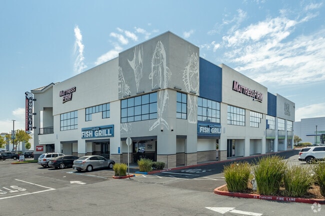
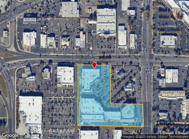
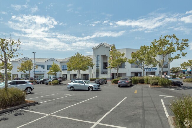
Property Record
2100 Arden Way, Sacramento, CA 95825
NEARBY LISTINGS FOR SALE OR LEASE
Property Detail
2100 Arden Way
285-0010-020
Rancho Del Paso
Regionalshoppingcenterormallwithanchorstore
THE E 690 NFT OF THEN 660 FT OF THE NW 1/4 OF THE NW 1/4 SEC 65,RANCHO DEL PASO, EXC THE N 425 FT OF THE E 360 FT THEREOF.
X
Sacramento
06067C0181H
California
2024
6.14 AC
2025
Arden/Watt/Howe
005506
Sacramento
149,833 SF
Sacramento--Roseville--Arden-Arcade, CA
DEMOGRAPHICS near 2100 Arden Way
1 Mile
3 Mile
5 Mile
2024 Total Population
21,273
148,724
401,754
2029 Population
21,512
149,828
405,429
Pop Growth 2024-2029
+ 1.12%
+ 0.74%
+ 0.91%
Average Age
34
38
39
2024 Total Households
8,489
59,455
158,541
HH Growth 2024-2029
+ 1.06%
+ 0.76%
+ 1.02%
Median Household Inc
$47,637
$62,059
$68,467
Avg Household Size
2.40
2.40
2.40
2024 Avg HH Vehicles
1.00
2.00
2.00
Median Home Value
$305,393
$523,531
$463,025
Median Year Built
1973
1963
1968
Nearby Places
Map Layers
Map Styles
 Street
 Aerial
- Restaurants
- Banks
- Shops
- Fitness
- Groceries
PUBLIC TRANSPORTATION
COMMUTER RAIL
Sacramento (Capitol Corridor - Capitol Corridor Joint Powers Authority)
DRIVE
WALK
Distance
Sacramento (Capitol Corridor - Capitol Corridor Joint Powers Authority)
10 min
6.0 mi
AIRPORT
Sacramento International
DRIVE
WALK
Distance
Sacramento International
22 min
14.3 mi
Freight Ports
Port of Stockton
DRIVE
WALK
Distance
Port of Stockton
62 min
52.7 mi
SALE & LEASE HISTORY
LISTING DATE
SALE/LEASE

Sep 25, 2016
For Lease
Sep 25, 2016
For Lease
Nearby Properties
Address
Land Use
TOTAL SIZE
Lot Size
Zoning
Address
Land Use
TOTAL SIZE
Lot Size
Zoning
10.28 AC
H
Address
Land Use
TOTAL SIZE
Lot Size
Zoning
201,132 SF
28.11 AC
C-2
Address
Land Use
TOTAL SIZE
Lot Size
Zoning
9.29 AC
R-1 OB-R-P
Address
Land Use
TOTAL SIZE
Lot Size
Zoning
490,607 SF
32.63 AC
RD-30
Address
Land Use
TOTAL SIZE
Lot Size
Zoning
2.87 AC
C-2
Address
Land Use
TOTAL SIZE
Lot Size
Zoning
31,163 SF
1.57 AC
C-2-TO-SPD
Address
Land Use
TOTAL SIZE
Lot Size
Zoning
10.49 AC
C-2
Address
Land Use
TOTAL SIZE
Lot Size
Zoning
319,856 SF
12.27 AC
R-3-R-PUD
Address
Land Use
TOTAL SIZE
Lot Size
Zoning
226,731 SF
15.73 AC
OB-PUD
Address
Land Use
TOTAL SIZE
Lot Size
Zoning
390,860 SF
20.17 AC
R-3-R-PUD
Address
Land Use
TOTAL SIZE
Lot Size
Zoning
383,000 SF
25.52 AC
M-1
Address
Land Use
TOTAL SIZE
Lot Size
Zoning
179,178 SF
3.35 AC
RO
Address
Land Use
TOTAL SIZE
Lot Size
Zoning
148,642 SF
7.15 AC
RD-30
Address
Land Use
TOTAL SIZE
Lot Size
Zoning
335,346 SF
16.65 AC
SC-R-PUD
Address
Land Use
TOTAL SIZE
Lot Size
Zoning
420,421 SF
25.39 AC
BP
Address
Land Use
TOTAL SIZE
Lot Size
Zoning
190,723 SF
9.10 AC
RD-30
Address
Land Use
TOTAL SIZE
Lot Size
Zoning
1,281 SF
0.42 AC
RD-20
Address
Land Use
TOTAL SIZE
Lot Size
Zoning
171,405 SF
13.80 AC
R-1
Address
Land Use
TOTAL SIZE
Lot Size
Zoning
74,008 SF
6.78 AC
H-PC
Address
Land Use
TOTAL SIZE
Lot Size
Zoning
303,950 SF
19.34 AC
R-2A-R
Address
Land Use
TOTAL SIZE
Lot Size
Zoning
82,936 SF
7.66 AC
SC-PUD
Address
Land Use
TOTAL SIZE
Lot Size
Zoning
136,152 SF
13.40 AC
AC LC
Address
Land Use
TOTAL SIZE
Lot Size
Zoning
168,560 SF
8.95 AC
RD-30
Address
Land Use
TOTAL SIZE
Lot Size
Zoning
152,000 SF
12.88 AC
SPA
Address
Land Use
TOTAL SIZE
Lot Size
Zoning
128,950 SF
0.75 AC
RMX-TO-SPD
Address
Land Use
TOTAL SIZE
Lot Size
Zoning
137,520 SF
10.37 AC
BP (PC)(PD
Address
Land Use
TOTAL SIZE
Lot Size
Zoning
81,504 SF
7.06 AC
LC (PC) RD
Address
Land Use
TOTAL SIZE
Lot Size
Zoning
387,136 SF
8.85 AC
RD-30
Address
Land Use
TOTAL SIZE
Lot Size
Zoning
168,846 SF
7.58 AC
RD-30 (PC)
The World's #1 Commercial Real Estate Marketplace
Connect with us
© 2026 CoStar Group
The information above has been obtained from sources believed reliable. While we do not doubt its accuracy we have not verified it and make no guarantee, warranty or representation about it. It is your responsibility to independently confirm its accuracy and completeness. Any projections, opinions, assumptions, or estimates used are for example only and do not represent the current or future performance of the property. The value of this transaction to you depends on tax and other factors which should be evaluated by your tax, financial, and legal advisors. You and your advisors should conduct a careful, independent investigation of the property to determine to your satisfaction the suitability of the property for your needs.