Property Record
2100 Burgaw Hwy, Jacksonville, NC 28540

NEARBY LISTINGS FOR SALE OR LEASE
-
-
View all Jacksonville listings for sale on LoopNet.com
Property Detail
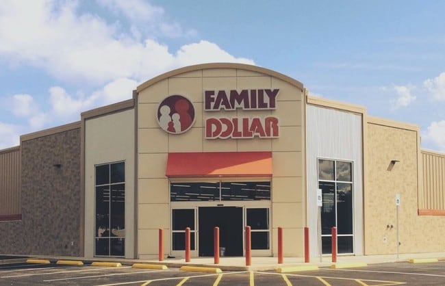
2100 Burgaw Hwy
001947
Crosland Southeast
Storebuilding
CROSLAND SOUTHEAST NC 53 & SR 1212
X
Onslow
3720434600J
North Carolina
2025
2.04 AC
2025
North Carolina Southeast Area
001101
Other Market Areas
8,320 SF
Jacksonville, NC
DEMOGRAPHICS near 2100 Burgaw Hwy
1 Mile
3 Mile
5 Mile
2024 Total Population
2,116
15,083
32,794
2029 Population
2,228
15,892
34,488
Pop Growth 2024-2029
+ 5.29%
+ 5.36%
+ 5.17%
Average Age
35
33
33
2024 Total Households
838
5,495
10,797
HH Growth 2024-2029
+ 5.61%
+ 5.84%
+ 5.80%
Median Household Inc
$47,466
$52,894
$53,259
Avg Household Size
2.50
2.50
2.50
2024 Avg HH Vehicles
2.00
2.00
2.00
Median Home Value
$157,017
$164,142
$166,889
Median Year Built
1988
1989
1987
Nearby Places
Map Layers
Map Styles
 Street
 Aerial
- Restaurants
- Banks
- Shops
- Fitness
- Groceries
PUBLIC TRANSPORTATION
AIRPORT
Albert J Ellis
DRIVE
WALK
Distance
Albert J Ellis
22 min
10.7 mi
Freight Ports
Port of Wilmington
DRIVE
WALK
Distance
Port of Wilmington
78 min
58.0 mi
SALE & LEASE HISTORY
LISTING DATE
SALE/LEASE

Sep 23, 2016
For Sale
Oct 17, 2016
For Sale
Oct 17, 2016
For Sale
Nearby Properties
Address
Land Use
TOTAL SIZE
Lot Size
Zoning
Address
Land Use
TOTAL SIZE
Lot Size
Zoning
211,186 SF
22.08 AC
CC
Address
Land Use
TOTAL SIZE
Lot Size
Zoning
96,863 SF
27.61 AC
RA
Address
Land Use
TOTAL SIZE
Lot Size
Zoning
93,849 SF
60 AC
HB
Address
Land Use
TOTAL SIZE
Lot Size
Zoning
464 SF
458.49 AC
H-IN
Address
Land Use
TOTAL SIZE
Lot Size
Zoning
79,581 SF
35 AC
O+I
Address
Land Use
TOTAL SIZE
Lot Size
Zoning
70,636 SF
48.82 AC
R-15
Address
Land Use
TOTAL SIZE
Lot Size
Zoning
11,064 SF
17.85 AC
RMF-HD
Address
Land Use
TOTAL SIZE
Lot Size
Zoning
140,403 SF
15.78 AC
CC
Address
Land Use
TOTAL SIZE
Lot Size
Zoning
36,567 SF
25.60 AC
HB
Address
Land Use
TOTAL SIZE
Lot Size
Zoning
29,476 SF
4.95 AC
CC
Address
Land Use
TOTAL SIZE
Lot Size
Zoning
10,001 SF
5.86 AC
CC
Address
Land Use
TOTAL SIZE
Lot Size
Zoning
30,036 SF
6.41 AC
CC
Address
Land Use
TOTAL SIZE
Lot Size
Zoning
15,950 SF
10.50 AC
CC
Address
Land Use
TOTAL SIZE
Lot Size
Zoning
32,854 SF
4.21 AC
HB
Address
Land Use
TOTAL SIZE
Lot Size
Zoning
11,860 SF
20.63 AC
HB
Address
Land Use
TOTAL SIZE
Lot Size
Zoning
8,298 SF
6.04 AC
CC
Address
Land Use
TOTAL SIZE
Lot Size
Zoning
15,000 SF
1.72 AC
CC
Address
Land Use
TOTAL SIZE
Lot Size
Zoning
6,032 SF
7.89 AC
HB
Address
Land Use
TOTAL SIZE
Lot Size
Zoning
17,160 SF
7.12 AC
CC
Address
Land Use
TOTAL SIZE
Lot Size
Zoning
22,455 SF
13.22 AC
RMF-HD
Address
Land Use
TOTAL SIZE
Lot Size
Zoning
27,500 SF
3.03 AC
CC
Address
Land Use
TOTAL SIZE
Lot Size
Zoning
14,736 SF
2.05 AC
CC
Address
Land Use
TOTAL SIZE
Lot Size
Zoning
12,149 SF
1.38 AC
CC
Address
Land Use
TOTAL SIZE
Lot Size
Zoning
23,812 SF
4 AC
CC
Address
Land Use
TOTAL SIZE
Lot Size
Zoning
17,196 SF
9.60 AC
RMF-HD
Address
Land Use
TOTAL SIZE
Lot Size
Zoning
12,172 SF
3.13 AC
CC
Address
Land Use
TOTAL SIZE
Lot Size
Zoning
20,744 SF
10.53 AC
RA
Address
Land Use
TOTAL SIZE
Lot Size
Zoning
10,716 SF
2.59 AC
HB
Address
Land Use
TOTAL SIZE
Lot Size
Zoning
10,640 SF
1.27 AC
CC
Address
Land Use
TOTAL SIZE
Lot Size
Zoning
13,122 SF
2.93 AC
RA
The World's #1 Commercial Real Estate Marketplace
Connect with us
© 2026 CoStar Group
The information above has been obtained from sources believed reliable. While we do not doubt its accuracy we have not verified it and make no guarantee, warranty or representation about it. It is your responsibility to independently confirm its accuracy and completeness. Any projections, opinions, assumptions, or estimates used are for example only and do not represent the current or future performance of the property. The value of this transaction to you depends on tax and other factors which should be evaluated by your tax, financial, and legal advisors. You and your advisors should conduct a careful, independent investigation of the property to determine to your satisfaction the suitability of the property for your needs.