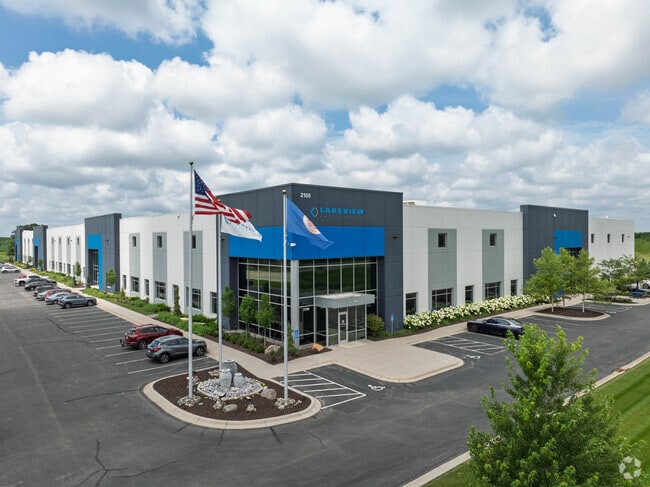
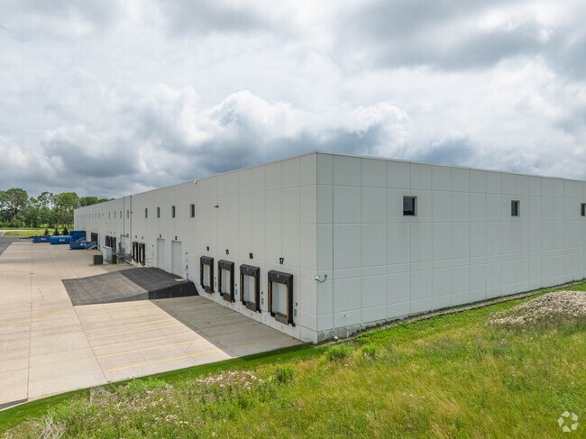
Property Record
2100 Commerce Dr, Carver, MN 55315

Current Lease Availabilities
Property Detail
2100 Commerce Dr
Minneapolis-St. Paul-Bloomington, MN-WI
Carver
20.1900010
Minnesota
Industrialgeneral
1
B and X Area of moderate flood hazard, usually the area between the limits of the 100-year and 500-year floods.
17.50 AC
2026
Southwest
2025
Minneapolis/St Paul
091100
NEARBY LISTINGS FOR SALE OR LEASE
-
-
View all Carver listings for lease on LoopNet.com
DEMOGRAPHICS near 2100 Commerce Dr
1 mile
3 mile
5 mile
2025 Total Population
1,531
21,618
47,320
2030 Population
1,659
22,766
49,490
Pop Growth 2025-2030
+ 8.36%
+ 5.31%
+ 4.59%
Average Age
38
37
39
2025 Total Households
517
7,561
16,921
HH Growth 2025-2030
+ 8.51%
+ 5.41%
+ 4.67%
Median Household Inc
$133,333
$134,047
$130,972
Avg Household Size
2.90
2.80
2.70
2025 Avg HH Vehicles
2.00
2.00
2.00
Median Home Value
$544,048
$415,975
$446,481
Median Year Built
2010
2002
1999
Nearby Places
Map Layers
Map Styles
 Street
 Aerial
Layers
 Traffic
 Biking
Places
Listings with unknown addresses are not visible on the map
- Restaurants
- Banks
- Shops
- Fitness
- Groceries
PUBLIC TRANSPORTATION
AIRPORT
Minneapolis-St Paul International/Wold-Chamberlain
Drive
Walk
Distance
Minneapolis-St Paul International/Wold-Chamberlain
35 min
26.0 mi
Freight Ports
Port Milwaukee
Drive
Walk
Distance
Port Milwaukee
404 min
363.1 mi
Nearby Properties
Address
Land Use
TOTAL SIZE
Lot Size
Zoning
Address
Land Use
TOTAL SIZE
Lot Size
Zoning
20,086 SF
12.99 AC
Address
Land Use
TOTAL SIZE
Lot Size
Zoning
20,586 SF
19.34 AC
Address
Land Use
TOTAL SIZE
Lot Size
Zoning
5.71 AC
Address
Land Use
TOTAL SIZE
Lot Size
Zoning
254,602 SF
18.19 AC
Address
Land Use
TOTAL SIZE
Lot Size
Zoning
57,769 SF
62.10 AC
Address
Land Use
TOTAL SIZE
Lot Size
Zoning
20.18 AC
Address
Land Use
TOTAL SIZE
Lot Size
Zoning
65,038 SF
6.72 AC
Address
Land Use
TOTAL SIZE
Lot Size
Zoning
3.20 AC
Address
Land Use
TOTAL SIZE
Lot Size
Zoning
18,980 SF
2.77 AC
Address
Land Use
TOTAL SIZE
Lot Size
Zoning
10.40 AC
Address
Land Use
TOTAL SIZE
Lot Size
Zoning
Address
Land Use
TOTAL SIZE
Lot Size
Zoning
33,982 SF
0.38 AC
Address
Land Use
TOTAL SIZE
Lot Size
Zoning
3.75 AC
Address
Land Use
TOTAL SIZE
Lot Size
Zoning
255,630 SF
27.07 AC
Address
Land Use
TOTAL SIZE
Lot Size
Zoning
6.32 AC
Address
Land Use
TOTAL SIZE
Lot Size
Zoning
119.59 AC
I-2
Address
Land Use
TOTAL SIZE
Lot Size
Zoning
6.08 AC
Address
Land Use
TOTAL SIZE
Lot Size
Zoning
100.55 AC
Address
Land Use
TOTAL SIZE
Lot Size
Zoning
29,674 SF
4.29 AC
Address
Land Use
TOTAL SIZE
Lot Size
Zoning
7,000 SF
31.53 AC
Address
Land Use
TOTAL SIZE
Lot Size
Zoning
17,600 SF
3.46 AC
Address
Land Use
TOTAL SIZE
Lot Size
Zoning
83.14 AC
Address
Land Use
TOTAL SIZE
Lot Size
Zoning
5,940 SF
1.52 AC
Address
Land Use
TOTAL SIZE
Lot Size
Zoning
100,524 SF
3.57 AC
Address
Land Use
TOTAL SIZE
Lot Size
Zoning
100,524 SF
2.72 AC
Address
Land Use
TOTAL SIZE
Lot Size
Zoning
Address
Land Use
TOTAL SIZE
Lot Size
Zoning
19,108 SF
1.51 AC
Address
Land Use
TOTAL SIZE
Lot Size
Zoning
70.74 AC
The World's #1 Commercial Real Estate Marketplace
Connect with us
© 2026 CoStar Group
The information above has been obtained from sources believed reliable. While we do not doubt its accuracy we have not verified it and make no guarantee, warranty or representation about it. It is your responsibility to independently confirm its accuracy and completeness. Any projections, opinions, assumptions, or estimates used are for example only and do not represent the current or future performance of the property. The value of this transaction to you depends on tax and other factors which should be evaluated by your tax, financial, and legal advisors. You and your advisors should conduct a careful, independent investigation of the property to determine to your satisfaction the suitability of the property for your needs.