Property Record
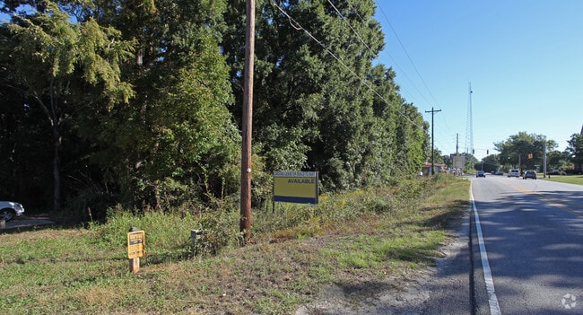
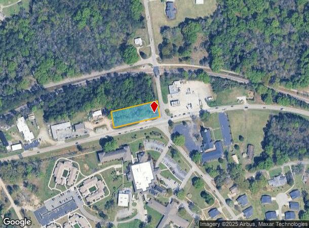
2100 Dutch Fork Rd, Chapin, SC 29036
Current Lease Availabilities
NEARBY LISTINGS FOR SALE OR LEASE
Property Detail
2100 Dutch Fork Rd
Columbia, SC
Irmo Whiterock Ballentine
01511-01-06
#SU #PR
Commercialnec
Richland
X
South Carolina
45063C0050J
0.63 AC
2025
Dutch Fork/Irmo
2024
Columbia
010311
DEMOGRAPHICS near 2100 Dutch Fork Rd
1 Mile
3 Mile
5 Mile
2024 Total Population
2,537
17,367
40,884
2029 Population
2,564
17,769
42,744
Pop Growth 2024-2029
+ 1.06%
+ 2.31%
+ 4.55%
Average Age
40
40
40
2024 Total Households
934
6,270
15,047
HH Growth 2024-2029
+ 1.07%
+ 2.34%
+ 4.69%
Median Household Inc
$99,732
$111,295
$105,565
Avg Household Size
2.60
2.70
2.70
2024 Avg HH Vehicles
2.00
2.00
2.00
Median Home Value
$387,653
$334,060
$304,921
Median Year Built
2004
2005
2002
Nearby Places
Map Layers
Map Styles
 Street
 Aerial
- Restaurants
- Banks
- Shops
- Fitness
- Groceries
PUBLIC TRANSPORTATION
AIRPORT
Columbia Metro
DRIVE
WALK
Distance
Columbia Metro
39 min
22.9 mi
Freight Ports
North Charleston Terminal
DRIVE
WALK
Distance
North Charleston Terminal
138 min
119.1 mi
Nearby Properties
Address
Land Use
TOTAL SIZE
Lot Size
Zoning
Address
Land Use
TOTAL SIZE
Lot Size
Zoning
3,957 SF
20.32 AC
GC
Address
Land Use
TOTAL SIZE
Lot Size
Zoning
333,986 SF
11.33 AC
GC
Address
Land Use
TOTAL SIZE
Lot Size
Zoning
31,005 SF
55.97 AC
PDD
Address
Land Use
TOTAL SIZE
Lot Size
Zoning
1,958 SF
145.19 AC
PDD
Address
Land Use
TOTAL SIZE
Lot Size
Zoning
1,728 SF
5.24 AC
GC
Address
Land Use
TOTAL SIZE
Lot Size
Zoning
64,680 SF
11 AC
GC
Address
Land Use
TOTAL SIZE
Lot Size
Zoning
21,580 SF
16.15 AC
GC
Address
Land Use
TOTAL SIZE
Lot Size
Zoning
56,750 SF
8.16 AC
M-1
Address
Land Use
TOTAL SIZE
Lot Size
Zoning
76,066 SF
7.29 AC
M-1
Address
Land Use
TOTAL SIZE
Lot Size
Zoning
57,020 SF
11.80 AC
PDD
Address
Land Use
TOTAL SIZE
Lot Size
Zoning
56,588 SF
6.46 AC
GC
Address
Land Use
TOTAL SIZE
Lot Size
Zoning
20,344 SF
13.21 AC
RU
Address
Land Use
TOTAL SIZE
Lot Size
Zoning
15,205 SF
2.05 AC
C-3
Address
Land Use
TOTAL SIZE
Lot Size
Zoning
31,032 SF
7.36 AC
GC
Address
Land Use
TOTAL SIZE
Lot Size
Zoning
17,683 SF
16.46 AC
RU
Address
Land Use
TOTAL SIZE
Lot Size
Zoning
23,439 SF
7.68 AC
RU
Address
Land Use
TOTAL SIZE
Lot Size
Zoning
19,142 SF
15.08 AC
PDD
Address
Land Use
TOTAL SIZE
Lot Size
Zoning
5,050 SF
4.68 AC
RU
Address
Land Use
TOTAL SIZE
Lot Size
Zoning
23,600 SF
3.50 AC
M-1
Address
Land Use
TOTAL SIZE
Lot Size
Zoning
4.20 AC
RU
Address
Land Use
TOTAL SIZE
Lot Size
Zoning
10,953 SF
1.20 AC
GC
Address
Land Use
TOTAL SIZE
Lot Size
Zoning
27.42 AC
M-1
Address
Land Use
TOTAL SIZE
Lot Size
Zoning
15,184 SF
3.17 AC
GC
Address
Land Use
TOTAL SIZE
Lot Size
Zoning
32,200 SF
2.33 AC
M-1
Address
Land Use
TOTAL SIZE
Lot Size
Zoning
16,034 SF
4.74 AC
RU
Address
Land Use
TOTAL SIZE
Lot Size
Zoning
14.62 AC
M-1
Address
Land Use
TOTAL SIZE
Lot Size
Zoning
10,764 SF
1.84 AC
GC
Address
Land Use
TOTAL SIZE
Lot Size
Zoning
55.02 AC
RS-LD
Address
Land Use
TOTAL SIZE
Lot Size
Zoning
3,830 SF
3 AC
M-1
Address
Land Use
TOTAL SIZE
Lot Size
Zoning
19,500 SF
2 AC
M-1
The World's #1 Commercial Real Estate Marketplace
Connect with us
© 2025 CoStar Group
The information above has been obtained from sources believed reliable. While we do not doubt its accuracy we have not verified it and make no guarantee, warranty or representation about it. It is your responsibility to independently confirm its accuracy and completeness. Any projections, opinions, assumptions, or estimates used are for example only and do not represent the current or future performance of the property. The value of this transaction to you depends on tax and other factors which should be evaluated by your tax, financial, and legal advisors. You and your advisors should conduct a careful, independent investigation of the property to determine to your satisfaction the suitability of the property for your needs.