Property Record
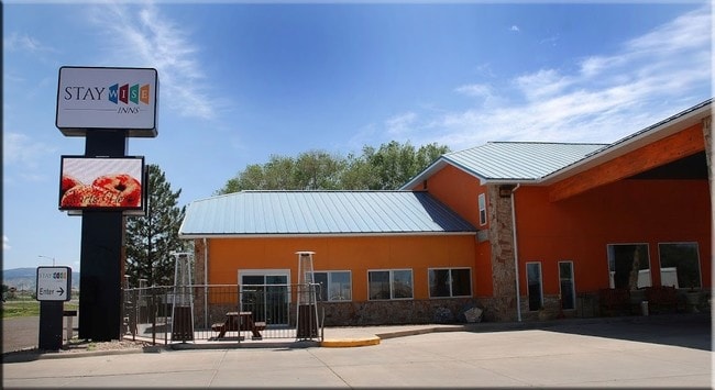
2100 E Main St, Montrose, CO 81401


Property Detail
2100 E Main St
Montrose, CO
SUBD: S F & E MINOR SUBD LOT 2 SPLIT LOT: A S: 26 T: 49 R: 9
R0652233
Montrose
Hotelormotel
Colorado
B and X Area of moderate flood hazard, usually the area between the limits of the 100-year and 500-year floods.
2
2024
1.43 AC
2024
Colorado Southwest Area
966402
Other Market Areas
24,942 SF
NEARBY LISTINGS FOR SALE OR LEASE
DEMOGRAPHICS near 2100 E Main St
1 mile
3 mile
5 mile
2024 Total Population
5,132
25,183
31,592
2029 Population
5,355
26,363
33,095
Pop Growth 2024-2029
+ 4.35%
+ 4.69%
+ 4.76%
Average Age
42
43
44
2024 Total Households
2,177
10,635
13,216
HH Growth 2024-2029
+ 4.36%
+ 4.70%
+ 4.77%
Median Household Inc
$76,865
$67,295
$71,459
Avg Household Size
2.30
2.30
2.30
2024 Avg HH Vehicles
2.00
2.00
2.00
Median Home Value
$341,265
$354,809
$376,812
Median Year Built
1986
1992
1993
Nearby Places
Map Layers
Map Styles
 Street
 Aerial
Transit
 Traffic
 Biking
Places
Listings with unknown addresses are not visible on the map
- Restaurants
- Banks
- Shops
- Fitness
- Groceries
PUBLIC TRANSPORTATION
AIRPORT
Montrose Regional
Drive
Walk
Distance
Montrose Regional
14 min
5.1 mi
SALE & LEASE HISTORY
LISTING DATE
SALE/LEASE

Feb 13, 2017
For Sale
Nearby Properties
Address
Land Use
TOTAL SIZE
Lot Size
Zoning
Address
Land Use
TOTAL SIZE
Lot Size
Zoning
229,488 SF
Address
Land Use
TOTAL SIZE
Lot Size
Zoning
82,754 SF
21.29 AC
Address
Land Use
TOTAL SIZE
Lot Size
Zoning
104,240 SF
29.39 AC
Address
Land Use
TOTAL SIZE
Lot Size
Zoning
84,927 SF
15.45 AC
Address
Land Use
TOTAL SIZE
Lot Size
Zoning
83,990 SF
Address
Land Use
TOTAL SIZE
Lot Size
Zoning
67,223 SF
0.62 AC
Address
Land Use
TOTAL SIZE
Lot Size
Zoning
49,158 SF
18.15 AC
Address
Land Use
TOTAL SIZE
Lot Size
Zoning
93,240 SF
8.32 AC
Address
Land Use
TOTAL SIZE
Lot Size
Zoning
17,872 SF
2 AC
Address
Land Use
TOTAL SIZE
Lot Size
Zoning
52,533 SF
3.73 AC
Address
Land Use
TOTAL SIZE
Lot Size
Zoning
204,041 SF
17.30 AC
Address
Land Use
TOTAL SIZE
Lot Size
Zoning
63,757 SF
2.14 AC
Address
Land Use
TOTAL SIZE
Lot Size
Zoning
54,088 SF
79.70 AC
Address
Land Use
TOTAL SIZE
Lot Size
Zoning
9,607 SF
17.78 AC
Address
Land Use
TOTAL SIZE
Lot Size
Zoning
21,000 SF
14.34 AC
Address
Land Use
TOTAL SIZE
Lot Size
Zoning
48,096 SF
33.43 AC
B2
Address
Land Use
TOTAL SIZE
Lot Size
Zoning
68,768 SF
7.73 AC
Address
Land Use
TOTAL SIZE
Lot Size
Zoning
33,554 SF
10 AC
Address
Land Use
TOTAL SIZE
Lot Size
Zoning
51,727 SF
2.56 AC
Address
Land Use
TOTAL SIZE
Lot Size
Zoning
38,729 SF
3.83 AC
Address
Land Use
TOTAL SIZE
Lot Size
Zoning
13,091 SF
0.86 AC
MR
Address
Land Use
TOTAL SIZE
Lot Size
Zoning
250,620 SF
21.70 AC
Address
Land Use
TOTAL SIZE
Lot Size
Zoning
95,971 SF
4.68 AC
Address
Land Use
TOTAL SIZE
Lot Size
Zoning
97,056 SF
11.51 AC
Address
Land Use
TOTAL SIZE
Lot Size
Zoning
34,032 SF
1.56 AC
Address
Land Use
TOTAL SIZE
Lot Size
Zoning
38,566 SF
2 AC
Address
Land Use
TOTAL SIZE
Lot Size
Zoning
965.96 AC
Address
Land Use
TOTAL SIZE
Lot Size
Zoning
44,918 SF
4.49 AC
Address
Land Use
TOTAL SIZE
Lot Size
Zoning
22,219 SF
6.27 AC
Address
Land Use
TOTAL SIZE
Lot Size
Zoning
48,396 SF
7.94 AC
The World's #1 Commercial Real Estate Marketplace
Connect with us
© 2026 CoStar Group
The information above has been obtained from sources believed reliable. While we do not doubt its accuracy we have not verified it and make no guarantee, warranty or representation about it. It is your responsibility to independently confirm its accuracy and completeness. Any projections, opinions, assumptions, or estimates used are for example only and do not represent the current or future performance of the property. The value of this transaction to you depends on tax and other factors which should be evaluated by your tax, financial, and legal advisors. You and your advisors should conduct a careful, independent investigation of the property to determine to your satisfaction the suitability of the property for your needs.