Property Record
2100 Emmanuel Way, Springfield, OH 45502

NEARBY LISTINGS FOR SALE OR LEASE
Property Detail
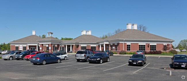
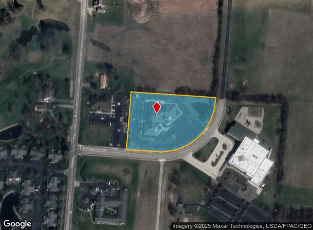
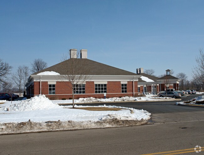
2100 Emmanuel Way
Springfield, OH
Springfield Prof Suites Rec
32-00300-02040-0064
SPRINGFIELD PROFESSIONAL SUITES 18953
Officebuilding
Clark
X
Ohio
39023C0185E
64
2024
3.32 AC
2025
Northeast Dayton
002501
Cincinnati/Dayton
25,952 SF
DEMOGRAPHICS near 2100 Emmanuel Way
1 Mile
3 Mile
5 Mile
2024 Total Population
5,537
29,731
70,964
2029 Population
5,487
29,362
70,737
Pop Growth 2024-2029
(0.90%)
(1.24%)
(0.32%)
Average Age
48
44
41
2024 Total Households
2,558
13,105
29,736
HH Growth 2024-2029
(1.09%)
(1.31%)
(0.43%)
Median Household Inc
$60,170
$59,875
$52,055
Avg Household Size
2.10
2.20
2.20
2024 Avg HH Vehicles
2.00
2.00
2.00
Median Home Value
$156,315
$153,773
$136,257
Median Year Built
1978
1971
1958
Nearby Places
Map Layers
Map Styles
 Street
 Aerial
- Restaurants
- Banks
- Shops
- Fitness
- Groceries
PUBLIC TRANSPORTATION
AIRPORT
James M Cox Dayton International
DRIVE
WALK
Distance
James M Cox Dayton International
41 min
32.4 mi
Freight Ports
Port of Toledo
DRIVE
WALK
Distance
Port of Toledo
184 min
129.0 mi
SALE & LEASE HISTORY
LISTING DATE
SALE/LEASE

Sep 23, 2016
For Sale
Nearby Properties
Address
Land Use
TOTAL SIZE
Lot Size
Zoning
Address
Land Use
TOTAL SIZE
Lot Size
Zoning
399,308 SF
11.06 AC
Address
Land Use
TOTAL SIZE
Lot Size
Zoning
107.87 AC
Address
Land Use
TOTAL SIZE
Lot Size
Zoning
3,360 SF
96.84 AC
Address
Land Use
TOTAL SIZE
Lot Size
Zoning
193,701 SF
16.31 AC
Address
Land Use
TOTAL SIZE
Lot Size
Zoning
399,308 SF
11.06 AC
Address
Land Use
TOTAL SIZE
Lot Size
Zoning
61,376 SF
3.95 AC
Address
Land Use
TOTAL SIZE
Lot Size
Zoning
25.44 AC
Address
Land Use
TOTAL SIZE
Lot Size
Zoning
1,582 SF
42.13 AC
Address
Land Use
TOTAL SIZE
Lot Size
Zoning
48,514 SF
9.72 AC
R-4S
Address
Land Use
TOTAL SIZE
Lot Size
Zoning
62,085 SF
6.05 AC
A-1
Address
Land Use
TOTAL SIZE
Lot Size
Zoning
6,521 SF
94.30 AC
Address
Land Use
TOTAL SIZE
Lot Size
Zoning
79,187 SF
7.70 AC
Address
Land Use
TOTAL SIZE
Lot Size
Zoning
36,172 SF
2.14 AC
Address
Land Use
TOTAL SIZE
Lot Size
Zoning
12.76 AC
Address
Land Use
TOTAL SIZE
Lot Size
Zoning
399,308 SF
31.78 AC
Address
Land Use
TOTAL SIZE
Lot Size
Zoning
28,228 SF
7.47 AC
A-1
Address
Land Use
TOTAL SIZE
Lot Size
Zoning
41,710 SF
5.25 AC
Address
Land Use
TOTAL SIZE
Lot Size
Zoning
20,448 SF
7.35 AC
Address
Land Use
TOTAL SIZE
Lot Size
Zoning
36,858 SF
17.81 AC
Address
Land Use
TOTAL SIZE
Lot Size
Zoning
50,170 SF
7.09 AC
Address
Land Use
TOTAL SIZE
Lot Size
Zoning
16,860 SF
18.13 AC
Address
Land Use
TOTAL SIZE
Lot Size
Zoning
6,636 SF
5.53 AC
Address
Land Use
TOTAL SIZE
Lot Size
Zoning
11.42 AC
Address
Land Use
TOTAL SIZE
Lot Size
Zoning
Address
Land Use
TOTAL SIZE
Lot Size
Zoning
137,420 SF
5.45 AC
Address
Land Use
TOTAL SIZE
Lot Size
Zoning
399,308 SF
11.06 AC
Address
Land Use
TOTAL SIZE
Lot Size
Zoning
65,174 SF
4.06 AC
Address
Land Use
TOTAL SIZE
Lot Size
Zoning
137,420 SF
5.45 AC
Address
Land Use
TOTAL SIZE
Lot Size
Zoning
191,825 SF
9.23 AC
Address
Land Use
TOTAL SIZE
Lot Size
Zoning
96,300 SF
11.57 AC
The World's #1 Commercial Real Estate Marketplace
Connect with us
© 2026 CoStar Group
The information above has been obtained from sources believed reliable. While we do not doubt its accuracy we have not verified it and make no guarantee, warranty or representation about it. It is your responsibility to independently confirm its accuracy and completeness. Any projections, opinions, assumptions, or estimates used are for example only and do not represent the current or future performance of the property. The value of this transaction to you depends on tax and other factors which should be evaluated by your tax, financial, and legal advisors. You and your advisors should conduct a careful, independent investigation of the property to determine to your satisfaction the suitability of the property for your needs.