Property Record
2100 N Clifton Ave, Springfield, MO 65803


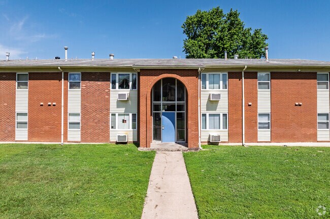
Property Detail
2100 N Clifton Ave
13-10-206-090
HUGHES APTS, JOHN B & HUGHES APTS UNIT 2, JOHN B
Apartment
Greene
INC
Missouri
B and X Area of moderate flood hazard, usually the area between the limits of the 100-year and 500-year floods.
11.85 AC
2025
Northwest Springfield
2025
Springfield
003300
Springfield, MO
NEARBY LISTINGS FOR SALE OR LEASE
DEMOGRAPHICS near 2100 N Clifton Ave
1 mile
3 mile
5 mile
2025 Total Population
6,609
58,462
125,793
2030 Population
6,868
60,381
129,571
Pop Growth 2025-2030
+ 3.92%
+ 3.28%
+ 3.00%
Average Age
37
37
37
2025 Total Households
2,777
24,346
53,565
HH Growth 2025-2030
+ 4.11%
+ 3.51%
+ 3.25%
Median Household Inc
$39,301
$43,536
$47,676
Avg Household Size
2.30
2.20
2.10
2025 Avg HH Vehicles
1.00
2.00
2.00
Median Home Value
$103,116
$134,679
$169,098
Median Year Built
1975
1971
1976
Nearby Places
Map Layers
Map Styles
 Street
 Aerial
Layers
 Traffic
 Biking
Places
Listings with unknown addresses are not visible on the map
- Restaurants
- Banks
- Shops
- Fitness
- Groceries
PUBLIC TRANSPORTATION
AIRPORT
Springfield-Branson Ntl
Drive
Walk
Distance
Springfield-Branson Ntl
15 min
5.3 mi
Freight Ports
Tulsa Port of Inola
Drive
Walk
Distance
Tulsa Port of Inola
190 min
170.1 mi
Nearby Properties
Address
Land Use
TOTAL SIZE
Lot Size
Zoning
Address
Land Use
TOTAL SIZE
Lot Size
Zoning
320,532 SF
33.54 AC
INC
Address
Land Use
TOTAL SIZE
Lot Size
Zoning
23.75 AC
Address
Land Use
TOTAL SIZE
Lot Size
Zoning
355,759 SF
2.23 AC
INC
Address
Land Use
TOTAL SIZE
Lot Size
Zoning
11 AC
INC
Address
Land Use
TOTAL SIZE
Lot Size
Zoning
234,926 SF
9.41 AC
INC
Address
Land Use
TOTAL SIZE
Lot Size
Zoning
102,925 SF
57.24 AC
INC
Address
Land Use
TOTAL SIZE
Lot Size
Zoning
186,125 SF
21.09 AC
INC
Address
Land Use
TOTAL SIZE
Lot Size
Zoning
2.92 AC
INC
Address
Land Use
TOTAL SIZE
Lot Size
Zoning
93,916 SF
7.91 AC
INC
Address
Land Use
TOTAL SIZE
Lot Size
Zoning
167,705 SF
1.43 AC
INC
Address
Land Use
TOTAL SIZE
Lot Size
Zoning
29.42 AC
INC
Address
Land Use
TOTAL SIZE
Lot Size
Zoning
136,629 SF
26.79 AC
INC
Address
Land Use
TOTAL SIZE
Lot Size
Zoning
10.76 AC
INC
Address
Land Use
TOTAL SIZE
Lot Size
Zoning
75.07 AC
INC
Address
Land Use
TOTAL SIZE
Lot Size
Zoning
20.54 AC
Address
Land Use
TOTAL SIZE
Lot Size
Zoning
Address
Land Use
TOTAL SIZE
Lot Size
Zoning
83,380 SF
7.20 AC
INC
Address
Land Use
TOTAL SIZE
Lot Size
Zoning
107,429 SF
0.78 AC
INC
Address
Land Use
TOTAL SIZE
Lot Size
Zoning
Address
Land Use
TOTAL SIZE
Lot Size
Zoning
Address
Land Use
TOTAL SIZE
Lot Size
Zoning
12.39 AC
Address
Land Use
TOTAL SIZE
Lot Size
Zoning
78,239 SF
10.01 AC
INC
Address
Land Use
TOTAL SIZE
Lot Size
Zoning
213,437 SF
1.58 AC
INC
Address
Land Use
TOTAL SIZE
Lot Size
Zoning
Address
Land Use
TOTAL SIZE
Lot Size
Zoning
77,160 SF
6.31 AC
INC
Address
Land Use
TOTAL SIZE
Lot Size
Zoning
55,568 SF
2.13 AC
INC
Address
Land Use
TOTAL SIZE
Lot Size
Zoning
55,309 SF
0.69 AC
INC
Address
Land Use
TOTAL SIZE
Lot Size
Zoning
105,920 SF
4.88 AC
INC
Address
Land Use
TOTAL SIZE
Lot Size
Zoning
75,000 SF
8.92 AC
INC
Address
Land Use
TOTAL SIZE
Lot Size
Zoning
52,772 SF
5.12 AC
INC
The World's #1 Commercial Real Estate Marketplace
Connect with us
© 2026 CoStar Group
The information above has been obtained from sources believed reliable. While we do not doubt its accuracy we have not verified it and make no guarantee, warranty or representation about it. It is your responsibility to independently confirm its accuracy and completeness. Any projections, opinions, assumptions, or estimates used are for example only and do not represent the current or future performance of the property. The value of this transaction to you depends on tax and other factors which should be evaluated by your tax, financial, and legal advisors. You and your advisors should conduct a careful, independent investigation of the property to determine to your satisfaction the suitability of the property for your needs.