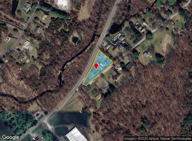
Property Record
2100 Route 9G, Staatsburg, NY 12580
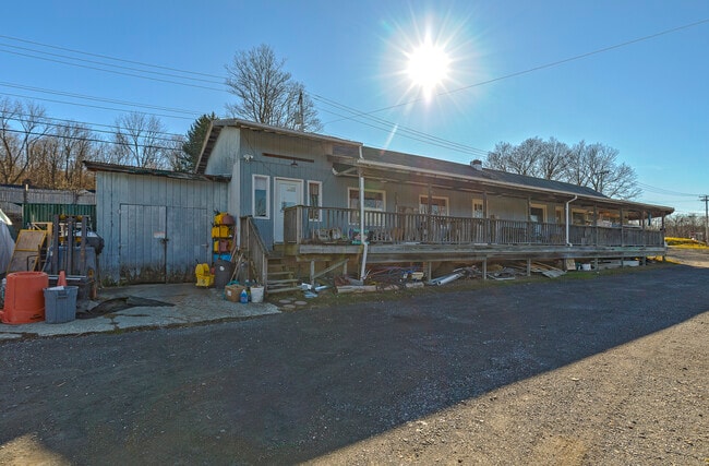
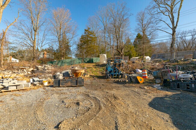
This Property Is For Sale
NEARBY LISTINGS FOR SALE OR LEASE
Property Detail
2100 Route 9G
132400-6267-00-180570-0000
.79 AC (D) 1545 0738 1326 0932
Commercialnec
Dutchess
X
New York
36027C0257E
180
2025
0.79 AC
2024
Fishkill
030000
Westchester/So Connecticut
3,060 SF
Dutchess County-Putnam County, NY
DEMOGRAPHICS near 2100 Route 9G
1 Mile
3 Mile
5 Mile
2024 Total Population
651
5,577
15,716
2029 Population
656
5,631
15,824
Pop Growth 2024-2029
+ 0.77%
+ 0.97%
+ 0.69%
Average Age
46
46
46
2024 Total Households
265
2,165
6,242
HH Growth 2024-2029
+ 0.75%
+ 1.06%
+ 0.72%
Median Household Inc
$136,111
$101,429
$91,370
Avg Household Size
2.40
2.40
2.30
2024 Avg HH Vehicles
2.00
2.00
2.00
Median Home Value
$396,077
$361,255
$350,974
Median Year Built
1977
1978
1972
Nearby Places
Map Layers
Map Styles
 Street
 Aerial
- Restaurants
- Banks
- Shops
- Fitness
- Groceries
PUBLIC TRANSPORTATION
COMMUTER RAIL
DRIVE
WALK
Distance
17 min
9.6 mi
DRIVE
WALK
Distance
16 min
9.7 mi
AIRPORT
New York Stewart International
DRIVE
WALK
Distance
New York Stewart International
52 min
35.4 mi
Nearby Properties
Address
Land Use
TOTAL SIZE
Lot Size
Zoning
Address
Land Use
TOTAL SIZE
Lot Size
Zoning
162.70 AC
R20
Address
Land Use
TOTAL SIZE
Lot Size
Zoning
250,645 SF
65 AC
GB
Address
Land Use
TOTAL SIZE
Lot Size
Zoning
13,306 SF
72.74 AC
RA10
Address
Land Use
TOTAL SIZE
Lot Size
Zoning
50,867 SF
136 AC
RC5
Address
Land Use
TOTAL SIZE
Lot Size
Zoning
24,956 SF
100 AC
WF
Address
Land Use
TOTAL SIZE
Lot Size
Zoning
170.76 AC
RA10
Address
Land Use
TOTAL SIZE
Lot Size
Zoning
11,071 SF
500.10 AC
G
Address
Land Use
TOTAL SIZE
Lot Size
Zoning
3,857 SF
226.87 AC
AR5A
Address
Land Use
TOTAL SIZE
Lot Size
Zoning
9,528 SF
20 AC
RC5
Address
Land Use
TOTAL SIZE
Lot Size
Zoning
9,994 SF
61 AC
AR5A
Address
Land Use
TOTAL SIZE
Lot Size
Zoning
5,366 SF
21.30 AC
RC5
Address
Land Use
TOTAL SIZE
Lot Size
Zoning
5,192 SF
88.89 AC
AR3A
Address
Land Use
TOTAL SIZE
Lot Size
Zoning
90 AC
WF
Address
Land Use
TOTAL SIZE
Lot Size
Zoning
48,075 SF
3.30 AC
WF
Address
Land Use
TOTAL SIZE
Lot Size
Zoning
6,078 SF
10.09 AC
AR5A
Address
Land Use
TOTAL SIZE
Lot Size
Zoning
6,868 SF
107.85 AC
AR3A
Address
Land Use
TOTAL SIZE
Lot Size
Zoning
5,304 SF
6.41 AC
HP20
Address
Land Use
TOTAL SIZE
Lot Size
Zoning
5,216 SF
16.65 AC
AR5A
Address
Land Use
TOTAL SIZE
Lot Size
Zoning
22,736 SF
8 AC
GB
Address
Land Use
TOTAL SIZE
Lot Size
Zoning
11,903 SF
91.10 AC
WF
Address
Land Use
TOTAL SIZE
Lot Size
Zoning
4,408 SF
3.92 AC
AR5A
Address
Land Use
TOTAL SIZE
Lot Size
Zoning
2,696 SF
67.22 AC
AR3A
Address
Land Use
TOTAL SIZE
Lot Size
Zoning
41,595 SF
4.03 AC
NBD
Address
Land Use
TOTAL SIZE
Lot Size
Zoning
8,678 SF
1.56 AC
AR3A
Address
Land Use
TOTAL SIZE
Lot Size
Zoning
5,298 SF
6.40 AC
RC5
Address
Land Use
TOTAL SIZE
Lot Size
Zoning
36,720 SF
24.50 AC
I
Address
Land Use
TOTAL SIZE
Lot Size
Zoning
2,681 SF
2.41 AC
RC5
Address
Land Use
TOTAL SIZE
Lot Size
Zoning
6,608 SF
1.48 AC
RC5
Address
Land Use
TOTAL SIZE
Lot Size
Zoning
2,965 SF
24.26 AC
MR1A
Address
Land Use
TOTAL SIZE
Lot Size
Zoning
105 AC
WF
The World's #1 Commercial Real Estate Marketplace
Connect with us
© 2025 CoStar Group
The information above has been obtained from sources believed reliable. While we do not doubt its accuracy we have not verified it and make no guarantee, warranty or representation about it. It is your responsibility to independently confirm its accuracy and completeness. Any projections, opinions, assumptions, or estimates used are for example only and do not represent the current or future performance of the property. The value of this transaction to you depends on tax and other factors which should be evaluated by your tax, financial, and legal advisors. You and your advisors should conduct a careful, independent investigation of the property to determine to your satisfaction the suitability of the property for your needs.