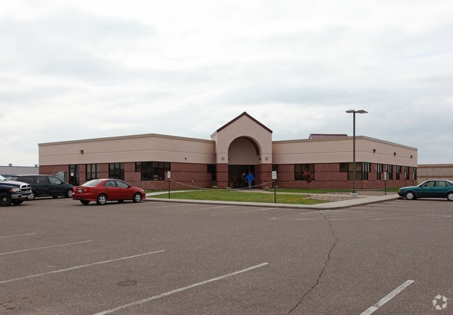
Property Record
2100 Oneil Rd, Hudson, WI 54016

Property Detail
2100 Oneil Rd
236-1982-25-000
LOT 25 ST CROIX BUSINESS PARK FIRST ADDITION
Industrialpark
Saint Croix
I-1
Wisconsin
B and X Area of moderate flood hazard, usually the area between the limits of the 100-year and 500-year floods.
25
2025
1.91 AC
2025
St Croix County
120905
Minneapolis/St Paul
2,592 SF
Minneapolis-St. Paul-Bloomington, MN-WI
NEARBY LISTINGS FOR SALE OR LEASE
DEMOGRAPHICS near 2100 Oneil Rd
1 mile
3 mile
5 mile
2025 Total Population
4,207
20,662
37,615
2030 Population
4,344
21,405
38,946
Pop Growth 2025-2030
+ 3.26%
+ 3.60%
+ 3.54%
Average Age
42
42
42
2025 Total Households
1,778
8,259
14,788
HH Growth 2025-2030
+ 3.37%
+ 3.69%
+ 3.67%
Median Household Inc
$116,165
$112,056
$115,786
Avg Household Size
2.30
2.50
2.50
2025 Avg HH Vehicles
2.00
2.00
2.00
Median Home Value
$425,631
$431,417
$441,707
Median Year Built
2007
1999
1994
Nearby Places
Map Layers
Map Styles
 Street
 Aerial
Layers
 Traffic
 Biking
Places
Listings with unknown addresses are not visible on the map
- Restaurants
- Banks
- Shops
- Fitness
- Groceries
PUBLIC TRANSPORTATION
AIRPORT
Minneapolis-St Paul International/Wold-Chamberlain
Drive
Walk
Distance
Minneapolis-St Paul International/Wold-Chamberlain
42 min
29.7 mi
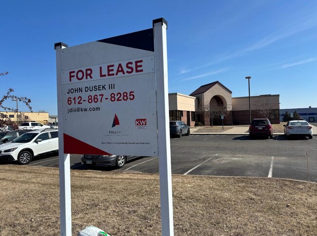
SALE & LEASE HISTORY
LISTING DATE
SALE/LEASE

Sep 17, 2020
For Sale
Nearby Properties
Address
Land Use
TOTAL SIZE
Lot Size
Zoning
Address
Land Use
TOTAL SIZE
Lot Size
Zoning
10.90 AC
Address
Land Use
TOTAL SIZE
Lot Size
Zoning
404,968 SF
29.93 AC
I-1
Address
Land Use
TOTAL SIZE
Lot Size
Zoning
3.78 AC
Address
Land Use
TOTAL SIZE
Lot Size
Zoning
255,000 SF
16.74 AC
I-1
Address
Land Use
TOTAL SIZE
Lot Size
Zoning
5.34 AC
Address
Land Use
TOTAL SIZE
Lot Size
Zoning
2,592 SF
7.73 AC
B-2
Address
Land Use
TOTAL SIZE
Lot Size
Zoning
3.68 AC
Address
Land Use
TOTAL SIZE
Lot Size
Zoning
124,739 SF
10.26 AC
B-2
Address
Land Use
TOTAL SIZE
Lot Size
Zoning
7.66 AC
Address
Land Use
TOTAL SIZE
Lot Size
Zoning
66,516 SF
5 AC
PRD-2
Address
Land Use
TOTAL SIZE
Lot Size
Zoning
100,892 SF
11.32 AC
I-1
Address
Land Use
TOTAL SIZE
Lot Size
Zoning
12,271 SF
8.56 AC
B-2
Address
Land Use
TOTAL SIZE
Lot Size
Zoning
0.90 AC
Address
Land Use
TOTAL SIZE
Lot Size
Zoning
2.67 AC
Address
Land Use
TOTAL SIZE
Lot Size
Zoning
2.51 AC
Address
Land Use
TOTAL SIZE
Lot Size
Zoning
4.50 AC
Address
Land Use
TOTAL SIZE
Lot Size
Zoning
20,845 SF
4.01 AC
B-2
Address
Land Use
TOTAL SIZE
Lot Size
Zoning
20,456 SF
13.93 AC
B-2
Address
Land Use
TOTAL SIZE
Lot Size
Zoning
92,971 SF
9.56 AC
B-2
Address
Land Use
TOTAL SIZE
Lot Size
Zoning
Address
Land Use
TOTAL SIZE
Lot Size
Zoning
18,848 SF
4.41 AC
RM-1
Address
Land Use
TOTAL SIZE
Lot Size
Zoning
25,272 SF
3.60 AC
RM-1
Address
Land Use
TOTAL SIZE
Lot Size
Zoning
12,612 SF
4 AC
RM-1
Address
Land Use
TOTAL SIZE
Lot Size
Zoning
63,024 SF
4.70 AC
Address
Land Use
TOTAL SIZE
Lot Size
Zoning
86,279 SF
8.46 AC
B-2
Address
Land Use
TOTAL SIZE
Lot Size
Zoning
27,601 SF
3.21 AC
B-2
Address
Land Use
TOTAL SIZE
Lot Size
Zoning
43,342 SF
8.11 AC
B-2
Address
Land Use
TOTAL SIZE
Lot Size
Zoning
6.76 AC
Address
Land Use
TOTAL SIZE
Lot Size
Zoning
20,744 SF
6.11 AC
RM-1
Address
Land Use
TOTAL SIZE
Lot Size
Zoning
55,072 SF
6.33 AC
B-2
The World's #1 Commercial Real Estate Marketplace
Connect with us
© 2026 CoStar Group
The information above has been obtained from sources believed reliable. While we do not doubt its accuracy we have not verified it and make no guarantee, warranty or representation about it. It is your responsibility to independently confirm its accuracy and completeness. Any projections, opinions, assumptions, or estimates used are for example only and do not represent the current or future performance of the property. The value of this transaction to you depends on tax and other factors which should be evaluated by your tax, financial, and legal advisors. You and your advisors should conduct a careful, independent investigation of the property to determine to your satisfaction the suitability of the property for your needs.