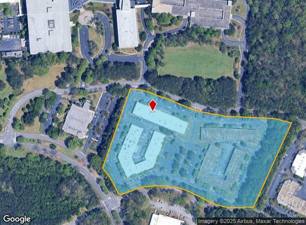
Property Record
2100 Riverchase Ctr, Hoover, AL 35244


NEARBY LISTINGS FOR SALE OR LEASE
Property Detail
2100 Riverchase Ctr
10-4-19-0-001-001-015
Riverchase Office Park Ph 02
Officebuilding
COM SE COR SE1/4NE1/4 TH W2723.44 S84.39 TO BEG TH ELY ALG S ROW PKWY OFC CIRCLE 1109.5 SW604.89 TO N ROW RIVERCHASE OFCRD TH W ON ROW918.59 TO E ROW RIVERCHASE PKWY EAST NE ON ROW TO POB
X
Shelby
01117C0206F
Alabama
2024
14.55 AC
2024
I-65 Corr/S Shelby County
030314
Birmingham
30,123 SF
Birmingham-Hoover, AL
DEMOGRAPHICS near 2100 Riverchase Ctr
1 Mile
3 Mile
5 Mile
2024 Total Population
6,321
48,390
107,457
2029 Population
6,495
49,733
108,904
Pop Growth 2024-2029
+ 2.75%
+ 2.78%
+ 1.35%
Average Age
38
39
40
2024 Total Households
2,934
20,629
43,681
HH Growth 2024-2029
+ 2.90%
+ 2.15%
+ 1.09%
Median Household Inc
$65,344
$71,646
$85,561
Avg Household Size
2.10
2.30
2.40
2024 Avg HH Vehicles
2.00
2.00
2.00
Median Home Value
$258,264
$282,430
$325,260
Median Year Built
1990
1987
1985
Nearby Places
Map Layers
Map Styles
 Street
 Aerial
- Restaurants
- Banks
- Shops
- Fitness
- Groceries
PUBLIC TRANSPORTATION
AIRPORT
Birmingham-Shuttlesworth International
DRIVE
WALK
Distance
Birmingham-Shuttlesworth International
28 min
18.1 mi
SALE & LEASE HISTORY
LISTING DATE
SALE/LEASE

Sep 24, 2016
For Lease
Jul 23, 2019
For Lease
Nearby Properties
Address
Land Use
TOTAL SIZE
Lot Size
Zoning
Address
Land Use
TOTAL SIZE
Lot Size
Zoning
515,818 SF
38 AC
CP
Address
Land Use
TOTAL SIZE
Lot Size
Zoning
501,099 SF
33 AC
PO
Address
Land Use
TOTAL SIZE
Lot Size
Zoning
1,008,008 SF
73.91 AC
R4
Address
Land Use
TOTAL SIZE
Lot Size
Zoning
745,655 SF
16 AC
C-1
Address
Land Use
TOTAL SIZE
Lot Size
Zoning
Address
Land Use
TOTAL SIZE
Lot Size
Zoning
333,513 SF
40.80 AC
C2
Address
Land Use
TOTAL SIZE
Lot Size
Zoning
442,000 SF
36.44 AC
Address
Land Use
TOTAL SIZE
Lot Size
Zoning
267,122 SF
26 AC
PC
Address
Land Use
TOTAL SIZE
Lot Size
Zoning
80,269 SF
2.50 AC
C-1
Address
Land Use
TOTAL SIZE
Lot Size
Zoning
12,200 SF
28.77 AC
Address
Land Use
TOTAL SIZE
Lot Size
Zoning
69,151 SF
4.90 AC
PC
Address
Land Use
TOTAL SIZE
Lot Size
Zoning
240,661 SF
53 AC
Address
Land Use
TOTAL SIZE
Lot Size
Zoning
210,033 SF
7.85 AC
Address
Land Use
TOTAL SIZE
Lot Size
Zoning
365,402 SF
25 AC
R4
Address
Land Use
TOTAL SIZE
Lot Size
Zoning
186,953 SF
20 AC
PR2
Address
Land Use
TOTAL SIZE
Lot Size
Zoning
2,199 SF
23 AC
Address
Land Use
TOTAL SIZE
Lot Size
Zoning
294,855 SF
30 AC
R4
Address
Land Use
TOTAL SIZE
Lot Size
Zoning
18,781 SF
12.09 AC
Address
Land Use
TOTAL SIZE
Lot Size
Zoning
41,980 SF
26.70 AC
PC
Address
Land Use
TOTAL SIZE
Lot Size
Zoning
241,232 SF
15.01 AC
PR2
Address
Land Use
TOTAL SIZE
Lot Size
Zoning
94,094 SF
14.40 AC
PO-P
Address
Land Use
TOTAL SIZE
Lot Size
Zoning
446,170 SF
18.93 AC
PR2
Address
Land Use
TOTAL SIZE
Lot Size
Zoning
165,474 SF
90 AC
PR2
Address
Land Use
TOTAL SIZE
Lot Size
Zoning
160,443 SF
23 AC
C-2
Address
Land Use
TOTAL SIZE
Lot Size
Zoning
238,304 SF
18.90 AC
PR-2
Address
Land Use
TOTAL SIZE
Lot Size
Zoning
200,679 SF
20 AC
PR2
Address
Land Use
TOTAL SIZE
Lot Size
Zoning
176,949 SF
19 AC
PC
Address
Land Use
TOTAL SIZE
Lot Size
Zoning
2,792 SF
15 AC
Address
Land Use
TOTAL SIZE
Lot Size
Zoning
224,746 SF
46 AC
C2
Address
Land Use
TOTAL SIZE
Lot Size
Zoning
191,623 SF
19.93 AC
R4
The World's #1 Commercial Real Estate Marketplace
Connect with us
© 2026 CoStar Group
The information above has been obtained from sources believed reliable. While we do not doubt its accuracy we have not verified it and make no guarantee, warranty or representation about it. It is your responsibility to independently confirm its accuracy and completeness. Any projections, opinions, assumptions, or estimates used are for example only and do not represent the current or future performance of the property. The value of this transaction to you depends on tax and other factors which should be evaluated by your tax, financial, and legal advisors. You and your advisors should conduct a careful, independent investigation of the property to determine to your satisfaction the suitability of the property for your needs.