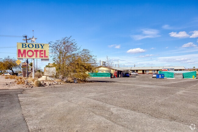
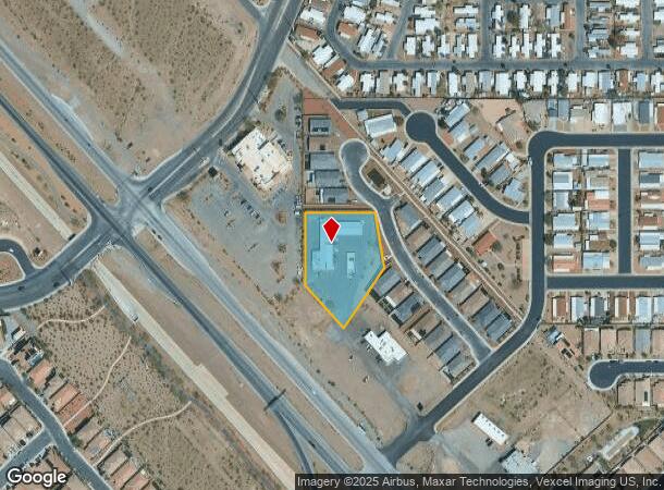
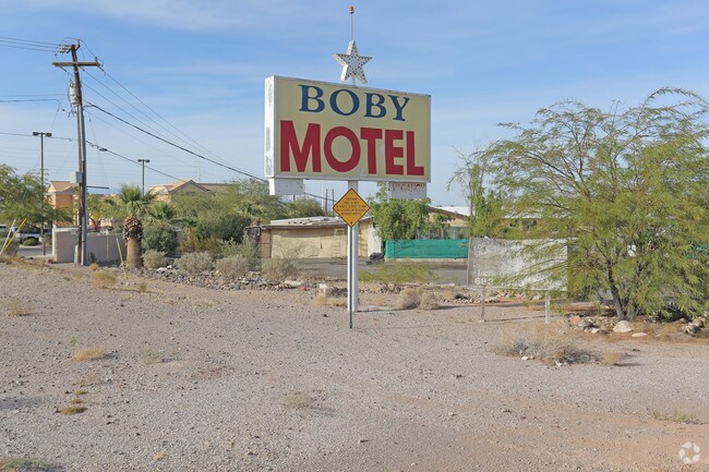
Property Record
2100 S Boulder Hwy, Henderson, NV 89002

NEARBY LISTINGS FOR SALE OR LEASE
-
-
View all Henderson listings for sale on LoopNet.com
Property Detail
2100 S Boulder Hwy
179-27-301-002
PT NW4 SW4 SEC 27 22 63
Motel
Clark
X
Nevada
32003C2615F
1.32 AC
2025
Las Vegas East/South
2025
Las Vegas
005433
Las Vegas-Henderson-Paradise, NV
6,450 SF
DEMOGRAPHICS near 2100 S Boulder Hwy
1 Mile
3 Mile
5 Mile
2024 Total Population
15,030
58,505
99,411
2029 Population
16,145
62,745
107,608
Pop Growth 2024-2029
+ 7.42%
+ 7.25%
+ 8.25%
Average Age
40
40
41
2024 Total Households
5,464
21,341
36,881
HH Growth 2024-2029
+ 7.43%
+ 7.27%
+ 8.31%
Median Household Inc
$76,282
$77,750
$74,112
Avg Household Size
2.70
2.70
2.60
2024 Avg HH Vehicles
2.00
2.00
2.00
Median Home Value
$384,700
$380,443
$380,610
Median Year Built
1998
1996
1998
Nearby Places
Map Layers
Map Styles
 Street
 Aerial
- Restaurants
- Banks
- Shops
- Fitness
- Groceries
PUBLIC TRANSPORTATION
AIRPORT
Boulder City Municipal
DRIVE
WALK
Distance
Boulder City Municipal
14 min
7.7 mi
Harry Reid International
DRIVE
WALK
Distance
Harry Reid International
24 min
17.7 mi
SALE & LEASE HISTORY
LISTING DATE
SALE/LEASE

Oct 10, 2016
For Sale
Nearby Properties
Address
Land Use
TOTAL SIZE
Lot Size
Zoning
Address
Land Use
TOTAL SIZE
Lot Size
Zoning
100 SF
320 AC
DH
Address
Land Use
TOTAL SIZE
Lot Size
Zoning
Address
Land Use
TOTAL SIZE
Lot Size
Zoning
917,210 SF
60.42 AC
Address
Land Use
TOTAL SIZE
Lot Size
Zoning
46.75 AC
PS
Address
Land Use
TOTAL SIZE
Lot Size
Zoning
81,485 SF
160.06 AC
PS
Address
Land Use
TOTAL SIZE
Lot Size
Zoning
26.83 AC
PS
Address
Land Use
TOTAL SIZE
Lot Size
Zoning
71,133 SF
7.56 AC
DP
Address
Land Use
TOTAL SIZE
Lot Size
Zoning
295,238 SF
23.49 AC
IP
Address
Land Use
TOTAL SIZE
Lot Size
Zoning
13.05 AC
PS
Address
Land Use
TOTAL SIZE
Lot Size
Zoning
23,087 SF
71.36 AC
PS
Address
Land Use
TOTAL SIZE
Lot Size
Zoning
213,472 SF
7.46 AC
Address
Land Use
TOTAL SIZE
Lot Size
Zoning
320 AC
PS
Address
Land Use
TOTAL SIZE
Lot Size
Zoning
4,627 SF
7.01 AC
MC
Address
Land Use
TOTAL SIZE
Lot Size
Zoning
2,650 SF
11.93 AC
H:RM-16-MP
Address
Land Use
TOTAL SIZE
Lot Size
Zoning
10.01 AC
PS
Address
Land Use
TOTAL SIZE
Lot Size
Zoning
416 SF
320 AC
PS
Address
Land Use
TOTAL SIZE
Lot Size
Zoning
320 AC
DH
Address
Land Use
TOTAL SIZE
Lot Size
Zoning
4,148 SF
4.38 AC
MC
Address
Land Use
TOTAL SIZE
Lot Size
Zoning
510.81 AC
Address
Land Use
TOTAL SIZE
Lot Size
Zoning
3,085 SF
2.51 AC
Address
Land Use
TOTAL SIZE
Lot Size
Zoning
41,199 SF
39.37 AC
Address
Land Use
TOTAL SIZE
Lot Size
Zoning
126,550 SF
1.23 AC
Address
Land Use
TOTAL SIZE
Lot Size
Zoning
20 AC
PS
Address
Land Use
TOTAL SIZE
Lot Size
Zoning
320 AC
DH
Address
Land Use
TOTAL SIZE
Lot Size
Zoning
411,144 SF
22.69 AC
IP
Address
Land Use
TOTAL SIZE
Lot Size
Zoning
320 AC
DH
Address
Land Use
TOTAL SIZE
Lot Size
Zoning
9.13 AC
PS
Address
Land Use
TOTAL SIZE
Lot Size
Zoning
2,450 SF
4.95 AC
MC
The World's #1 Commercial Real Estate Marketplace
Connect with us
© 2025 CoStar Group
The information above has been obtained from sources believed reliable. While we do not doubt its accuracy we have not verified it and make no guarantee, warranty or representation about it. It is your responsibility to independently confirm its accuracy and completeness. Any projections, opinions, assumptions, or estimates used are for example only and do not represent the current or future performance of the property. The value of this transaction to you depends on tax and other factors which should be evaluated by your tax, financial, and legal advisors. You and your advisors should conduct a careful, independent investigation of the property to determine to your satisfaction the suitability of the property for your needs.