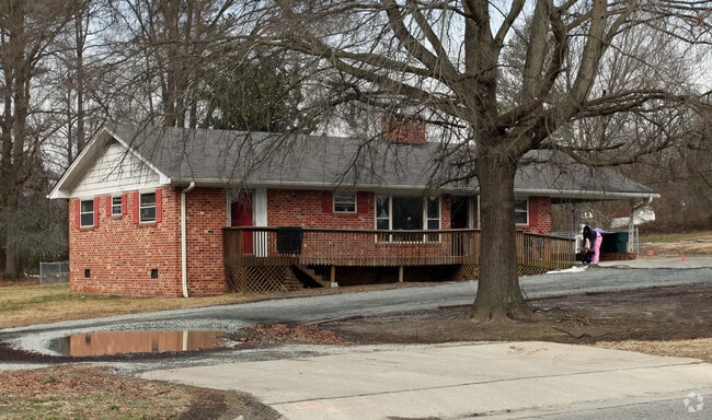
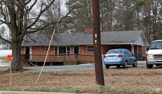
Property Record
2100 S Miami Blvd, Durham, NC 27703
NEARBY LISTINGS FOR SALE OR LEASE
Property Detail
2100 S Miami Blvd
163584
PROP-CASH LANDS/ADJ BETHE SDA SCHOOL GR PT DBA/ANT PL:000000-000000
Commercialnec
Durham
X
North Carolina
3720074900K
1.26 AC
2025
Research Triangle
2025
Raleigh/Durham
001809
Durham-Chapel Hill, NC
1,658 SF
DEMOGRAPHICS near 2100 S Miami Blvd
1 Mile
3 Mile
5 Mile
2024 Total Population
5,103
39,972
146,880
2029 Population
5,454
42,200
154,987
Pop Growth 2024-2029
+ 6.88%
+ 5.57%
+ 5.52%
Average Age
38
39
37
2024 Total Households
2,358
17,130
61,263
HH Growth 2024-2029
+ 7.38%
+ 5.93%
+ 5.87%
Median Household Inc
$88,997
$87,490
$72,324
Avg Household Size
2.10
2.30
2.30
2024 Avg HH Vehicles
2.00
2.00
2.00
Median Home Value
$278,285
$336,156
$294,005
Median Year Built
2006
2007
2002
Nearby Places
Map Layers
Map Styles
 Street
 Aerial
- Restaurants
- Banks
- Shops
- Fitness
- Groceries
PUBLIC TRANSPORTATION
COMMUTER RAIL
DRIVE
WALK
Distance
12 min
6.8 mi
AIRPORT
Raleigh-Durham International
DRIVE
WALK
Distance
Raleigh-Durham International
15 min
8.3 mi
SALE & LEASE HISTORY
LISTING DATE
SALE/LEASE

Aug 09, 2024
For Lease
Nearby Properties
Address
Land Use
TOTAL SIZE
Lot Size
Zoning
Address
Land Use
TOTAL SIZE
Lot Size
Zoning
2,436,024 SF
SRP
Address
Land Use
TOTAL SIZE
Lot Size
Zoning
875,384 SF
111.74 AC
SRP
Address
Land Use
TOTAL SIZE
Lot Size
Zoning
1,080,486 SF
61.68 AC
SRP
Address
Land Use
TOTAL SIZE
Lot Size
Zoning
677,504 SF
60.32 AC
SRP
Address
Land Use
TOTAL SIZE
Lot Size
Zoning
29.13 AC
CG(D)
Address
Land Use
TOTAL SIZE
Lot Size
Zoning
1,378,965 SF
183.46 AC
SRP
Address
Land Use
TOTAL SIZE
Lot Size
Zoning
868,283 SF
56.23 AC
SRP
Address
Land Use
TOTAL SIZE
Lot Size
Zoning
491,701 SF
124.48 AC
SRP
Address
Land Use
TOTAL SIZE
Lot Size
Zoning
799,818 SF
84.58 AC
IL
Address
Land Use
TOTAL SIZE
Lot Size
Zoning
11,670 SF
41.27 AC
RS-M(D)
Address
Land Use
TOTAL SIZE
Lot Size
Zoning
15,252 SF
29.36 AC
RS-M
Address
Land Use
TOTAL SIZE
Lot Size
Zoning
2,922 SF
30.57 AC
PDR 4.840
Address
Land Use
TOTAL SIZE
Lot Size
Zoning
353,339 SF
25.95 AC
SRP
Address
Land Use
TOTAL SIZE
Lot Size
Zoning
21.29 AC
CG(D)
Address
Land Use
TOTAL SIZE
Lot Size
Zoning
441,280 SF
48.43 AC
IL
Address
Land Use
TOTAL SIZE
Lot Size
Zoning
529,439 SF
29.84 AC
IL
Address
Land Use
TOTAL SIZE
Lot Size
Zoning
410,000 SF
31.41 AC
IL
Address
Land Use
TOTAL SIZE
Lot Size
Zoning
555,485 SF
34.84 AC
SRP
Address
Land Use
TOTAL SIZE
Lot Size
Zoning
28,632 SF
23.64 AC
PDR 3.990
Address
Land Use
TOTAL SIZE
Lot Size
Zoning
456,072 SF
35.73 AC
IP
Address
Land Use
TOTAL SIZE
Lot Size
Zoning
6,180 SF
26.56 AC
RS-M(D)
Address
Land Use
TOTAL SIZE
Lot Size
Zoning
10,572 SF
27.56 AC
RS-M(D)
Address
Land Use
TOTAL SIZE
Lot Size
Zoning
5,184 SF
42.28 AC
OI(D)
Address
Land Use
TOTAL SIZE
Lot Size
Zoning
1,524 SF
11.97 AC
CG(D)
Address
Land Use
TOTAL SIZE
Lot Size
Zoning
260,000 SF
35.58 AC
I,IL
Address
Land Use
TOTAL SIZE
Lot Size
Zoning
451,553 SF
422.05 AC
IL
Address
Land Use
TOTAL SIZE
Lot Size
Zoning
273,072 SF
24.51 AC
IL
Address
Land Use
TOTAL SIZE
Lot Size
Zoning
411,834 SF
29.02 AC
IP(D)
Address
Land Use
TOTAL SIZE
Lot Size
Zoning
12,150 SF
104.62 AC
SRP
Address
Land Use
TOTAL SIZE
Lot Size
Zoning
274,399 SF
19.36 AC
IL
The World's #1 Commercial Real Estate Marketplace
Connect with us
© 2025 CoStar Group
The information above has been obtained from sources believed reliable. While we do not doubt its accuracy we have not verified it and make no guarantee, warranty or representation about it. It is your responsibility to independently confirm its accuracy and completeness. Any projections, opinions, assumptions, or estimates used are for example only and do not represent the current or future performance of the property. The value of this transaction to you depends on tax and other factors which should be evaluated by your tax, financial, and legal advisors. You and your advisors should conduct a careful, independent investigation of the property to determine to your satisfaction the suitability of the property for your needs.