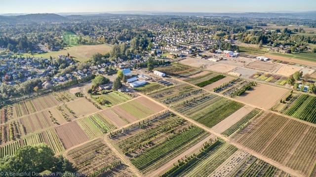
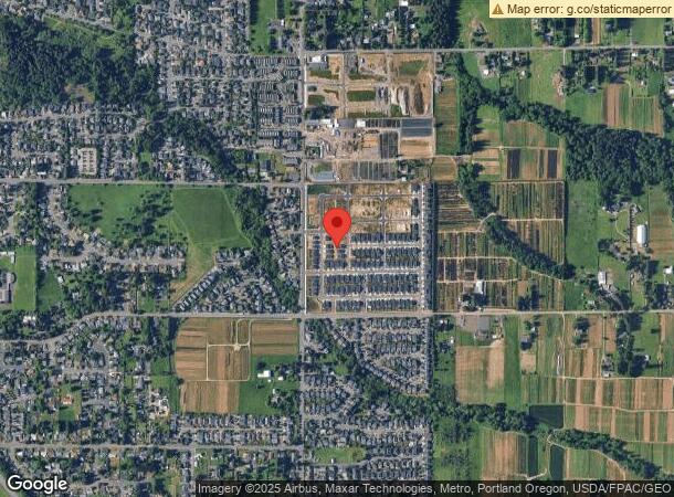
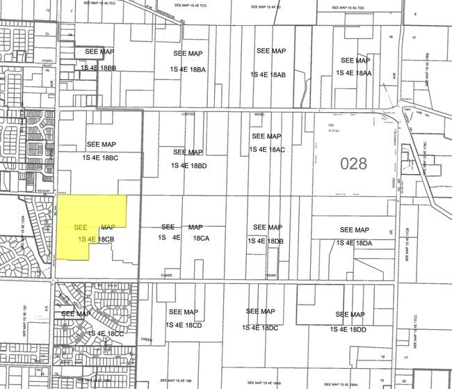
Property Record
2100 Se 282Nd Ave, Gresham, OR 97080
NEARBY LISTINGS FOR SALE OR LEASE
-
-
-
No Photo
-
View all Gresham listings for sale on LoopNet.com
Property Detail
2100 Se 282Nd Ave
R342003
Potential Additiona
Residentialacreage
SECTION 18 1S 4E, TL 200 6.28 ACRES
X
Multnomah
41051C0426J
Oregon
2023
6.28 AC
2023
NE Outlying
010402
Portland
3,772 SF
Portland-Vancouver-Hillsboro, OR-WA
DEMOGRAPHICS near 2100 Se 282Nd Ave
1 Mile
3 Mile
5 Mile
2024 Total Population
6,866
44,143
111,898
2029 Population
6,695
42,961
109,613
Pop Growth 2024-2029
(2.49%)
(2.68%)
(2.04%)
Average Age
40
40
40
2024 Total Households
2,191
15,578
40,117
HH Growth 2024-2029
(2.78%)
(3.07%)
(2.38%)
Median Household Inc
$120,269
$72,871
$74,152
Avg Household Size
3.00
2.70
2.70
2024 Avg HH Vehicles
3.00
2.00
2.00
Median Home Value
$451,890
$424,466
$421,292
Median Year Built
1993
1982
1983
Nearby Places
- Restaurants
- Banks
- Shops
- Fitness
- Groceries
PUBLIC TRANSPORTATION
AIRPORT
Portland International
DRIVE
WALK
Distance
Portland International
29 min
18.3 mi
Freight Ports
Port of Portland
DRIVE
WALK
Distance
Port of Portland
36 min
23.7 mi
SALE & LEASE HISTORY
LISTING DATE
SALE/LEASE

Oct 20, 2016
For Sale
Nearby Properties
Address
Land Use
TOTAL SIZE
Lot Size
Zoning
Address
Land Use
TOTAL SIZE
Lot Size
Zoning
40.81 AC
LDR-5
Address
Land Use
TOTAL SIZE
Lot Size
Zoning
3.20 AC
DEM
Address
Land Use
TOTAL SIZE
Lot Size
Zoning
300,843 SF
37.27 AC
MUA20
Address
Land Use
TOTAL SIZE
Lot Size
Zoning
75,850 SF
11.55 AC
LDR-5
Address
Land Use
TOTAL SIZE
Lot Size
Zoning
273,264 SF
11.39 AC
CMF
Address
Land Use
TOTAL SIZE
Lot Size
Zoning
83,072 SF
9.58 AC
LDR-5
Address
Land Use
TOTAL SIZE
Lot Size
Zoning
115,600 SF
28.24 AC
LDR-5
Address
Land Use
TOTAL SIZE
Lot Size
Zoning
235,728 SF
6.64 AC
MDR-24
Address
Land Use
TOTAL SIZE
Lot Size
Zoning
87,429 SF
0.95 AC
DTM
Address
Land Use
TOTAL SIZE
Lot Size
Zoning
102,431 SF
11.56 AC
RC
Address
Land Use
TOTAL SIZE
Lot Size
Zoning
97,430 SF
13.91 AC
HI
Address
Land Use
TOTAL SIZE
Lot Size
Zoning
65,461 SF
7.90 AC
LDR-5
Address
Land Use
TOTAL SIZE
Lot Size
Zoning
188,870 SF
17.13 AC
CC
Address
Land Use
TOTAL SIZE
Lot Size
Zoning
60,280 SF
10.62 AC
LDR
Address
Land Use
TOTAL SIZE
Lot Size
Zoning
203,148 SF
8.58 AC
MDR-24
Address
Land Use
TOTAL SIZE
Lot Size
Zoning
187,027 SF
9.09 AC
MDR-24
Address
Land Use
TOTAL SIZE
Lot Size
Zoning
31.05 AC
MDR12
Address
Land Use
TOTAL SIZE
Lot Size
Zoning
143,039 SF
8.02 AC
MDR24
Address
Land Use
TOTAL SIZE
Lot Size
Zoning
176,439 SF
9.15 AC
MDR24
Address
Land Use
TOTAL SIZE
Lot Size
Zoning
1,963 SF
86.37 AC
IND-SW
Address
Land Use
TOTAL SIZE
Lot Size
Zoning
224,358 SF
5.63 AC
MDR24
Address
Land Use
TOTAL SIZE
Lot Size
Zoning
55,677 SF
8.66 AC
R-10
Address
Land Use
TOTAL SIZE
Lot Size
Zoning
94,898 SF
10.58 AC
CC
Address
Land Use
TOTAL SIZE
Lot Size
Zoning
70,320 SF
3.79 AC
MDR24
Address
Land Use
TOTAL SIZE
Lot Size
Zoning
98,384 SF
4.67 AC
MDR-24
Address
Land Use
TOTAL SIZE
Lot Size
Zoning
95,863 SF
9.20 AC
CC
Address
Land Use
TOTAL SIZE
Lot Size
Zoning
83,547 SF
3.49 AC
MDR
Address
Land Use
TOTAL SIZE
Lot Size
Zoning
38,916 SF
4.84 AC
MDR24
Address
Land Use
TOTAL SIZE
Lot Size
Zoning
33,547 SF
27.77 AC
LDR-5
Address
Land Use
TOTAL SIZE
Lot Size
Zoning
94,638 SF
5.93 AC
CMF
The World's #1 Commercial Real Estate Marketplace
Connect with us
© 2025 CoStar Group
The information above has been obtained from sources believed reliable. While we do not doubt its accuracy we have not verified it and make no guarantee, warranty or representation about it. It is your responsibility to independently confirm its accuracy and completeness. Any projections, opinions, assumptions, or estimates used are for example only and do not represent the current or future performance of the property. The value of this transaction to you depends on tax and other factors which should be evaluated by your tax, financial, and legal advisors. You and your advisors should conduct a careful, independent investigation of the property to determine to your satisfaction the suitability of the property for your needs.