Property Record
2100 Summit Ct, Las Cruces, NM 88011


NEARBY LISTINGS FOR SALE OR LEASE
Property Detail
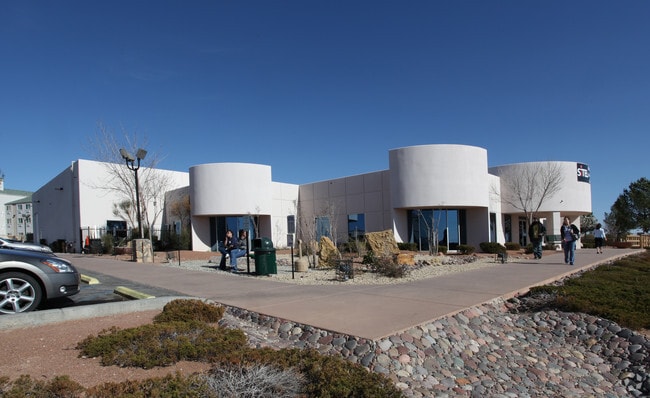
2100 Summit Ct
Las Cruces, NM
Northrise Business Park Parcel No 3
02-24525
SUBD: NORTHRISE BUSINESS PARK PARCEL NO 3 (BK 18 PG 266-267 - 9511622) LOT: 1 S: 5 T: 23S R: 2E
Commercialacreage
Dona Ana
X
New Mexico
35013C1084G
1
2024
2.07 AC
2025
Las Cruces/Alamogordo
001206
Other Market Areas
19,783 SF
DEMOGRAPHICS near 2100 Summit Ct
1 Mile
3 Mile
5 Mile
2024 Total Population
7,895
76,323
134,621
2029 Population
8,298
80,611
142,143
Pop Growth 2024-2029
+ 5.10%
+ 5.62%
+ 5.59%
Average Age
40
39
38
2024 Total Households
3,260
31,359
53,754
HH Growth 2024-2029
+ 5.21%
+ 5.70%
+ 5.71%
Median Household Inc
$54,750
$48,447
$47,089
Avg Household Size
2.40
2.40
2.40
2024 Avg HH Vehicles
2.00
2.00
2.00
Median Home Value
$194,880
$189,281
$193,404
Median Year Built
1989
1989
1989
Nearby Places
Map Layers
Map Styles
 Street
 Aerial
- Restaurants
- Banks
- Shops
- Fitness
- Groceries
SALE & LEASE HISTORY
LISTING DATE
SALE/LEASE

Jul 19, 2017
For Lease
Jul 11, 2019
For Sale
Apr 03, 2025
For Sale
Nearby Properties
Address
Land Use
TOTAL SIZE
Lot Size
Zoning
Address
Land Use
TOTAL SIZE
Lot Size
Zoning
266,671 SF
23.96 AC
PUD
Address
Land Use
TOTAL SIZE
Lot Size
Zoning
106,866 SF
10.61 AC
R1
Address
Land Use
TOTAL SIZE
Lot Size
Zoning
280,731 SF
15.55 AC
PUD
Address
Land Use
TOTAL SIZE
Lot Size
Zoning
29,466 SF
1.33 AC
C2
Address
Land Use
TOTAL SIZE
Lot Size
Zoning
78,452 SF
60 AC
A2
Address
Land Use
TOTAL SIZE
Lot Size
Zoning
49 AC
C1
Address
Land Use
TOTAL SIZE
Lot Size
Zoning
66,410 SF
7 AC
PUD
Address
Land Use
TOTAL SIZE
Lot Size
Zoning
6,232 SF
22.74 AC
C2
Address
Land Use
TOTAL SIZE
Lot Size
Zoning
154,592 SF
14.12 AC
A2
Address
Land Use
TOTAL SIZE
Lot Size
Zoning
170,972 SF
16.38 AC
R4
Address
Land Use
TOTAL SIZE
Lot Size
Zoning
195,560 SF
25.05 AC
PUD
Address
Land Use
TOTAL SIZE
Lot Size
Zoning
135,605 SF
6 AC
PUD
Address
Land Use
TOTAL SIZE
Lot Size
Zoning
98,015 SF
7.85 AC
A1
Address
Land Use
TOTAL SIZE
Lot Size
Zoning
394,043 SF
26.74 AC
C2
Address
Land Use
TOTAL SIZE
Lot Size
Zoning
139,122 SF
6.12 AC
C2
Address
Land Use
TOTAL SIZE
Lot Size
Zoning
463,811 SF
36.43 AC
C2
Address
Land Use
TOTAL SIZE
Lot Size
Zoning
49,295 SF
6.29 AC
R3
Address
Land Use
TOTAL SIZE
Lot Size
Zoning
7,483 SF
16.15 AC
PUD
Address
Land Use
TOTAL SIZE
Lot Size
Zoning
65,535 SF
5.64 AC
R1
Address
Land Use
TOTAL SIZE
Lot Size
Zoning
14.47 AC
R4
Address
Land Use
TOTAL SIZE
Lot Size
Zoning
78,845 SF
14.81 AC
A2
Address
Land Use
TOTAL SIZE
Lot Size
Zoning
132,179 SF
14.24 AC
M1
Address
Land Use
TOTAL SIZE
Lot Size
Zoning
42,295 SF
7.45 AC
C2
Address
Land Use
TOTAL SIZE
Lot Size
Zoning
76,950 SF
3.95 AC
Address
Land Use
TOTAL SIZE
Lot Size
Zoning
44,506 SF
C2
Address
Land Use
TOTAL SIZE
Lot Size
Zoning
119,985 SF
6 AC
R1
Address
Land Use
TOTAL SIZE
Lot Size
Zoning
136,629 SF
15.78 AC
C2
Address
Land Use
TOTAL SIZE
Lot Size
Zoning
79,362 SF
5.90 AC
C2
Address
Land Use
TOTAL SIZE
Lot Size
Zoning
62,645 SF
5.50 AC
R3
The World's #1 Commercial Real Estate Marketplace
Connect with us
© 2025 CoStar Group
The information above has been obtained from sources believed reliable. While we do not doubt its accuracy we have not verified it and make no guarantee, warranty or representation about it. It is your responsibility to independently confirm its accuracy and completeness. Any projections, opinions, assumptions, or estimates used are for example only and do not represent the current or future performance of the property. The value of this transaction to you depends on tax and other factors which should be evaluated by your tax, financial, and legal advisors. You and your advisors should conduct a careful, independent investigation of the property to determine to your satisfaction the suitability of the property for your needs.