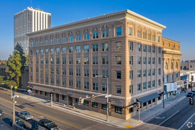
Property Record
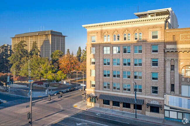
2100 Tulare St, Fresno, CA 93721


Property Detail
2100 Tulare St
468-251-10
LOTS 30-32 BLK 95 FRESNO CITY BLOCKS
Commercialnec
FRESNO
C4
California
B and X Area of moderate flood hazard, usually the area between the limits of the 100-year and 500-year floods.
31
2025
0.26 AC
2025
Downtown Fresno
000100
Fresno
82,096 SF
Fresno, CA
NEARBY LISTINGS FOR SALE OR LEASE
DEMOGRAPHICS near 2100 Tulare St
1 mile
3 mile
5 mile
2025 Total Population
16,419
142,700
303,430
2030 Population
16,607
143,770
306,006
Pop Growth 2025-2030
+ 1.15%
+ 0.75%
+ 0.85%
Average Age
36
34
35
2025 Total Households
4,738
41,457
91,570
HH Growth 2025-2030
+ 1.58%
+ 0.81%
+ 0.89%
Median Household Inc
$30,461
$44,110
$50,664
Avg Household Size
2.70
3.20
3.10
2025 Avg HH Vehicles
1.00
2.00
2.00
Median Home Value
$219,872
$247,872
$290,296
Median Year Built
1970
1959
1964
Nearby Places
Map Layers
Map Styles
 Street
 Aerial
Layers
 Traffic
 Biking
Places
Listings with unknown addresses are not visible on the map
- Restaurants
- Banks
- Shops
- Fitness
- Groceries
PUBLIC TRANSPORTATION
COMMUTER RAIL
Fresno (San Joaquins - Amtrak)
Drive
Walk
Distance
Fresno (San Joaquins - Amtrak)
0 min
8 min
0.4 mi
AIRPORT
Fresno Yosemite International
Drive
Walk
Distance
Fresno Yosemite International
11 min
6.1 mi
Freight Ports
Port of Stockton
Drive
Walk
Distance
Port of Stockton
151 min
127.8 mi
SALE & LEASE HISTORY
LISTING DATE
SALE/LEASE

Sep 25, 2016
For Lease
Nearby Properties
Address
Land Use
TOTAL SIZE
Lot Size
Zoning
Address
Land Use
TOTAL SIZE
Lot Size
Zoning
226,597 SF
12.80 AC
M3
Address
Land Use
TOTAL SIZE
Lot Size
Zoning
0.01 AC
P
Address
Land Use
TOTAL SIZE
Lot Size
Zoning
534,993 SF
5.23 AC
CP
Address
Land Use
TOTAL SIZE
Lot Size
Zoning
288,597 SF
1.18 AC
C4
Address
Land Use
TOTAL SIZE
Lot Size
Zoning
147,101 SF
6.31 AC
SPLIT
Address
Land Use
TOTAL SIZE
Lot Size
Zoning
184,130 SF
1.87 AC
PI
Address
Land Use
TOTAL SIZE
Lot Size
Zoning
141,959 SF
35.39 AC
SPLIT
Address
Land Use
TOTAL SIZE
Lot Size
Zoning
176,926 SF
9.79 AC
IH
Address
Land Use
TOTAL SIZE
Lot Size
Zoning
101,510 SF
3.37 AC
CM
Address
Land Use
TOTAL SIZE
Lot Size
Zoning
193,440 SF
16.82 AC
Address
Land Use
TOTAL SIZE
Lot Size
Zoning
238,160 SF
18.77 AC
M3
Address
Land Use
TOTAL SIZE
Lot Size
Zoning
471,760 SF
1.98 AC
CP
Address
Land Use
TOTAL SIZE
Lot Size
Zoning
213,874 SF
4.17 AC
SPLIT
Address
Land Use
TOTAL SIZE
Lot Size
Zoning
206,766 SF
17.11 AC
R2
Address
Land Use
TOTAL SIZE
Lot Size
Zoning
61,575 SF
3.50 AC
SPLIT
Address
Land Use
TOTAL SIZE
Lot Size
Zoning
79,518 SF
2.03 AC
R4
Address
Land Use
TOTAL SIZE
Lot Size
Zoning
409,374 SF
24.73 AC
SPLIT
Address
Land Use
TOTAL SIZE
Lot Size
Zoning
480,570 SF
2.98 AC
P
Address
Land Use
TOTAL SIZE
Lot Size
Zoning
90,500 SF
1.29 AC
CM
Address
Land Use
TOTAL SIZE
Lot Size
Zoning
54,526 SF
5.88 AC
M3
Address
Land Use
TOTAL SIZE
Lot Size
Zoning
314,915 SF
14.12 AC
M2
Address
Land Use
TOTAL SIZE
Lot Size
Zoning
569,220 SF
23.46 AC
SPLIT
Address
Land Use
TOTAL SIZE
Lot Size
Zoning
55,200 SF
14.94 AC
M3
Address
Land Use
TOTAL SIZE
Lot Size
Zoning
96,012 SF
1.33 AC
C4
Address
Land Use
TOTAL SIZE
Lot Size
Zoning
104,036 SF
6.73 AC
M3
Address
Land Use
TOTAL SIZE
Lot Size
Zoning
96,012 SF
0.60 AC
C4
Address
Land Use
TOTAL SIZE
Lot Size
Zoning
203,687 SF
10.63 AC
R3
Address
Land Use
TOTAL SIZE
Lot Size
Zoning
121,250 SF
9.51 AC
R3
Address
Land Use
TOTAL SIZE
Lot Size
Zoning
269,290 SF
12.36 AC
IL
The World's #1 Commercial Real Estate Marketplace
Connect with us
© 2026 CoStar Group
The information above has been obtained from sources believed reliable. While we do not doubt its accuracy we have not verified it and make no guarantee, warranty or representation about it. It is your responsibility to independently confirm its accuracy and completeness. Any projections, opinions, assumptions, or estimates used are for example only and do not represent the current or future performance of the property. The value of this transaction to you depends on tax and other factors which should be evaluated by your tax, financial, and legal advisors. You and your advisors should conduct a careful, independent investigation of the property to determine to your satisfaction the suitability of the property for your needs.