Property Record
2200 Knox Rd, Ardmore, OK 73401


NEARBY LISTINGS FOR SALE OR LEASE
Property Detail
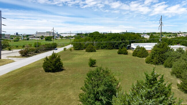
2200 Knox Rd
Ardmore, OK
Ardmore City Tracts
1990-24-04S-01E-2-009-00
FROM THE NW/C OF THE SECTION S00.1116W 884.81'; N89.4912E 588' TO TRUE POB; N00.1116E 224.51'; N89.4831E 721.40'; N00.1116E 534.70'; N88.0738E 201.38'; S00.1116W 582.72'; CURVE TO R W/RADIUS 275' DIST. 118.22'; S24.4908W 225.22'; CURVE TO L W/RADIUS
Commercialacreage
Carter
A
Oklahoma
40019C0435C
1e
2024
8.96 AC
2025
Oklahoma East Area
893100
Other Market Areas
DEMOGRAPHICS near 2200 Knox Rd
1 Mile
3 Mile
5 Mile
2024 Total Population
1,822
20,371
28,009
2029 Population
1,870
21,042
28,906
Pop Growth 2024-2029
+ 2.63%
+ 3.29%
+ 3.20%
Average Age
43
41
41
2024 Total Households
899
8,330
11,211
HH Growth 2024-2029
+ 2.56%
+ 3.22%
+ 3.16%
Median Household Inc
$40,776
$48,823
$49,426
Avg Household Size
2.00
2.30
2.40
2024 Avg HH Vehicles
2.00
2.00
2.00
Median Home Value
$160,539
$146,245
$148,584
Median Year Built
1991
1968
1971
Nearby Places
Map Layers
Map Styles
 Street
 Aerial
- Restaurants
- Banks
- Shops
- Fitness
- Groceries
PUBLIC TRANSPORTATION
COMMUTER RAIL
DRIVE
WALK
Distance
8 min
4.0 mi
SALE & LEASE HISTORY
LISTING DATE
SALE/LEASE

Nov 10, 2023
For Sale
Feb 06, 2019
For Sale
Nearby Properties
Address
Land Use
TOTAL SIZE
Lot Size
Zoning
Address
Land Use
TOTAL SIZE
Lot Size
Zoning
2,565 SF
5.42 AC
C1
Address
Land Use
TOTAL SIZE
Lot Size
Zoning
3,090 SF
17.88 AC
Address
Land Use
TOTAL SIZE
Lot Size
Zoning
15,336 SF
108.27 AC
C1
Address
Land Use
TOTAL SIZE
Lot Size
Zoning
720 SF
115.99 AC
C1
Address
Land Use
TOTAL SIZE
Lot Size
Zoning
1,134 SF
4.03 AC
C1
Address
Land Use
TOTAL SIZE
Lot Size
Zoning
120 SF
1.80 AC
C1
Address
Land Use
TOTAL SIZE
Lot Size
Zoning
2,859 SF
1.94 AC
C1
Address
Land Use
TOTAL SIZE
Lot Size
Zoning
2,018 SF
12.23 AC
Address
Land Use
TOTAL SIZE
Lot Size
Zoning
1,593 SF
10.52 AC
C1
Address
Land Use
TOTAL SIZE
Lot Size
Zoning
6,148 SF
3.34 AC
C1
Address
Land Use
TOTAL SIZE
Lot Size
Zoning
1,324 SF
3.13 AC
C1
Address
Land Use
TOTAL SIZE
Lot Size
Zoning
3,655 SF
4.90 AC
C1
Address
Land Use
TOTAL SIZE
Lot Size
Zoning
6,348 SF
7.69 AC
C1
Address
Land Use
TOTAL SIZE
Lot Size
Zoning
5,290 SF
2.75 AC
C1
Address
Land Use
TOTAL SIZE
Lot Size
Zoning
27,476 SF
12.53 AC
C1
Address
Land Use
TOTAL SIZE
Lot Size
Zoning
44,073 SF
17.07 AC
C1
Address
Land Use
TOTAL SIZE
Lot Size
Zoning
62,600 SF
5.15 AC
Address
Land Use
TOTAL SIZE
Lot Size
Zoning
3,188 SF
2.75 AC
C1
Address
Land Use
TOTAL SIZE
Lot Size
Zoning
1,225 SF
4.36 AC
C1
Address
Land Use
TOTAL SIZE
Lot Size
Zoning
4,294 SF
2.56 AC
C1
Address
Land Use
TOTAL SIZE
Lot Size
Zoning
1,040 SF
38.87 AC
C1
Address
Land Use
TOTAL SIZE
Lot Size
Zoning
264 SF
5.38 AC
C1
Address
Land Use
TOTAL SIZE
Lot Size
Zoning
18,185 SF
3.65 AC
C1
Address
Land Use
TOTAL SIZE
Lot Size
Zoning
1,479 SF
2.33 AC
C1
Address
Land Use
TOTAL SIZE
Lot Size
Zoning
224 SF
6.98 AC
C1
Address
Land Use
TOTAL SIZE
Lot Size
Zoning
11,856 SF
5.63 AC
R1
Address
Land Use
TOTAL SIZE
Lot Size
Zoning
60 SF
10.72 AC
C1
Address
Land Use
TOTAL SIZE
Lot Size
Zoning
41,201 SF
6.96 AC
C1
Address
Land Use
TOTAL SIZE
Lot Size
Zoning
408 SF
2.76 AC
Address
Land Use
TOTAL SIZE
Lot Size
Zoning
3,167 SF
2.73 AC
C1
The World's #1 Commercial Real Estate Marketplace
Connect with us
© 2026 CoStar Group
The information above has been obtained from sources believed reliable. While we do not doubt its accuracy we have not verified it and make no guarantee, warranty or representation about it. It is your responsibility to independently confirm its accuracy and completeness. Any projections, opinions, assumptions, or estimates used are for example only and do not represent the current or future performance of the property. The value of this transaction to you depends on tax and other factors which should be evaluated by your tax, financial, and legal advisors. You and your advisors should conduct a careful, independent investigation of the property to determine to your satisfaction the suitability of the property for your needs.