Property Record
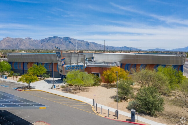
2100 W Curtis Rd, Tucson, AZ 85705

Property Detail
2100 W Curtis Rd
101-13-016D
N187 S220 W212 E337 SE4 NE4 .91 AC SEC 16-13-13
Countyproperty
Pima
SH
Arizona
C and X Area of minimal flood hazard, usually depicted on FIRMs as above the 500-year flood level.
590
0
0.91 AC
2026
Central West
004506
Tucson
42,934 SF
Tucson, AZ
NEARBY LISTINGS FOR SALE OR LEASE
DEMOGRAPHICS near 2100 W Curtis Rd
1 mile
3 mile
5 mile
2025 Total Population
11,952
73,294
184,152
2030 Population
12,331
75,261
189,529
Pop Growth 2025-2030
+ 3.17%
+ 2.68%
+ 2.92%
Average Age
40
41
41
2025 Total Households
4,714
32,132
81,024
HH Growth 2025-2030
+ 3.42%
+ 2.76%
+ 3.00%
Median Household Inc
$65,254
$58,856
$60,195
Avg Household Size
2.40
2.20
2.20
2025 Avg HH Vehicles
2.00
2.00
2.00
Median Home Value
$210,301
$262,862
$324,787
Median Year Built
1989
1983
1983
Nearby Places
Map Layers
Map Styles
 Street
 Aerial
Layers
 Traffic
 Biking
Places
Listings with unknown addresses are not visible on the map
- Restaurants
- Banks
- Shops
- Fitness
- Groceries
PUBLIC TRANSPORTATION
COMMUTER RAIL
Tucson Amtrak Station (Sunset Limited - Amtrak, Texas Eagle - Amtrak)
Drive
Walk
Distance
Tucson Amtrak Station (Sunset Limited - Amtrak, Texas Eagle - Amtrak)
13 min
8.6 mi
AIRPORT
Tucson International
Drive
Walk
Distance
Tucson International
25 min
16.1 mi
Freight Ports
Port of San Diego
Drive
Walk
Distance
Port of San Diego
428 min
402.9 mi
Nearby Properties
Address
Land Use
TOTAL SIZE
Lot Size
Zoning
Address
Land Use
TOTAL SIZE
Lot Size
Zoning
369,656 SF
12.62 AC
SP
Address
Land Use
TOTAL SIZE
Lot Size
Zoning
106,852 SF
19.50 AC
I1
Address
Land Use
TOTAL SIZE
Lot Size
Zoning
64,134 SF
9.58 AC
SR
Address
Land Use
TOTAL SIZE
Lot Size
Zoning
35,300 SF
5.20 AC
SR
Address
Land Use
TOTAL SIZE
Lot Size
Zoning
451,596 SF
18.92 AC
C3
Address
Land Use
TOTAL SIZE
Lot Size
Zoning
39,508 SF
7.29 AC
MU
Address
Land Use
TOTAL SIZE
Lot Size
Zoning
50,340 SF
14.37 AC
HI
Address
Land Use
TOTAL SIZE
Lot Size
Zoning
131,575 SF
25.97 AC
SR
Address
Land Use
TOTAL SIZE
Lot Size
Zoning
251,043 SF
14.96 AC
Address
Land Use
TOTAL SIZE
Lot Size
Zoning
119,165 SF
21.85 AC
I1
Address
Land Use
TOTAL SIZE
Lot Size
Zoning
139,733 SF
9.80 AC
C3
Address
Land Use
TOTAL SIZE
Lot Size
Zoning
290,039 SF
1.98 AC
C3
Address
Land Use
TOTAL SIZE
Lot Size
Zoning
177,018 SF
16.78 AC
C2
Address
Land Use
TOTAL SIZE
Lot Size
Zoning
0.82 AC
Address
Land Use
TOTAL SIZE
Lot Size
Zoning
5,618 SF
3.15 AC
Address
Land Use
TOTAL SIZE
Lot Size
Zoning
373,887 SF
28.70 AC
CR4
Address
Land Use
TOTAL SIZE
Lot Size
Zoning
388,226 SF
22 AC
CR5
Address
Land Use
TOTAL SIZE
Lot Size
Zoning
312,586 SF
28.73 AC
Address
Land Use
TOTAL SIZE
Lot Size
Zoning
310,258 SF
17.11 AC
TR
Address
Land Use
TOTAL SIZE
Lot Size
Zoning
24,100 SF
4.96 AC
MU
Address
Land Use
TOTAL SIZE
Lot Size
Zoning
21,000 SF
9.34 AC
Address
Land Use
TOTAL SIZE
Lot Size
Zoning
280,281 SF
12.85 AC
TR
Address
Land Use
TOTAL SIZE
Lot Size
Zoning
209,131 SF
18.55 AC
CB2
Address
Land Use
TOTAL SIZE
Lot Size
Zoning
318,278 SF
18.26 AC
TR
Address
Land Use
TOTAL SIZE
Lot Size
Zoning
209,967 SF
14.19 AC
Address
Land Use
TOTAL SIZE
Lot Size
Zoning
19,892 SF
3.36 AC
CB1
Address
Land Use
TOTAL SIZE
Lot Size
Zoning
223,640 SF
18.06 AC
CB1
Address
Land Use
TOTAL SIZE
Lot Size
Zoning
277,576 SF
13.49 AC
TR
Address
Land Use
TOTAL SIZE
Lot Size
Zoning
239,374 SF
11.65 AC
TR
Address
Land Use
TOTAL SIZE
Lot Size
Zoning
16,244 SF
3.49 AC
TR
The World's #1 Commercial Real Estate Marketplace
Connect with us
© 2026 CoStar Group
The information above has been obtained from sources believed reliable. While we do not doubt its accuracy we have not verified it and make no guarantee, warranty or representation about it. It is your responsibility to independently confirm its accuracy and completeness. Any projections, opinions, assumptions, or estimates used are for example only and do not represent the current or future performance of the property. The value of this transaction to you depends on tax and other factors which should be evaluated by your tax, financial, and legal advisors. You and your advisors should conduct a careful, independent investigation of the property to determine to your satisfaction the suitability of the property for your needs.