Property Record
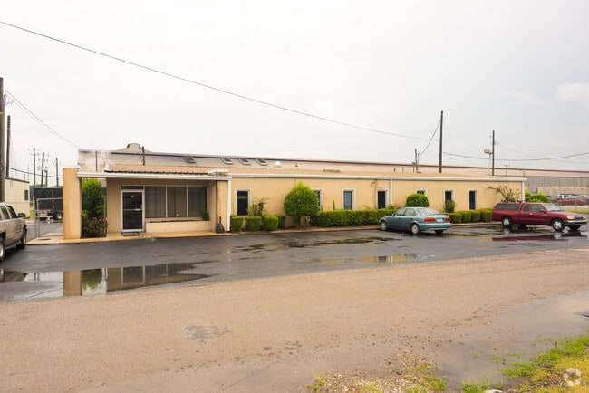
2101 18Th Ave N, Bessemer, AL 35020


NEARBY LISTINGS FOR SALE OR LEASE
Property Detail
2101 18Th Ave N
Birmingham-Hoover, AL
Us Pipe Mini Mill Survey
38-00-04-2-016-002.000
TH PT OF LOT 1 US PIPE MINI MILL SURVEY PB 45 PG 68 LYING IN NW1/4 SEC 4 TP 19S R4W
Lightindustrial
Jefferson
AE
Alabama
01073C0536G
1
2023
21 AC
2024
Bessemer
010200
Birmingham
366,421 SF
DEMOGRAPHICS near 2101 18Th Ave N
1 Mile
3 Mile
5 Mile
2024 Total Population
4,056
35,593
71,290
2029 Population
4,069
35,283
70,329
Pop Growth 2024-2029
+ 0.32%
(0.87%)
(1.35%)
Average Age
41
40
40
2024 Total Households
1,583
14,202
28,444
HH Growth 2024-2029
+ 0.25%
(1.00%)
(1.47%)
Median Household Inc
$38,302
$39,813
$47,240
Avg Household Size
2.40
2.40
2.40
2024 Avg HH Vehicles
2.00
2.00
2.00
Median Home Value
$69,030
$107,195
$139,788
Median Year Built
1955
1961
1969
Nearby Places
Map Layers
Map Styles
 Street
 Aerial
- Restaurants
- Banks
- Shops
- Fitness
- Groceries
PUBLIC TRANSPORTATION
AIRPORT
Birmingham-Shuttlesworth International
DRIVE
WALK
Distance
Birmingham-Shuttlesworth International
25 min
19.7 mi
Freight Ports
Port of Mobile
DRIVE
WALK
Distance
Port of Mobile
280 min
238.4 mi
Nearby Properties
Address
Land Use
TOTAL SIZE
Lot Size
Zoning
Address
Land Use
TOTAL SIZE
Lot Size
Zoning
460,483 SF
20 AC
I3
Address
Land Use
TOTAL SIZE
Lot Size
Zoning
187,200 SF
22 AC
I3
Address
Land Use
TOTAL SIZE
Lot Size
Zoning
553,137 SF
87 AC
I2
Address
Land Use
TOTAL SIZE
Lot Size
Zoning
195,461 SF
15.03 AC
C3-R
Address
Land Use
TOTAL SIZE
Lot Size
Zoning
136,115 SF
14.90 AC
C3
Address
Land Use
TOTAL SIZE
Lot Size
Zoning
145,300 SF
25 AC
R3
Address
Land Use
TOTAL SIZE
Lot Size
Zoning
137,641 SF
26.80 AC
R4
Address
Land Use
TOTAL SIZE
Lot Size
Zoning
132,116 SF
9.15 AC
R3
Address
Land Use
TOTAL SIZE
Lot Size
Zoning
219,210 SF
19.40 AC
M2
Address
Land Use
TOTAL SIZE
Lot Size
Zoning
230,088 SF
I3
Address
Land Use
TOTAL SIZE
Lot Size
Zoning
66,928 SF
5.70 AC
B2-R
Address
Land Use
TOTAL SIZE
Lot Size
Zoning
77,902 SF
44 AC
I3
Address
Land Use
TOTAL SIZE
Lot Size
Zoning
1,090,237 SF
28.10 AC
I4
Address
Land Use
TOTAL SIZE
Lot Size
Zoning
66,900 SF
3.78 AC
I4
Address
Land Use
TOTAL SIZE
Lot Size
Zoning
58,822 SF
7.80 AC
B3
Address
Land Use
TOTAL SIZE
Lot Size
Zoning
1,200 SF
13.40 AC
R3
Address
Land Use
TOTAL SIZE
Lot Size
Zoning
69,344 SF
2.30 AC
B-1
Address
Land Use
TOTAL SIZE
Lot Size
Zoning
26,234 SF
3.30 AC
B2
Address
Land Use
TOTAL SIZE
Lot Size
Zoning
80,043 SF
10.89 AC
B3-C
Address
Land Use
TOTAL SIZE
Lot Size
Zoning
163,056 SF
I-3
Address
Land Use
TOTAL SIZE
Lot Size
Zoning
43,674 SF
0.44 AC
C3
Address
Land Use
TOTAL SIZE
Lot Size
Zoning
80,220 SF
6.68 AC
M2
Address
Land Use
TOTAL SIZE
Lot Size
Zoning
172,253 SF
20 AC
C1
Address
Land Use
TOTAL SIZE
Lot Size
Zoning
40,098 SF
0.48 AC
C1
Address
Land Use
TOTAL SIZE
Lot Size
Zoning
52,810 SF
3.44 AC
B-3
Address
Land Use
TOTAL SIZE
Lot Size
Zoning
65,232 SF
3.60 AC
R-5
Address
Land Use
TOTAL SIZE
Lot Size
Zoning
59,554 SF
1.37 AC
R2
Address
Land Use
TOTAL SIZE
Lot Size
Zoning
32,606 SF
2.18 AC
B2-R
Address
Land Use
TOTAL SIZE
Lot Size
Zoning
51,920 SF
1.70 AC
01
The World's #1 Commercial Real Estate Marketplace
Connect with us
© 2025 CoStar Group
The information above has been obtained from sources believed reliable. While we do not doubt its accuracy we have not verified it and make no guarantee, warranty or representation about it. It is your responsibility to independently confirm its accuracy and completeness. Any projections, opinions, assumptions, or estimates used are for example only and do not represent the current or future performance of the property. The value of this transaction to you depends on tax and other factors which should be evaluated by your tax, financial, and legal advisors. You and your advisors should conduct a careful, independent investigation of the property to determine to your satisfaction the suitability of the property for your needs.