Property Record
2235 Sw 21St Ter, Miami, FL 33145

Current Lease Availabilities
NEARBY LISTINGS FOR SALE OR LEASE
Property Detail
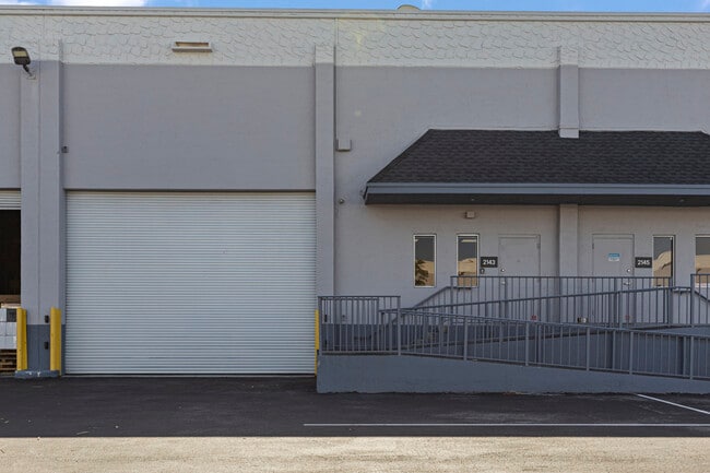
2235 Sw 21St Ter
01-4110-057-0320
South Vedado
Duplex
MIAMI INTL COMMERCE CTR SEC 12 PB 134-75 TRACT 12-A LESS BEG 246.63FTW & 740.87FTS CONT 1240.58FT TH W44.40FT NWLY1242.28FT E80.02FT TO POB LOT SIZE 928175 SQ FT F/A/U 30-3034-014-0010 COC 21943-1997 12 2003 6
X
Miami/Dade
12086C0313L
Florida
2024
0.12 AC
2025
Miami Airport West
009010
South Florida
2,289 SF
Miami-Miami Beach-Kendall, FL
DEMOGRAPHICS near 2235 Sw 21St Ter
1 Mile
3 Mile
5 Mile
2024 Total Population
870
129,152
438,859
2029 Population
875
126,885
427,583
Pop Growth 2024-2029
+ 0.57%
(1.76%)
(2.57%)
Average Age
34
42
43
2024 Total Households
373
46,967
152,958
HH Growth 2024-2029
+ 0.27%
(2.10%)
(2.96%)
Median Household Inc
$64,091
$58,631
$55,675
Avg Household Size
2.30
2.70
2.70
2024 Avg HH Vehicles
1.00
2.00
2.00
Median Home Value
$999,999
$349,114
$378,187
Median Year Built
2011
1981
1976
Nearby Places
Map Layers
Map Styles
 Street
 Aerial
- Restaurants
- Banks
- Shops
- Fitness
- Groceries
PUBLIC TRANSPORTATION
COMMUTER RAIL
Coconut Grove (Metrorail Green Line - Miami-Dade Transit (Metrorail/Metromover))
DRIVE
WALK
Distance
Coconut Grove (Metrorail Green Line - Miami-Dade Transit (Metrorail/Metromover))
2 min
1.2 mi
Vizcaya (Metrorail Green Line - Miami-Dade Transit (Metrorail/Metromover))
DRIVE
WALK
Distance
Vizcaya (Metrorail Green Line - Miami-Dade Transit (Metrorail/Metromover))
5 min
2.4 mi
AIRPORT
Miami International
DRIVE
WALK
Distance
Miami International
21 min
10.6 mi
Fort Lauderdale/Hollywood International
DRIVE
WALK
Distance
Fort Lauderdale/Hollywood International
38 min
26.5 mi
Freight Ports
Port of Miami
DRIVE
WALK
Distance
Port of Miami
14 min
6.3 mi
Nearby Properties
Address
Land Use
TOTAL SIZE
Lot Size
Zoning
Address
Land Use
TOTAL SIZE
Lot Size
Zoning
1,050,691 SF
0.83 AC
6408
Address
Land Use
TOTAL SIZE
Lot Size
Zoning
955,966 SF
38.91 AC
9600
Address
Land Use
TOTAL SIZE
Lot Size
Zoning
2,559,318 SF
2.21 AC
6407
Address
Land Use
TOTAL SIZE
Lot Size
Zoning
928,000 SF
14.30 AC
8000
Address
Land Use
TOTAL SIZE
Lot Size
Zoning
1,346,294 SF
1.89 AC
6408
Address
Land Use
TOTAL SIZE
Lot Size
Zoning
2,403,353 SF
7.37 AC
6100
Address
Land Use
TOTAL SIZE
Lot Size
Zoning
1,162,113 SF
1.92 AC
6407
Address
Land Use
TOTAL SIZE
Lot Size
Zoning
1,657,362 SF
1.15 AC
6401
Address
Land Use
TOTAL SIZE
Lot Size
Zoning
1,072,012 SF
1.78 AC
6407
Address
Land Use
TOTAL SIZE
Lot Size
Zoning
694,863 SF
1.90 AC
6407
Address
Land Use
TOTAL SIZE
Lot Size
Zoning
656,821 SF
2.06 AC
6407
Address
Land Use
TOTAL SIZE
Lot Size
Zoning
416,675 SF
6.48 AC
6401
Address
Land Use
TOTAL SIZE
Lot Size
Zoning
870,720 SF
1.90 AC
4800
Address
Land Use
TOTAL SIZE
Lot Size
Zoning
2.50 AC
6407
Address
Land Use
TOTAL SIZE
Lot Size
Zoning
491,308 SF
0.14 AC
6401
Address
Land Use
TOTAL SIZE
Lot Size
Zoning
872,245 SF
0.56 AC
6401
Address
Land Use
TOTAL SIZE
Lot Size
Zoning
727,757 SF
0.64 AC
6408
Address
Land Use
TOTAL SIZE
Lot Size
Zoning
2 AC
8000
Address
Land Use
TOTAL SIZE
Lot Size
Zoning
1,101,032 SF
5.18 AC
8000
Address
Land Use
TOTAL SIZE
Lot Size
Zoning
616,963 SF
0.75 AC
6401
Address
Land Use
TOTAL SIZE
Lot Size
Zoning
656,110 SF
1.75 AC
6401
Address
Land Use
TOTAL SIZE
Lot Size
Zoning
655,148 SF
0.30 AC
6401
Address
Land Use
TOTAL SIZE
Lot Size
Zoning
615,867 SF
1.87 AC
6402
Address
Land Use
TOTAL SIZE
Lot Size
Zoning
662,099 SF
3.54 AC
6405
Address
Land Use
TOTAL SIZE
Lot Size
Zoning
413,538 SF
3.07 AC
6408
Address
Land Use
TOTAL SIZE
Lot Size
Zoning
211,121 SF
3.16 AC
4603
Address
Land Use
TOTAL SIZE
Lot Size
Zoning
996,100 SF
3.58 AC
9600
Address
Land Use
TOTAL SIZE
Lot Size
Zoning
1,428,214 SF
31.07 AC
8000
Address
Land Use
TOTAL SIZE
Lot Size
Zoning
517,450 SF
1.84 AC
6407
Address
Land Use
TOTAL SIZE
Lot Size
Zoning
589,020 SF
3.78 AC
6407
The World's #1 Commercial Real Estate Marketplace
Connect with us
© 2026 CoStar Group
The information above has been obtained from sources believed reliable. While we do not doubt its accuracy we have not verified it and make no guarantee, warranty or representation about it. It is your responsibility to independently confirm its accuracy and completeness. Any projections, opinions, assumptions, or estimates used are for example only and do not represent the current or future performance of the property. The value of this transaction to you depends on tax and other factors which should be evaluated by your tax, financial, and legal advisors. You and your advisors should conduct a careful, independent investigation of the property to determine to your satisfaction the suitability of the property for your needs.