Property Record
2101 N Wilpar Dr, Greensboro, NC 27406

NEARBY LISTINGS FOR SALE OR LEASE
-
-
View all Greensboro listings for sale on LoopNet.com
Property Detail
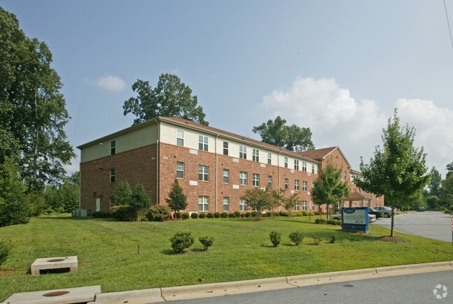
2101 N Wilpar Dr
Greensboro-High Point, NC
Anointed Acs
0079856
11.26AC 1 PB 142-55 ANOINTED ACS PL:142-55
Hospitalprivate
Guilford
X
North Carolina
3710787300J
8
0
11.26 AC
2025
Outer Pleasant Garden
012805
Greensboro/Winston-Salem
44,899 SF
DEMOGRAPHICS near 2101 N Wilpar Dr
1 Mile
3 Mile
5 Mile
2024 Total Population
3,593
45,257
136,852
2029 Population
3,604
45,375
136,883
Pop Growth 2024-2029
+ 0.31%
+ 0.26%
+ 0.02%
Average Age
39
37
36
2024 Total Households
1,595
17,608
51,175
HH Growth 2024-2029
+ 0.31%
+ 0.32%
+ 0.17%
Median Household Inc
$44,186
$42,296
$46,110
Avg Household Size
2.20
2.30
2.30
2024 Avg HH Vehicles
2.00
2.00
2.00
Median Home Value
$149,324
$137,190
$152,656
Median Year Built
2000
1978
1975
Nearby Places
Map Layers
Map Styles
 Street
 Aerial
- Restaurants
- Banks
- Shops
- Fitness
- Groceries
PUBLIC TRANSPORTATION
COMMUTER RAIL
Greensboro Station (Piedmont - North Carolina by Train (NC Train))
DRIVE
WALK
Distance
Greensboro Station (Piedmont - North Carolina by Train (NC Train))
7 min
3.4 mi
AIRPORT
Piedmont Triad International
DRIVE
WALK
Distance
Piedmont Triad International
25 min
13.7 mi
Freight Ports
Virginia Port Authority - Richmond
DRIVE
WALK
Distance
Virginia Port Authority - Richmond
226 min
196.5 mi
Nearby Properties
Address
Land Use
TOTAL SIZE
Lot Size
Zoning
Address
Land Use
TOTAL SIZE
Lot Size
Zoning
905,672 SF
28.64 AC
PI
Address
Land Use
TOTAL SIZE
Lot Size
Zoning
570,402 SF
33.42 AC
RM-18
Address
Land Use
TOTAL SIZE
Lot Size
Zoning
313,033 SF
71.38 AC
O
Address
Land Use
TOTAL SIZE
Lot Size
Zoning
446,318 SF
125.67 AC
LI
Address
Land Use
TOTAL SIZE
Lot Size
Zoning
291,464 SF
17.51 AC
PI
Address
Land Use
TOTAL SIZE
Lot Size
Zoning
236,374 SF
7.69 AC
CB
Address
Land Use
TOTAL SIZE
Lot Size
Zoning
345,087 SF
15.73 AC
PI
Address
Land Use
TOTAL SIZE
Lot Size
Zoning
267,277 SF
12.97 AC
PI
Address
Land Use
TOTAL SIZE
Lot Size
Zoning
310,758 SF
63.58 AC
PI
Address
Land Use
TOTAL SIZE
Lot Size
Zoning
242,730 SF
13.70 AC
PUD
Address
Land Use
TOTAL SIZE
Lot Size
Zoning
582,543 SF
47.07 AC
C-M
Address
Land Use
TOTAL SIZE
Lot Size
Zoning
82,450 SF
117.82 AC
R-5
Address
Land Use
TOTAL SIZE
Lot Size
Zoning
109,706 SF
1.56 AC
CB
Address
Land Use
TOTAL SIZE
Lot Size
Zoning
336,760 SF
55.13 AC
LI
Address
Land Use
TOTAL SIZE
Lot Size
Zoning
83,667 SF
1.04 AC
CB
Address
Land Use
TOTAL SIZE
Lot Size
Zoning
141,210 SF
4.42 AC
PUD
Address
Land Use
TOTAL SIZE
Lot Size
Zoning
141,729 SF
8.68 AC
O
Address
Land Use
TOTAL SIZE
Lot Size
Zoning
168,572 SF
11.94 AC
LI
Address
Land Use
TOTAL SIZE
Lot Size
Zoning
49,625 SF
6.25 AC
C-M
Address
Land Use
TOTAL SIZE
Lot Size
Zoning
223,912 SF
23.25 AC
O
Address
Land Use
TOTAL SIZE
Lot Size
Zoning
262,937 SF
20.40 AC
RM-18
Address
Land Use
TOTAL SIZE
Lot Size
Zoning
172,950 SF
11.49 AC
RM-18
Address
Land Use
TOTAL SIZE
Lot Size
Zoning
214,062 SF
9.99 AC
LI
Address
Land Use
TOTAL SIZE
Lot Size
Zoning
102,782 SF
4 AC
PUD
Address
Land Use
TOTAL SIZE
Lot Size
Zoning
14,562 SF
103.79 AC
PI
Address
Land Use
TOTAL SIZE
Lot Size
Zoning
81,260 SF
6.61 AC
CU-GO-H
Address
Land Use
TOTAL SIZE
Lot Size
Zoning
158,500 SF
17.35 AC
RM-12
Address
Land Use
TOTAL SIZE
Lot Size
Zoning
184,330 SF
10.92 AC
RM-12
Address
Land Use
TOTAL SIZE
Lot Size
Zoning
80,696 SF
10.39 AC
PI
Address
Land Use
TOTAL SIZE
Lot Size
Zoning
146,677 SF
11.39 AC
LI
The World's #1 Commercial Real Estate Marketplace
Connect with us
© 2026 CoStar Group
The information above has been obtained from sources believed reliable. While we do not doubt its accuracy we have not verified it and make no guarantee, warranty or representation about it. It is your responsibility to independently confirm its accuracy and completeness. Any projections, opinions, assumptions, or estimates used are for example only and do not represent the current or future performance of the property. The value of this transaction to you depends on tax and other factors which should be evaluated by your tax, financial, and legal advisors. You and your advisors should conduct a careful, independent investigation of the property to determine to your satisfaction the suitability of the property for your needs.