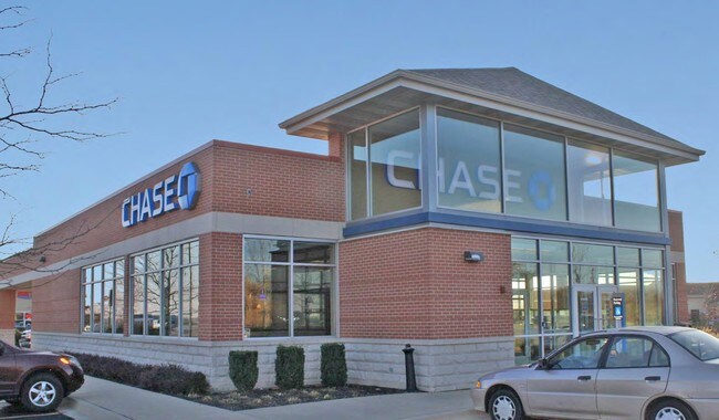
Property Record
2101 Orchard Rd, Montgomery, IL 60538

NEARBY LISTINGS FOR SALE OR LEASE
Property Detail
2101 Orchard Rd
Chicago-Naperville-Elgin, IL-IN-WI
Blackberry Creek
02-01-255-003
LOT 1 BLACKBERRY CREEK RETAIL DEV VILLAGE OF MONTGOMERY
Commercialnec
Kendall
X
Illinois
17093C0035H
1
2024
1.63 AC
2024
Western East/West Corr
890403
Chicago
3,896 SF
DEMOGRAPHICS near 2101 Orchard Rd
1 Mile
3 Mile
5 Mile
2024 Total Population
4,469
56,464
162,406
2029 Population
4,785
60,468
169,323
Pop Growth 2024-2029
+ 7.07%
+ 7.09%
+ 4.26%
Average Age
34
37
37
2024 Total Households
1,404
19,001
53,541
HH Growth 2024-2029
+ 6.77%
+ 7.13%
+ 4.33%
Median Household Inc
$101,306
$87,809
$80,006
Avg Household Size
3.20
2.90
2.90
2024 Avg HH Vehicles
2.00
2.00
2.00
Median Home Value
$244,711
$240,556
$234,431
Median Year Built
2003
1995
1983
Nearby Places
Map Layers
Map Styles
 Street
 Aerial
- Restaurants
- Banks
- Shops
- Fitness
- Groceries
PUBLIC TRANSPORTATION
COMMUTER RAIL
Aurora Station (Burlington Northern-Santa Fe Railway Line - Northeast Illinois Regional Commuter Railroad (Metra))
DRIVE
WALK
Distance
Aurora Station (Burlington Northern-Santa Fe Railway Line - Northeast Illinois Regional Commuter Railroad (Metra))
11 min
5.6 mi
Freight Ports
Port Milwaukee
DRIVE
WALK
Distance
Port Milwaukee
142 min
115.1 mi
SALE & LEASE HISTORY
LISTING DATE
SALE/LEASE

Sep 23, 2016
For Sale
Aug 08, 2017
For Sale
Nearby Properties
Address
Land Use
TOTAL SIZE
Lot Size
Zoning
Address
Land Use
TOTAL SIZE
Lot Size
Zoning
19.80 AC
Address
Land Use
TOTAL SIZE
Lot Size
Zoning
350.78 AC
Address
Land Use
TOTAL SIZE
Lot Size
Zoning
989,724 SF
49.41 AC
Address
Land Use
TOTAL SIZE
Lot Size
Zoning
56.02 AC
Address
Land Use
TOTAL SIZE
Lot Size
Zoning
218,020 SF
21.35 AC
Address
Land Use
TOTAL SIZE
Lot Size
Zoning
169,918 SF
20 AC
Address
Land Use
TOTAL SIZE
Lot Size
Zoning
428,544 SF
41.38 AC
Address
Land Use
TOTAL SIZE
Lot Size
Zoning
97,136 SF
6.08 AC
Address
Land Use
TOTAL SIZE
Lot Size
Zoning
9.86 AC
Address
Land Use
TOTAL SIZE
Lot Size
Zoning
259,140 SF
18.05 AC
Address
Land Use
TOTAL SIZE
Lot Size
Zoning
366,503 SF
11.88 AC
Address
Land Use
TOTAL SIZE
Lot Size
Zoning
118,236 SF
20.93 AC
Address
Land Use
TOTAL SIZE
Lot Size
Zoning
56.13 AC
Address
Land Use
TOTAL SIZE
Lot Size
Zoning
217,505 SF
17.50 AC
Address
Land Use
TOTAL SIZE
Lot Size
Zoning
581,048 SF
37.29 AC
Address
Land Use
TOTAL SIZE
Lot Size
Zoning
34,822 SF
136.74 AC
Address
Land Use
TOTAL SIZE
Lot Size
Zoning
17.35 AC
Address
Land Use
TOTAL SIZE
Lot Size
Zoning
287,902 SF
3.31 AC
Address
Land Use
TOTAL SIZE
Lot Size
Zoning
146,500 SF
8.65 AC
Address
Land Use
TOTAL SIZE
Lot Size
Zoning
49,292 SF
1.70 AC
Address
Land Use
TOTAL SIZE
Lot Size
Zoning
49,292 SF
1.70 AC
Address
Land Use
TOTAL SIZE
Lot Size
Zoning
49,292 SF
1.70 AC
Address
Land Use
TOTAL SIZE
Lot Size
Zoning
84,884 SF
5.23 AC
Address
Land Use
TOTAL SIZE
Lot Size
Zoning
118,498 SF
11.28 AC
Address
Land Use
TOTAL SIZE
Lot Size
Zoning
127,229 SF
11.36 AC
Address
Land Use
TOTAL SIZE
Lot Size
Zoning
224,589 SF
4.95 AC
Address
Land Use
TOTAL SIZE
Lot Size
Zoning
62,164 SF
6.76 AC
Address
Land Use
TOTAL SIZE
Lot Size
Zoning
39,020 SF
1.70 AC
Address
Land Use
TOTAL SIZE
Lot Size
Zoning
Address
Land Use
TOTAL SIZE
Lot Size
Zoning
53,152 SF
4.44 AC
The World's #1 Commercial Real Estate Marketplace
Connect with us
© 2025 CoStar Group
The information above has been obtained from sources believed reliable. While we do not doubt its accuracy we have not verified it and make no guarantee, warranty or representation about it. It is your responsibility to independently confirm its accuracy and completeness. Any projections, opinions, assumptions, or estimates used are for example only and do not represent the current or future performance of the property. The value of this transaction to you depends on tax and other factors which should be evaluated by your tax, financial, and legal advisors. You and your advisors should conduct a careful, independent investigation of the property to determine to your satisfaction the suitability of the property for your needs.