Property Record
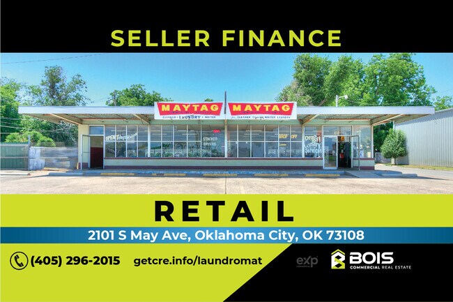
2101 S May Ave, Oklahoma City, OK 73108


NEARBY LISTINGS FOR SALE OR LEASE
Property Detail
2101 S May Ave
Oklahoma City, OK
Hutchison Addition
086750050
HUTCHISON ADDITION 001 001
Laundromat
Oklahoma
X
Oklahoma
40109C0280H
1
2023
0.28 AC
2024
South
105600
Oklahoma City
2,122 SF
DEMOGRAPHICS near 2101 S May Ave
1 Mile
3 Mile
5 Mile
2024 Total Population
8,922
82,241
218,798
2029 Population
9,210
84,908
225,429
Pop Growth 2024-2029
+ 3.23%
+ 3.24%
+ 3.03%
Average Age
33
34
35
2024 Total Households
2,807
28,484
85,028
HH Growth 2024-2029
+ 3.35%
+ 3.36%
+ 3.15%
Median Household Inc
$40,131
$40,753
$43,952
Avg Household Size
3.10
2.70
2.50
2024 Avg HH Vehicles
2.00
2.00
2.00
Median Home Value
$67,047
$72,167
$113,821
Median Year Built
1957
1956
1961
Nearby Places
Map Layers
Map Styles
 Street
 Aerial
- Restaurants
- Banks
- Shops
- Fitness
- Groceries
PUBLIC TRANSPORTATION
COMMUTER RAIL
Oklahoma City (Heartland Flyer - Amtrak)
DRIVE
WALK
Distance
Oklahoma City (Heartland Flyer - Amtrak)
8 min
4.0 mi
AIRPORT
Will Rogers World
DRIVE
WALK
Distance
Will Rogers World
14 min
5.5 mi
Freight Ports
Tulsa Port Of Catoosa
DRIVE
WALK
Distance
Tulsa Port Of Catoosa
140 min
128.4 mi
SALE & LEASE HISTORY
LISTING DATE
SALE/LEASE

May 30, 2023
For Sale
Nearby Properties
Address
Land Use
TOTAL SIZE
Lot Size
Zoning
Address
Land Use
TOTAL SIZE
Lot Size
Zoning
64,658 SF
1.86 AC
SPUD
Address
Land Use
TOTAL SIZE
Lot Size
Zoning
246,774 SF
55.60 AC
PUD
Address
Land Use
TOTAL SIZE
Lot Size
Zoning
195,412 SF
4.42 AC
I-1
Address
Land Use
TOTAL SIZE
Lot Size
Zoning
259,726 SF
19.94 AC
PUD
Address
Land Use
TOTAL SIZE
Lot Size
Zoning
181,946 SF
4.42 AC
C-4
Address
Land Use
TOTAL SIZE
Lot Size
Zoning
192,771 SF
11.20 AC
I-3
Address
Land Use
TOTAL SIZE
Lot Size
Zoning
371,946 SF
31.38 AC
I-2
Address
Land Use
TOTAL SIZE
Lot Size
Zoning
178,297 SF
4.25 AC
Address
Land Use
TOTAL SIZE
Lot Size
Zoning
239,466 SF
1.73 AC
DTD-2
Address
Land Use
TOTAL SIZE
Lot Size
Zoning
2,950 SF
1.51 AC
DTD-2
Address
Land Use
TOTAL SIZE
Lot Size
Zoning
39,734 SF
5.16 AC
C-3
Address
Land Use
TOTAL SIZE
Lot Size
Zoning
336,750 SF
15.53 AC
I-3
Address
Land Use
TOTAL SIZE
Lot Size
Zoning
203,880 SF
9.93 AC
R-4
Address
Land Use
TOTAL SIZE
Lot Size
Zoning
11,850 SF
1.49 AC
R-2
Address
Land Use
TOTAL SIZE
Lot Size
Zoning
158,150 SF
15.18 AC
I-2
Address
Land Use
TOTAL SIZE
Lot Size
Zoning
141,204 SF
6.10 AC
I-2
Address
Land Use
TOTAL SIZE
Lot Size
Zoning
246,884 SF
11.64 AC
I-2
Address
Land Use
TOTAL SIZE
Lot Size
Zoning
181,673 SF
1.31 AC
DTD-2
Address
Land Use
TOTAL SIZE
Lot Size
Zoning
166,850 SF
9.97 AC
I-2
Address
Land Use
TOTAL SIZE
Lot Size
Zoning
110,391 SF
28.91 AC
I-2
Address
Land Use
TOTAL SIZE
Lot Size
Zoning
258,262 SF
15.17 AC
Address
Land Use
TOTAL SIZE
Lot Size
Zoning
150,205 SF
0.50 AC
DBD
Address
Land Use
TOTAL SIZE
Lot Size
Zoning
239,654 SF
24.50 AC
PUD
Address
Land Use
TOTAL SIZE
Lot Size
Zoning
88,098 SF
5.94 AC
C-4
Address
Land Use
TOTAL SIZE
Lot Size
Zoning
39,860 SF
3.85 AC
I-2
Address
Land Use
TOTAL SIZE
Lot Size
Zoning
235,670 SF
10.38 AC
R-4
Address
Land Use
TOTAL SIZE
Lot Size
Zoning
92,222 SF
6.40 AC
R-4
Address
Land Use
TOTAL SIZE
Lot Size
Zoning
164,114 SF
21.70 AC
I-3
Address
Land Use
TOTAL SIZE
Lot Size
Zoning
92,520 SF
2.28 AC
C-3
Address
Land Use
TOTAL SIZE
Lot Size
Zoning
208,400 SF
11.28 AC
I-3
The World's #1 Commercial Real Estate Marketplace
Connect with us
© 2026 CoStar Group
The information above has been obtained from sources believed reliable. While we do not doubt its accuracy we have not verified it and make no guarantee, warranty or representation about it. It is your responsibility to independently confirm its accuracy and completeness. Any projections, opinions, assumptions, or estimates used are for example only and do not represent the current or future performance of the property. The value of this transaction to you depends on tax and other factors which should be evaluated by your tax, financial, and legal advisors. You and your advisors should conduct a careful, independent investigation of the property to determine to your satisfaction the suitability of the property for your needs.