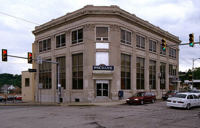
Property Record
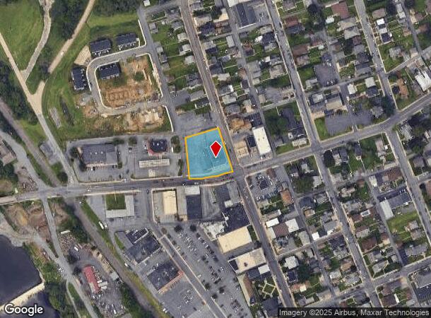
2102 Main St, Northampton, PA 18067
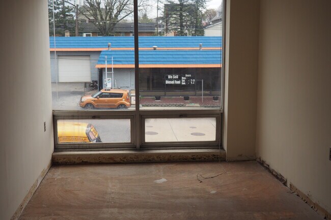

Current Lease Availabilities
NEARBY LISTINGS FOR SALE OR LEASE
Property Detail
2102 Main St
L4SW4B-1-2-0522
Adam Laubachs Plan Of Lots Of Siegfrieds
Financialbuilding
Northampton
X
Pennsylvania
42095C0228E
0.70 AC
2025
Lehigh Valley
2025
Philadelphia
016201
Allentown-Bethlehem-Easton, PA-NJ
20,360 SF
DEMOGRAPHICS near 2102 Main St
1 Mile
3 Mile
5 Mile
2024 Total Population
8,239
38,667
78,362
2029 Population
8,301
38,869
78,934
Pop Growth 2024-2029
+ 0.75%
+ 0.52%
+ 0.73%
Average Age
41
42
42
2024 Total Households
3,417
15,694
31,193
HH Growth 2024-2029
+ 0.76%
+ 0.54%
+ 0.71%
Median Household Inc
$73,412
$74,362
$73,118
Avg Household Size
2.40
2.40
2.50
2024 Avg HH Vehicles
2.00
2.00
2.00
Median Home Value
$198,234
$228,634
$240,239
Median Year Built
1949
1964
1970
Nearby Places
- Restaurants
- Banks
- Shops
- Fitness
- Groceries
PUBLIC TRANSPORTATION
AIRPORT
Lehigh Valley International
DRIVE
WALK
Distance
Lehigh Valley International
15 min
6.5 mi
Freight Ports
Port of Philadelphia
DRIVE
WALK
Distance
Port of Philadelphia
95 min
68.7 mi
Nearby Properties
Address
Land Use
TOTAL SIZE
Lot Size
Zoning
Address
Land Use
TOTAL SIZE
Lot Size
Zoning
230,853 SF
96.66 AC
R-3
Address
Land Use
TOTAL SIZE
Lot Size
Zoning
453,600 SF
32.57 AC
PIO
Address
Land Use
TOTAL SIZE
Lot Size
Zoning
1,046,625 SF
69.55 AC
RS
Address
Land Use
TOTAL SIZE
Lot Size
Zoning
956,444 SF
I
Address
Land Use
TOTAL SIZE
Lot Size
Zoning
504,475 SF
39.36 AC
I
Address
Land Use
TOTAL SIZE
Lot Size
Zoning
85.20 AC
I2
Address
Land Use
TOTAL SIZE
Lot Size
Zoning
1,050,392 SF
218.15 AC
RS
Address
Land Use
TOTAL SIZE
Lot Size
Zoning
605,893 SF
I
Address
Land Use
TOTAL SIZE
Lot Size
Zoning
45,176 SF
11.04 AC
R-4
Address
Land Use
TOTAL SIZE
Lot Size
Zoning
96,999 SF
19.37 AC
INS
Address
Land Use
TOTAL SIZE
Lot Size
Zoning
105,219 SF
47.10 AC
RA
Address
Land Use
TOTAL SIZE
Lot Size
Zoning
164,816 SF
48.85 AC
R1
Address
Land Use
TOTAL SIZE
Lot Size
Zoning
292,700 SF
21.68 AC
RS
Address
Land Use
TOTAL SIZE
Lot Size
Zoning
316,786 SF
29.22 AC
I2
Address
Land Use
TOTAL SIZE
Lot Size
Zoning
24,878 SF
20.66 AC
AR
Address
Land Use
TOTAL SIZE
Lot Size
Zoning
262,476 SF
30.77 AC
I2
Address
Land Use
TOTAL SIZE
Lot Size
Zoning
107,414 SF
4.20 AC
I
Address
Land Use
TOTAL SIZE
Lot Size
Zoning
15,624 SF
6.09 AC
R3
Address
Land Use
TOTAL SIZE
Lot Size
Zoning
65,524 SF
22.48 AC
I
Address
Land Use
TOTAL SIZE
Lot Size
Zoning
3,522 SF
20.74 AC
R3
Address
Land Use
TOTAL SIZE
Lot Size
Zoning
55,048 SF
12.47 AC
C-2A
Address
Land Use
TOTAL SIZE
Lot Size
Zoning
11,040 SF
4.18 AC
C-1
Address
Land Use
TOTAL SIZE
Lot Size
Zoning
301,097 SF
14.19 AC
I
Address
Land Use
TOTAL SIZE
Lot Size
Zoning
34,153 SF
1.28 AC
TC
Address
Land Use
TOTAL SIZE
Lot Size
Zoning
56,720 SF
4.17 AC
C-1
Address
Land Use
TOTAL SIZE
Lot Size
Zoning
8,280 SF
4.20 AC
R-5
Address
Land Use
TOTAL SIZE
Lot Size
Zoning
61,282 SF
0.96 AC
R3
Address
Land Use
TOTAL SIZE
Lot Size
Zoning
15,750 SF
5.10 AC
R-6
Address
Land Use
TOTAL SIZE
Lot Size
Zoning
3,600 SF
2.40 AC
C-2
Address
Land Use
TOTAL SIZE
Lot Size
Zoning
6,799 SF
2.82 AC
R-5
The World's #1 Commercial Real Estate Marketplace
Connect with us
© 2025 CoStar Group
The information above has been obtained from sources believed reliable. While we do not doubt its accuracy we have not verified it and make no guarantee, warranty or representation about it. It is your responsibility to independently confirm its accuracy and completeness. Any projections, opinions, assumptions, or estimates used are for example only and do not represent the current or future performance of the property. The value of this transaction to you depends on tax and other factors which should be evaluated by your tax, financial, and legal advisors. You and your advisors should conduct a careful, independent investigation of the property to determine to your satisfaction the suitability of the property for your needs.