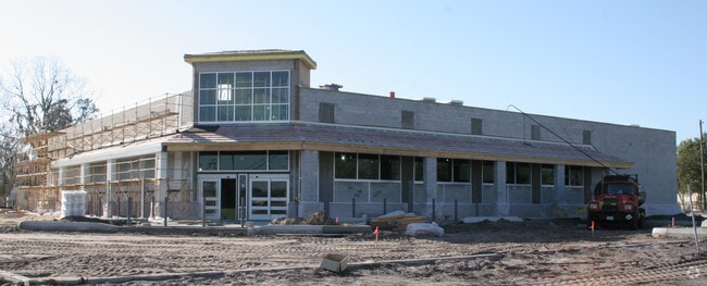
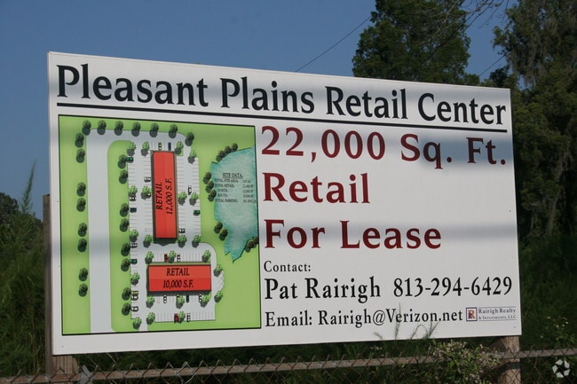
Property Record
21021 Betel Palm Ln, Land O Lakes, FL 34638

NEARBY LISTINGS FOR SALE OR LEASE
Property Detail
21021 Betel Palm Ln
35-25-18-0000-00800-0000
Acreage
Retirementnursinghomecombined
PART OF WEST 1/2 OF NW1/4 OF SEC LYING WEST OF STATE RD 45 (HWY 41) DESC AS BEGIN AT NW COR OF SEC TH S89DEG1513E 385.02 FT ALG NORTH BDY OF NW1/4 TH S00DEG1409W 275.01 FT TH S89DEG1513E 424.07 FT TH S18DEG1800E 259.48 FT TH S71DEG4200W 40.00 FT TH S
AE
Pasco
12101C0238F
Florida
2024
4.08 AC
2026
Pasco County
031903
Tampa/St Petersburg
64,347 SF
Tampa-St. Petersburg-Clearwater, FL
DEMOGRAPHICS near 21021 Betel Palm Ln
1 Mile
3 Mile
5 Mile
2024 Total Population
4,609
23,981
53,517
2029 Population
5,581
29,272
64,960
Pop Growth 2024-2029
+ 21.09%
+ 22.06%
+ 21.38%
Average Age
40
39
39
2024 Total Households
1,519
7,853
17,970
HH Growth 2024-2029
+ 21.00%
+ 22.07%
+ 21.37%
Median Household Inc
$107,190
$102,566
$101,482
Avg Household Size
2.80
2.80
2.80
2024 Avg HH Vehicles
2.00
2.00
2.00
Median Home Value
$336,712
$335,122
$338,508
Median Year Built
2006
2007
2006
Nearby Places
Map Layers
Map Styles
 Street
 Aerial
- Restaurants
- Banks
- Shops
- Fitness
- Groceries
PUBLIC TRANSPORTATION
AIRPORT
Tampa International
DRIVE
WALK
Distance
Tampa International
42 min
28.8 mi
St Pete-Clearwater International
DRIVE
WALK
Distance
St Pete-Clearwater International
62 min
40.3 mi
Freight Ports
Port of Tampa Bay
DRIVE
WALK
Distance
Port of Tampa Bay
43 min
26.5 mi
Nearby Properties
Address
Land Use
TOTAL SIZE
Lot Size
Zoning
Address
Land Use
TOTAL SIZE
Lot Size
Zoning
368,919 SF
21.43 AC
MPUD
Address
Land Use
TOTAL SIZE
Lot Size
Zoning
384,420 SF
116.64 AC
AC
Address
Land Use
TOTAL SIZE
Lot Size
Zoning
102,301 SF
13.97 AC
MPUD
Address
Land Use
TOTAL SIZE
Lot Size
Zoning
21,914 SF
68.49 AC
MPUD
Address
Land Use
TOTAL SIZE
Lot Size
Zoning
74,685 SF
4.57 AC
MPUD
Address
Land Use
TOTAL SIZE
Lot Size
Zoning
17.27 AC
MPUD
Address
Land Use
TOTAL SIZE
Lot Size
Zoning
55,252 SF
2.83 AC
MPUD
Address
Land Use
TOTAL SIZE
Lot Size
Zoning
76,379 SF
9.46 AC
MPUD
Address
Land Use
TOTAL SIZE
Lot Size
Zoning
86,933 SF
2.58 AC
C2
Address
Land Use
TOTAL SIZE
Lot Size
Zoning
62,299 SF
4.32 AC
C2
Address
Land Use
TOTAL SIZE
Lot Size
Zoning
100,486 SF
186.81 AC
MPUD
Address
Land Use
TOTAL SIZE
Lot Size
Zoning
29,624 SF
12.43 AC
MPUD
Address
Land Use
TOTAL SIZE
Lot Size
Zoning
49,229 SF
30.32 AC
MPUD
Address
Land Use
TOTAL SIZE
Lot Size
Zoning
72,431 SF
12 AC
PUD
Address
Land Use
TOTAL SIZE
Lot Size
Zoning
52,016 SF
19.06 AC
MPUD
Address
Land Use
TOTAL SIZE
Lot Size
Zoning
9,314 SF
16.47 AC
R2
Address
Land Use
TOTAL SIZE
Lot Size
Zoning
35,801 SF
6.91 AC
R1
Address
Land Use
TOTAL SIZE
Lot Size
Zoning
22,304 SF
3.08 AC
MPUD
Address
Land Use
TOTAL SIZE
Lot Size
Zoning
20,581 SF
0.50 AC
MPUD
Address
Land Use
TOTAL SIZE
Lot Size
Zoning
38,225 SF
3.03 AC
C2
Address
Land Use
TOTAL SIZE
Lot Size
Zoning
7,220 SF
15 AC
C2
Address
Land Use
TOTAL SIZE
Lot Size
Zoning
14,528 SF
2.40 AC
C2
Address
Land Use
TOTAL SIZE
Lot Size
Zoning
4,365 SF
1.92 AC
MPUD
Address
Land Use
TOTAL SIZE
Lot Size
Zoning
12,067 SF
1.77 AC
C2
Address
Land Use
TOTAL SIZE
Lot Size
Zoning
5,424 SF
1.95 AC
MPUD
Address
Land Use
TOTAL SIZE
Lot Size
Zoning
9,600 SF
9.25 AC
C3
The World's #1 Commercial Real Estate Marketplace
Connect with us
© 2026 CoStar Group
The information above has been obtained from sources believed reliable. While we do not doubt its accuracy we have not verified it and make no guarantee, warranty or representation about it. It is your responsibility to independently confirm its accuracy and completeness. Any projections, opinions, assumptions, or estimates used are for example only and do not represent the current or future performance of the property. The value of this transaction to you depends on tax and other factors which should be evaluated by your tax, financial, and legal advisors. You and your advisors should conduct a careful, independent investigation of the property to determine to your satisfaction the suitability of the property for your needs.