Property Record
2103 Blue Mount Rd, Monkton, MD 21111

Current Lease Availabilities
Property Detail
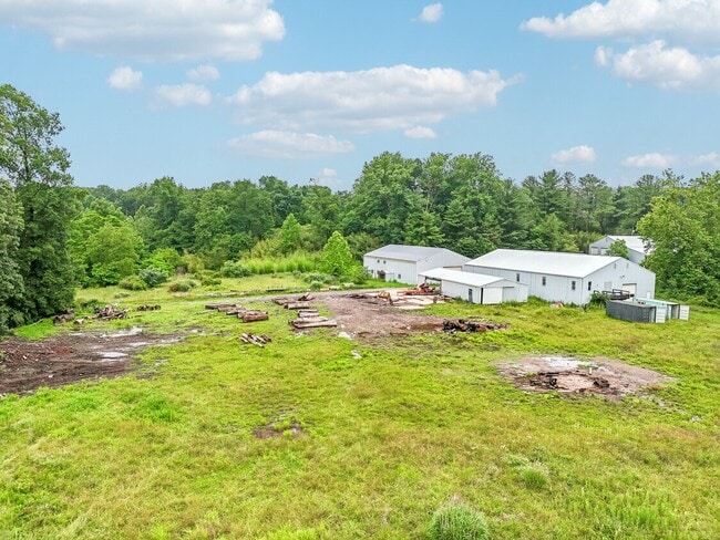
2103 Blue Mount Rd
10-1019039050
50.625 AC
Agriculturalland
Baltimore
B and X Area of moderate flood hazard, usually the area between the limits of the 100-year and 500-year floods.
Maryland
2024
50.62 AC
2025
Rt 83 Corridor North
410100
Baltimore
3,316 SF
Baltimore-Columbia-Towson, MD
NEARBY LISTINGS FOR SALE OR LEASE
-
-
View all Monkton listings for lease on LoopNet.com
DEMOGRAPHICS near 2103 Blue Mount Rd
1 mile
3 mile
5 mile
2025 Total Population
382
3,795
10,815
2030 Population
376
3,760
10,736
Pop Growth 2025-2030
(1.57%)
(0.92%)
(0.73%)
Average Age
45
44
44
2025 Total Households
149
1,396
3,932
HH Growth 2025-2030
(2.01%)
(0.93%)
(0.76%)
Median Household Inc
$124,999
$118,867
$130,091
Avg Household Size
2.60
2.70
2.70
2025 Avg HH Vehicles
3.00
3.00
3.00
Median Home Value
$595,454
$586,387
$596,655
Median Year Built
1987
1981
1980
Nearby Places
Map Layers
Map Styles
 Street
 Aerial
Layers
 Traffic
 Biking
Places
Listings with unknown addresses are not visible on the map
- Restaurants
- Banks
- Shops
- Fitness
- Groceries
PUBLIC TRANSPORTATION
AIRPORT
Baltimore/Washington International Thurgood Marshall
Drive
Walk
Distance
Baltimore/Washington International Thurgood Marshall
64 min
39.9 mi
Freight Ports
Port of Baltimore
Drive
Walk
Distance
Port of Baltimore
58 min
31.6 mi
Nearby Properties
Address
Land Use
TOTAL SIZE
Lot Size
Zoning
Address
Land Use
TOTAL SIZE
Lot Size
Zoning
230,793 SF
103 AC
Address
Land Use
TOTAL SIZE
Lot Size
Zoning
5,000 SF
190.47 AC
ML
Address
Land Use
TOTAL SIZE
Lot Size
Zoning
2,492 SF
228.70 AC
Address
Land Use
TOTAL SIZE
Lot Size
Zoning
22,697 SF
92.32 AC
Address
Land Use
TOTAL SIZE
Lot Size
Zoning
4,227 SF
14.65 AC
Address
Land Use
TOTAL SIZE
Lot Size
Zoning
9,241 SF
18.53 AC
RC2
Address
Land Use
TOTAL SIZE
Lot Size
Zoning
188.19 AC
Address
Land Use
TOTAL SIZE
Lot Size
Zoning
6,354 SF
24.72 AC
Address
Land Use
TOTAL SIZE
Lot Size
Zoning
8,896 SF
34.26 AC
Address
Land Use
TOTAL SIZE
Lot Size
Zoning
7,413 SF
16.40 AC
RC5
Address
Land Use
TOTAL SIZE
Lot Size
Zoning
7,051 SF
3.46 AC
Address
Land Use
TOTAL SIZE
Lot Size
Zoning
4,703 SF
78.19 AC
Address
Land Use
TOTAL SIZE
Lot Size
Zoning
6,755 SF
10.45 AC
Address
Land Use
TOTAL SIZE
Lot Size
Zoning
15,002 SF
20.84 AC
RC2
Address
Land Use
TOTAL SIZE
Lot Size
Zoning
5,869 SF
10.03 AC
Address
Land Use
TOTAL SIZE
Lot Size
Zoning
6,551 SF
18 AC
Address
Land Use
TOTAL SIZE
Lot Size
Zoning
6,240 SF
16.61 AC
Address
Land Use
TOTAL SIZE
Lot Size
Zoning
7,693 SF
46.37 AC
Address
Land Use
TOTAL SIZE
Lot Size
Zoning
7,925 SF
47 AC
Address
Land Use
TOTAL SIZE
Lot Size
Zoning
7,477 SF
2.33 AC
BL
Address
Land Use
TOTAL SIZE
Lot Size
Zoning
11,295 SF
16.29 AC
Address
Land Use
TOTAL SIZE
Lot Size
Zoning
4,728 SF
15.50 AC
Address
Land Use
TOTAL SIZE
Lot Size
Zoning
4,354 SF
71.23 AC
Address
Land Use
TOTAL SIZE
Lot Size
Zoning
5,533 SF
21.16 AC
Address
Land Use
TOTAL SIZE
Lot Size
Zoning
6,953 SF
66.41 AC
RC2
Address
Land Use
TOTAL SIZE
Lot Size
Zoning
7,645 SF
62.50 AC
Address
Land Use
TOTAL SIZE
Lot Size
Zoning
4,896 SF
12.31 AC
Address
Land Use
TOTAL SIZE
Lot Size
Zoning
84.41 AC
Address
Land Use
TOTAL SIZE
Lot Size
Zoning
5,648 SF
42.72 AC
Address
Land Use
TOTAL SIZE
Lot Size
Zoning
6,633 SF
10.53 AC
The World's #1 Commercial Real Estate Marketplace
Connect with us
© 2026 CoStar Group
The information above has been obtained from sources believed reliable. While we do not doubt its accuracy we have not verified it and make no guarantee, warranty or representation about it. It is your responsibility to independently confirm its accuracy and completeness. Any projections, opinions, assumptions, or estimates used are for example only and do not represent the current or future performance of the property. The value of this transaction to you depends on tax and other factors which should be evaluated by your tax, financial, and legal advisors. You and your advisors should conduct a careful, independent investigation of the property to determine to your satisfaction the suitability of the property for your needs.