Property Record
2103 N 1St St, San Jose, CA 95131
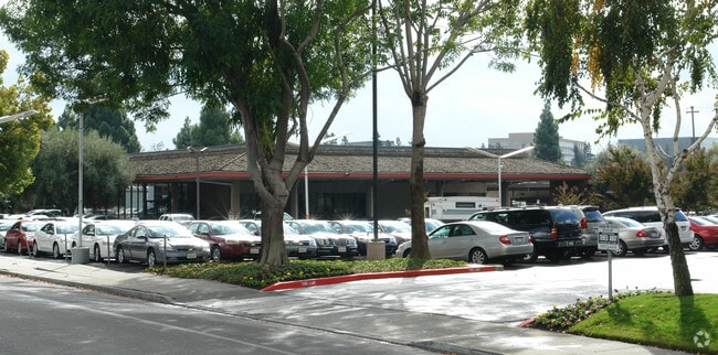


Property Detail
2103 N 1St St
Storebuilding
SANTA CLARA
TEC
California
AO River or stream flood hazard areas, and areas with a 1% or greater chance of shallow flooding each year. These areas have a 26% chance of flooding over the life of a 30-year mortgage.
2.52 AC
2024
North San Jose
2025
South Bay/San Jose
505006
San Jose-Sunnyvale-Santa Clara, CA
107,153 SF
101-05-010
NEARBY LISTINGS FOR SALE OR LEASE
DEMOGRAPHICS near 2103 N 1St St
1 mile
3 mile
5 mile
2025 Total Population
2,818
183,148
597,561
2030 Population
2,824
188,616
612,771
Pop Growth 2025-2030
+ 0.21%
+ 2.99%
+ 2.55%
Average Age
39
37
38
2025 Total Households
1,351
68,546
208,433
HH Growth 2025-2030
+ 0.15%
+ 3.18%
+ 2.74%
Median Household Inc
$116,999
$164,853
$147,169
Avg Household Size
2.10
2.50
2.70
2025 Avg HH Vehicles
1.00
2.00
2.00
Median Home Value
$945,160
$1,089,670
$1,078,781
Median Year Built
2002
1992
1978
Nearby Places
Map Layers
Map Styles
 Street
 Aerial
Layers
 Traffic
 Biking
Places
Listings with unknown addresses are not visible on the map
- Restaurants
- Banks
- Shops
- Fitness
- Groceries
PUBLIC TRANSPORTATION
TRANSIT/SUBWAY
Karina Station (Baypointe - Santa Teresa - VTA, Old Ironsides - Winchester - VTA)
Drive
Walk
Distance
Karina Station (Baypointe - Santa Teresa - VTA, Old Ironsides - Winchester - VTA)
1 min
3 min
0.2 mi
Metro/Airport Station (Alum Rock - Santa Teresa Line - Santa Clara VTA Light Rail, Mountain View - Winchester Line - Santa Clara VTA Light Rail)
Drive
Walk
Distance
Metro/Airport Station (Alum Rock - Santa Teresa Line - Santa Clara VTA Light Rail, Mountain View - Winchester Line - Santa Clara VTA Light Rail)
1 min
8 min
0.4 mi
Component Station (Baypointe - Santa Teresa - VTA, Old Ironsides - Winchester - VTA)
Drive
Walk
Distance
Component Station (Baypointe - Santa Teresa - VTA, Old Ironsides - Winchester - VTA)
2 min
12 min
0.7 mi
COMMUTER RAIL
University-Santa Clara (ACE Train - Caltrain (Caltrain), Capitol Corridor - Caltrain (Caltrain), Limited - Caltrain (Caltrain), Local Weekday - Caltrain (Caltrain), Local Weekend - Caltrain (Caltrain))
Drive
Walk
Distance
University-Santa Clara (ACE Train - Caltrain (Caltrain), Capitol Corridor - Caltrain (Caltrain), Limited - Caltrain (Caltrain), Local Weekday - Caltrain (Caltrain), Local Weekend - Caltrain (Caltrain))
7 min
4.3 mi
Santa Clara Caltrain Station Northbound (Limited - Caltrain (Caltrain), Local Weekday - Caltrain (Caltrain), Local Weekend - Caltrain (Caltrain))
Drive
Walk
Distance
Santa Clara Caltrain Station Northbound (Limited - Caltrain (Caltrain), Local Weekday - Caltrain (Caltrain), Local Weekend - Caltrain (Caltrain))
7 min
4.3 mi
AIRPORT
Norman Y Mineta San Jose International
Drive
Walk
Distance
Norman Y Mineta San Jose International
7 min
3.1 mi
Metro Oakland International
Drive
Walk
Distance
Metro Oakland International
42 min
33.6 mi
Freight Ports
Port of Redwood City
Drive
Walk
Distance
Port of Redwood City
26 min
19.9 mi
Nearby Properties
Address
Land Use
TOTAL SIZE
Lot Size
Zoning
Address
Land Use
TOTAL SIZE
Lot Size
Zoning
553,793 SF
38.06 AC
ML
Address
Land Use
TOTAL SIZE
Lot Size
Zoning
0.06 AC
PD
Address
Land Use
TOTAL SIZE
Lot Size
Zoning
238,239 SF
24.67 AC
PD
Address
Land Use
TOTAL SIZE
Lot Size
Zoning
576,892 SF
8.28 AC
APD
Address
Land Use
TOTAL SIZE
Lot Size
Zoning
360,000 SF
18.81 AC
MH
Address
Land Use
TOTAL SIZE
Lot Size
Zoning
636,145 SF
9.44 AC
IP
Address
Land Use
TOTAL SIZE
Lot Size
Zoning
74,528 SF
9.26 AC
TEC
Address
Land Use
TOTAL SIZE
Lot Size
Zoning
818,051 SF
13.81 AC
CP
Address
Land Use
TOTAL SIZE
Lot Size
Zoning
9.11 AC
ML
Address
Land Use
TOTAL SIZE
Lot Size
Zoning
194,790 SF
5.30 AC
APDCI
Address
Land Use
TOTAL SIZE
Lot Size
Zoning
2.99 AC
MH
Address
Land Use
TOTAL SIZE
Lot Size
Zoning
180,846 SF
12.19 AC
ML
Address
Land Use
TOTAL SIZE
Lot Size
Zoning
242,320 SF
8.01 AC
TEC
Address
Land Use
TOTAL SIZE
Lot Size
Zoning
208,562 SF
9.10 AC
CP
Address
Land Use
TOTAL SIZE
Lot Size
Zoning
281,574 SF
32.09 AC
IP
Address
Land Use
TOTAL SIZE
Lot Size
Zoning
423,160 SF
6.24 AC
A(PD)
Address
Land Use
TOTAL SIZE
Lot Size
Zoning
50,774 SF
3.84 AC
MP
Address
Land Use
TOTAL SIZE
Lot Size
Zoning
320,000 SF
15.18 AC
APD
Address
Land Use
TOTAL SIZE
Lot Size
Zoning
556,649 SF
8.09 AC
IP
Address
Land Use
TOTAL SIZE
Lot Size
Zoning
104,960 SF
10.19 AC
IP
Address
Land Use
TOTAL SIZE
Lot Size
Zoning
500,000 SF
41.05 AC
MH
Address
Land Use
TOTAL SIZE
Lot Size
Zoning
605,915 SF
5.36 AC
APD
Address
Land Use
TOTAL SIZE
Lot Size
Zoning
130,306 SF
8.75 AC
ML
Address
Land Use
TOTAL SIZE
Lot Size
Zoning
2.99 AC
MH
Address
Land Use
TOTAL SIZE
Lot Size
Zoning
473,849 SF
6 AC
ML
Address
Land Use
TOTAL SIZE
Lot Size
Zoning
27,000 SF
2 AC
MH
Address
Land Use
TOTAL SIZE
Lot Size
Zoning
446,996 SF
5.24 AC
ML
Address
Land Use
TOTAL SIZE
Lot Size
Zoning
329,907 SF
3.94 AC
A(PD)
Address
Land Use
TOTAL SIZE
Lot Size
Zoning
486,104 SF
5.43 AC
ML
Address
Land Use
TOTAL SIZE
Lot Size
Zoning
12.40 AC
R3
The World's #1 Commercial Real Estate Marketplace
Connect with us
© 2026 CoStar Group
The information above has been obtained from sources believed reliable. While we do not doubt its accuracy we have not verified it and make no guarantee, warranty or representation about it. It is your responsibility to independently confirm its accuracy and completeness. Any projections, opinions, assumptions, or estimates used are for example only and do not represent the current or future performance of the property. The value of this transaction to you depends on tax and other factors which should be evaluated by your tax, financial, and legal advisors. You and your advisors should conduct a careful, independent investigation of the property to determine to your satisfaction the suitability of the property for your needs.