Property Record
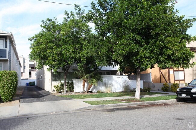
21035 Bryant St, Canoga Park, CA 91304


NEARBY LISTINGS FOR SALE OR LEASE
Property Detail
21035 Bryant St
2779-010-192
P M 4-34 LOT B
Quadruplex
Los Angeles
X
California
06037C1280F
b
2024
0.21 AC
2025
Canoga Park
113427
Los Angeles
4,768 SF
Los Angeles-Long Beach-Glendale, CA
DEMOGRAPHICS near 21035 Bryant St
1 mile
3 mile
5 mile
2024 Total Population
32,216
202,748
448,921
2029 Population
31,532
198,077
438,046
Pop Growth 2024-2029
(2.12%)
(2.30%)
(2.42%)
Average Age
38
40
41
2024 Total Households
10,234
67,798
155,226
HH Growth 2024-2029
(2.36%)
(2.38%)
(2.55%)
Median Household Inc
$65,440
$83,132
$89,383
Avg Household Size
3.10
2.90
2.80
2024 Avg HH Vehicles
2.00
2.00
2.00
Median Home Value
$639,744
$730,935
$777,966
Median Year Built
1972
1972
1971
Nearby Places
Map Layers
Map Styles
 Street
 Aerial
Transit
 Traffic
 Biking
Places
Listings with unknown addresses are not visible on the map
- Restaurants
- Banks
- Shops
- Fitness
- Groceries
PUBLIC TRANSPORTATION
COMMUTER RAIL
Chatsworth (Ventura County Line - Southern California Regional Rail Authority (Metrolink))
Drive
Walk
Distance
Chatsworth (Ventura County Line - Southern California Regional Rail Authority (Metrolink))
5 min
2.6 mi
Northridge (Pacific Surfliner - Amtrak)
Drive
Walk
Distance
Northridge (Pacific Surfliner - Amtrak)
7 min
3.0 mi
AIRPORT
Bob Hope
Drive
Walk
Distance
Bob Hope
27 min
19.5 mi
Los Angeles International
Drive
Walk
Distance
Los Angeles International
42 min
28.6 mi
Freight Ports
The Port of Hueneme
Drive
Walk
Distance
The Port of Hueneme
61 min
44.2 mi
Nearby Properties
Address
Land Use
TOTAL SIZE
Lot Size
Zoning
Address
Land Use
TOTAL SIZE
Lot Size
Zoning
515,900 SF
30.43 AC
LAWC
Address
Land Use
TOTAL SIZE
Lot Size
Zoning
928,124 SF
19.98 AC
LAWC
Address
Land Use
TOTAL SIZE
Lot Size
Zoning
628,282 SF
2.86 AC
LAWC
Address
Land Use
TOTAL SIZE
Lot Size
Zoning
1,595,158 SF
7.95 AC
LAWC
Address
Land Use
TOTAL SIZE
Lot Size
Zoning
967,368 SF
7.87 AC
LAWC
Address
Land Use
TOTAL SIZE
Lot Size
Zoning
254,527 SF
10.14 AC
LAWC
Address
Land Use
TOTAL SIZE
Lot Size
Zoning
508,314 SF
10.05 AC
LAWC
Address
Land Use
TOTAL SIZE
Lot Size
Zoning
484,354 SF
5.94 AC
LAWC
Address
Land Use
TOTAL SIZE
Lot Size
Zoning
546,652 SF
4.27 AC
LAC2
Address
Land Use
TOTAL SIZE
Lot Size
Zoning
426,935 SF
2.74 AC
LAWC
Address
Land Use
TOTAL SIZE
Lot Size
Zoning
726,146 SF
7.66 AC
LAWC
Address
Land Use
TOTAL SIZE
Lot Size
Zoning
143,806 SF
23.03 AC
LACM
Address
Land Use
TOTAL SIZE
Lot Size
Zoning
771,791 SF
9.19 AC
LAWC
Address
Land Use
TOTAL SIZE
Lot Size
Zoning
292,739 SF
1.88 AC
LAWC
Address
Land Use
TOTAL SIZE
Lot Size
Zoning
354,762 SF
5.05 AC
LAC2
Address
Land Use
TOTAL SIZE
Lot Size
Zoning
805,833 SF
9.02 AC
LAC4
Address
Land Use
TOTAL SIZE
Lot Size
Zoning
539,022 SF
35.67 AC
LAMR2
Address
Land Use
TOTAL SIZE
Lot Size
Zoning
302,865 SF
5.80 AC
LAWC
Address
Land Use
TOTAL SIZE
Lot Size
Zoning
528,264 SF
4.10 AC
LAWC
Address
Land Use
TOTAL SIZE
Lot Size
Zoning
219,083 SF
23.03 AC
LACM
Address
Land Use
TOTAL SIZE
Lot Size
Zoning
298,782 SF
8.63 AC
LAR3
Address
Land Use
TOTAL SIZE
Lot Size
Zoning
252,317 SF
5.38 AC
LAWC
Address
Land Use
TOTAL SIZE
Lot Size
Zoning
218,113 SF
7.73 AC
LAWC
Address
Land Use
TOTAL SIZE
Lot Size
Zoning
241,112 SF
5.15 AC
LAWC
Address
Land Use
TOTAL SIZE
Lot Size
Zoning
260,991 SF
3.32 AC
LAC2
Address
Land Use
TOTAL SIZE
Lot Size
Zoning
200,669 SF
6.69 AC
LAWC
Address
Land Use
TOTAL SIZE
Lot Size
Zoning
348,200 SF
9.20 AC
LAWC
Address
Land Use
TOTAL SIZE
Lot Size
Zoning
179,781 SF
1.13 AC
LAWC
The World's #1 Commercial Real Estate Marketplace
Connect with us
© 2026 CoStar Group
The information above has been obtained from sources believed reliable. While we do not doubt its accuracy we have not verified it and make no guarantee, warranty or representation about it. It is your responsibility to independently confirm its accuracy and completeness. Any projections, opinions, assumptions, or estimates used are for example only and do not represent the current or future performance of the property. The value of this transaction to you depends on tax and other factors which should be evaluated by your tax, financial, and legal advisors. You and your advisors should conduct a careful, independent investigation of the property to determine to your satisfaction the suitability of the property for your needs.