Property Record
21035 N Cave Creek Rd, Phoenix, AZ 85024

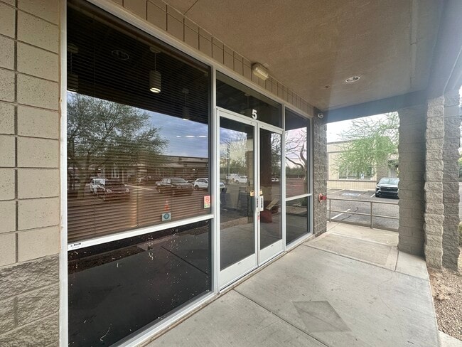
This Property Is For Sale
NEARBY LISTINGS FOR SALE OR LEASE
Property Detail
21035 N Cave Creek Rd
Phoenix-Mesa-Scottsdale, AZ
Rose Garden Retail Center Condominium
213-10-032
ROSE GARDEN RETAIL CENTER CONDOMINIUM MCR 632-10
Storebuilding
Maricopa
X
Arizona
04013C1292M
2c
2025
0.04 AC
2025
North Scottsdale
617001
Phoenix
7,420 SF
DEMOGRAPHICS near 21035 N Cave Creek Rd
1 Mile
3 Mile
5 Mile
2024 Total Population
7,956
93,676
220,597
2029 Population
8,693
101,494
238,447
Pop Growth 2024-2029
+ 9.26%
+ 8.35%
+ 8.09%
Average Age
40
38
39
2024 Total Households
3,382
38,040
89,386
HH Growth 2024-2029
+ 9.25%
+ 8.44%
+ 8.23%
Median Household Inc
$71,773
$78,741
$79,390
Avg Household Size
2.30
2.40
2.40
2024 Avg HH Vehicles
2.00
2.00
2.00
Median Home Value
$407,843
$373,993
$397,901
Median Year Built
1996
1993
1989
Nearby Places
Map Layers
Map Styles
 Street
 Aerial
- Restaurants
- Banks
- Shops
- Fitness
- Groceries
PUBLIC TRANSPORTATION
AIRPORT
Phoenix Sky Harbor International
DRIVE
WALK
Distance
Phoenix Sky Harbor International
31 min
21.8 mi
Phoenix-Mesa Gateway
DRIVE
WALK
Distance
Phoenix-Mesa Gateway
61 min
46.0 mi
Nearby Properties
Address
Land Use
TOTAL SIZE
Lot Size
Zoning
Address
Land Use
TOTAL SIZE
Lot Size
Zoning
267,397 SF
108.70 AC
R-43AG
Address
Land Use
TOTAL SIZE
Lot Size
Zoning
1,200,514 SF
47.28 AC
S1
Address
Land Use
TOTAL SIZE
Lot Size
Zoning
429,168 SF
9.52 AC
R-8
Address
Land Use
TOTAL SIZE
Lot Size
Zoning
342,574 SF
85.69 AC
R-18
Address
Land Use
TOTAL SIZE
Lot Size
Zoning
289,901 SF
12.30 AC
A-1
Address
Land Use
TOTAL SIZE
Lot Size
Zoning
336,494 SF
55.06 AC
R-43AG
Address
Land Use
TOTAL SIZE
Lot Size
Zoning
389,967 SF
245.48 AC
I-1
Address
Land Use
TOTAL SIZE
Lot Size
Zoning
8,469 SF
215.03 AC
Address
Land Use
TOTAL SIZE
Lot Size
Zoning
3.27 AC
C-C
Address
Land Use
TOTAL SIZE
Lot Size
Zoning
338,640 SF
10.39 AC
R-4A
Address
Land Use
TOTAL SIZE
Lot Size
Zoning
336,529 SF
11.23 AC
R4A
Address
Land Use
TOTAL SIZE
Lot Size
Zoning
312,070 SF
20.04 AC
A1
Address
Land Use
TOTAL SIZE
Lot Size
Zoning
242,144 SF
29.78 AC
RE-43
Address
Land Use
TOTAL SIZE
Lot Size
Zoning
240.86 AC
IND.PK.
Address
Land Use
TOTAL SIZE
Lot Size
Zoning
105,406 SF
22.69 AC
R-18
Address
Land Use
TOTAL SIZE
Lot Size
Zoning
355,606 SF
11.35 AC
C-C
Address
Land Use
TOTAL SIZE
Lot Size
Zoning
45,487 SF
117.90 AC
S1
Address
Land Use
TOTAL SIZE
Lot Size
Zoning
28,805 SF
2.67 AC
C-C
Address
Land Use
TOTAL SIZE
Lot Size
Zoning
255,482 SF
15.30 AC
M-H
Address
Land Use
TOTAL SIZE
Lot Size
Zoning
240,311 SF
14.42 AC
R-43AG
Address
Land Use
TOTAL SIZE
Lot Size
Zoning
151,716 SF
19.68 AC
R-43AG
Address
Land Use
TOTAL SIZE
Lot Size
Zoning
63,192 SF
94.91 AC
RE43
Address
Land Use
TOTAL SIZE
Lot Size
Zoning
316,766 SF
13.32 AC
M-H
Address
Land Use
TOTAL SIZE
Lot Size
Zoning
135,939 SF
19.35 AC
R1-8
Address
Land Use
TOTAL SIZE
Lot Size
Zoning
205,996 SF
20.50 AC
PAD-MD
Address
Land Use
TOTAL SIZE
Lot Size
Zoning
286,650 SF
13.89 AC
M-L
Address
Land Use
TOTAL SIZE
Lot Size
Zoning
631 SF
83.59 AC
R-43AG
Address
Land Use
TOTAL SIZE
Lot Size
Zoning
78,552 SF
10.01 AC
R-43AG
Address
Land Use
TOTAL SIZE
Lot Size
Zoning
247.81 AC
RE-43
Address
Land Use
TOTAL SIZE
Lot Size
Zoning
149,760 SF
16.13 AC
C-C
The World's #1 Commercial Real Estate Marketplace
Connect with us
© 2025 CoStar Group
The information above has been obtained from sources believed reliable. While we do not doubt its accuracy we have not verified it and make no guarantee, warranty or representation about it. It is your responsibility to independently confirm its accuracy and completeness. Any projections, opinions, assumptions, or estimates used are for example only and do not represent the current or future performance of the property. The value of this transaction to you depends on tax and other factors which should be evaluated by your tax, financial, and legal advisors. You and your advisors should conduct a careful, independent investigation of the property to determine to your satisfaction the suitability of the property for your needs.