Property Record
2104 3Rd Ave S, Irondale, AL 35210
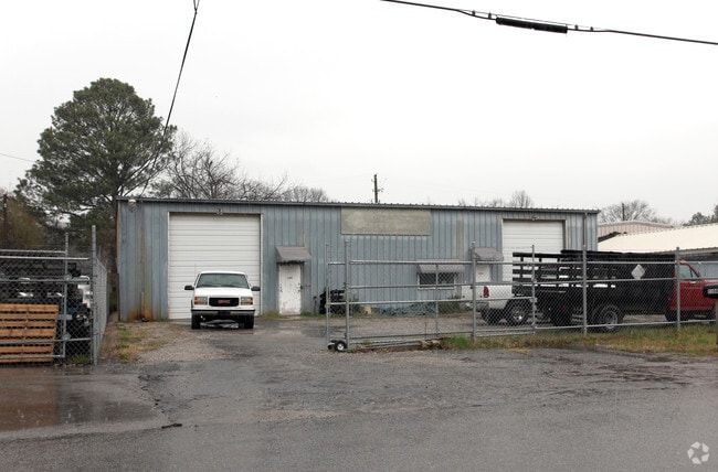


Property Detail
2104 3Rd Ave S
23-00-24-3-020-008.000
LOT 3 & E 25.5 FT OF LOT 2 BLK 10 SOUTH IRONDALE 1/229
Commercialnec
Jefferson
C2
Alabama
B and X Area of moderate flood hazard, usually the area between the limits of the 100-year and 500-year floods.
3,2
2024
0.24 AC
2025
Trussville
012602
Birmingham
5,250 SF
Birmingham, AL
NEARBY LISTINGS FOR SALE OR LEASE
DEMOGRAPHICS near 2104 3Rd Ave S
1 mile
3 mile
5 mile
2025 Total Population
3,290
44,311
98,958
2030 Population
3,243
44,132
97,978
Pop Growth 2025-2030
(1.43%)
(0.40%)
(0.99%)
Average Age
40
40
39
2025 Total Households
1,515
18,453
40,578
HH Growth 2025-2030
(1.39%)
(0.67%)
(1.11%)
Median Household Inc
$67,004
$65,693
$68,349
Avg Household Size
2.10
2.20
2.30
2025 Avg HH Vehicles
2.00
2.00
2.00
Median Home Value
$219,047
$285,673
$316,383
Median Year Built
1970
1967
1967
Nearby Places
Map Layers
Map Styles
 Street
 Aerial
Layers
 Traffic
 Biking
Places
Listings with unknown addresses are not visible on the map
- Restaurants
- Banks
- Shops
- Fitness
- Groceries
PUBLIC TRANSPORTATION
COMMUTER RAIL
Drive
Walk
Distance
13 min
7.9 mi
AIRPORT
Birmingham-Shuttlesworth International
Drive
Walk
Distance
Birmingham-Shuttlesworth International
10 min
5.3 mi
Nearby Properties
Address
Land Use
TOTAL SIZE
Lot Size
Zoning
Address
Land Use
TOTAL SIZE
Lot Size
Zoning
134,574 SF
15 AC
Address
Land Use
TOTAL SIZE
Lot Size
Zoning
166,863 SF
21 AC
CB2
Address
Land Use
TOTAL SIZE
Lot Size
Zoning
155,160 SF
14 AC
B6
Address
Land Use
TOTAL SIZE
Lot Size
Zoning
423,995 SF
25 AC
R3
Address
Land Use
TOTAL SIZE
Lot Size
Zoning
80,288 SF
3 AC
CB2
Address
Land Use
TOTAL SIZE
Lot Size
Zoning
144,135 SF
32 AC
CR5
Address
Land Use
TOTAL SIZE
Lot Size
Zoning
158,161 SF
15 AC
C1
Address
Land Use
TOTAL SIZE
Lot Size
Zoning
297,391 SF
27 AC
CR5
Address
Land Use
TOTAL SIZE
Lot Size
Zoning
137,168 SF
63 AC
A1
Address
Land Use
TOTAL SIZE
Lot Size
Zoning
235,552 SF
10 AC
R3
Address
Land Use
TOTAL SIZE
Lot Size
Zoning
168,744 SF
8 AC
I1
Address
Land Use
TOTAL SIZE
Lot Size
Zoning
456,619 SF
27.30 AC
M2
Address
Land Use
TOTAL SIZE
Lot Size
Zoning
83,931 SF
6 AC
O&I
Address
Land Use
TOTAL SIZE
Lot Size
Zoning
83,776 SF
3.79 AC
B6
Address
Land Use
TOTAL SIZE
Lot Size
Zoning
22 AC
CB2
Address
Land Use
TOTAL SIZE
Lot Size
Zoning
151,235 SF
12.60 AC
CB2
Address
Land Use
TOTAL SIZE
Lot Size
Zoning
131,319 SF
13 AC
CB2
Address
Land Use
TOTAL SIZE
Lot Size
Zoning
210,920 SF
22 AC
CB2
Address
Land Use
TOTAL SIZE
Lot Size
Zoning
145,949 SF
10 AC
QR6
Address
Land Use
TOTAL SIZE
Lot Size
Zoning
51,242 SF
18.99 AC
C1
Address
Land Use
TOTAL SIZE
Lot Size
Zoning
8 AC
QR6
Address
Land Use
TOTAL SIZE
Lot Size
Zoning
223,365 SF
15 AC
I1
Address
Land Use
TOTAL SIZE
Lot Size
Zoning
67,074 SF
5.21 AC
QB2
Address
Land Use
TOTAL SIZE
Lot Size
Zoning
150,750 SF
13 AC
CR5
Address
Land Use
TOTAL SIZE
Lot Size
Zoning
52,416 SF
7 AC
A1
Address
Land Use
TOTAL SIZE
Lot Size
Zoning
301,531 SF
41 AC
B5
Address
Land Use
TOTAL SIZE
Lot Size
Zoning
93,300 SF
29 AC
R3
Address
Land Use
TOTAL SIZE
Lot Size
Zoning
114,134 SF
8 AC
I1
Address
Land Use
TOTAL SIZE
Lot Size
Zoning
188,160 SF
14 AC
CB2
Address
Land Use
TOTAL SIZE
Lot Size
Zoning
60,832 SF
162 AC
M1
The World's #1 Commercial Real Estate Marketplace
Connect with us
© 2026 CoStar Group
The information above has been obtained from sources believed reliable. While we do not doubt its accuracy we have not verified it and make no guarantee, warranty or representation about it. It is your responsibility to independently confirm its accuracy and completeness. Any projections, opinions, assumptions, or estimates used are for example only and do not represent the current or future performance of the property. The value of this transaction to you depends on tax and other factors which should be evaluated by your tax, financial, and legal advisors. You and your advisors should conduct a careful, independent investigation of the property to determine to your satisfaction the suitability of the property for your needs.