Property Record
2104 W Riggin Ave, Visalia, CA 93291


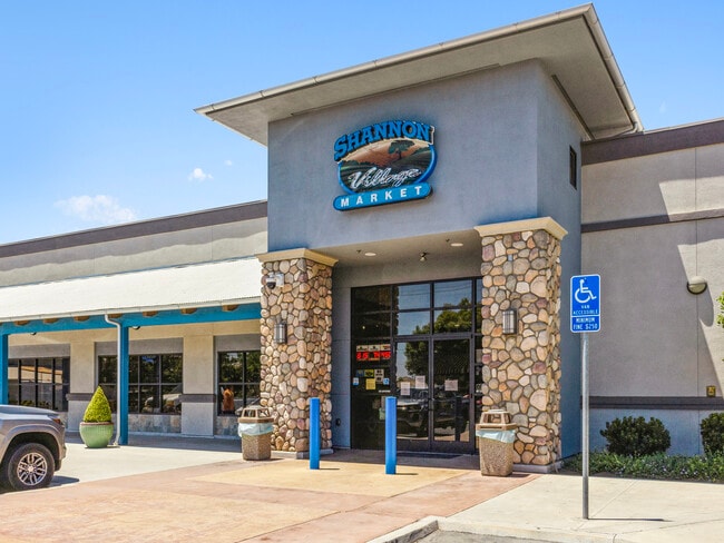
Property Detail
2104 W Riggin Ave
078-350-042-000
PARCEL 1, PARCEL MAP_NO 5067 PM 51-73
Supermarket
TULARE
CSO
California
B and X Area of moderate flood hazard, usually the area between the limits of the 100-year and 500-year floods.
2.18 AC
2024
NW Outlying Tulare County
2025
Visalia/Porterville
001012
Visalia, CA
7,890 SF
NEARBY LISTINGS FOR SALE OR LEASE
DEMOGRAPHICS near 2104 W Riggin Ave
1 mile
3 mile
5 mile
2025 Total Population
17,713
84,528
154,887
2030 Population
18,185
86,447
158,422
Pop Growth 2025-2030
+ 2.66%
+ 2.27%
+ 2.28%
Average Age
33
35
37
2025 Total Households
5,032
26,739
50,838
HH Growth 2025-2030
+ 2.52%
+ 2.25%
+ 2.25%
Median Household Inc
$92,835
$82,138
$87,135
Avg Household Size
3.50
3.10
3.00
2025 Avg HH Vehicles
2.00
2.00
2.00
Median Home Value
$392,130
$389,057
$378,465
Median Year Built
2006
1987
1987
Nearby Places
Map Layers
Map Styles
 Street
 Aerial
Layers
 Traffic
 Biking
Places
Listings with unknown addresses are not visible on the map
- Restaurants
- Banks
- Shops
- Fitness
- Groceries
SALE & LEASE HISTORY
LISTING DATE
SALE/LEASE

Oct 03, 2018
For Lease
Aug 01, 2023
For Sale
Nearby Properties
Address
Land Use
TOTAL SIZE
Lot Size
Zoning
Address
Land Use
TOTAL SIZE
Lot Size
Zoning
Address
Land Use
TOTAL SIZE
Lot Size
Zoning
82.35 AC
QP
Address
Land Use
TOTAL SIZE
Lot Size
Zoning
146,890 SF
11.73 AC
CCM
Address
Land Use
TOTAL SIZE
Lot Size
Zoning
139,410 SF
11.35 AC
CC
Address
Land Use
TOTAL SIZE
Lot Size
Zoning
6.96 AC
Address
Land Use
TOTAL SIZE
Lot Size
Zoning
61,587 SF
0.43 AC
PA
Address
Land Use
TOTAL SIZE
Lot Size
Zoning
4.24 AC
Address
Land Use
TOTAL SIZE
Lot Size
Zoning
56,384 SF
9.14 AC
Address
Land Use
TOTAL SIZE
Lot Size
Zoning
54,674 SF
1.26 AC
CDT
Address
Land Use
TOTAL SIZE
Lot Size
Zoning
134,055 SF
3.49 AC
CDT
Address
Land Use
TOTAL SIZE
Lot Size
Zoning
5.85 AC
RM2
Address
Land Use
TOTAL SIZE
Lot Size
Zoning
82,200 SF
6.29 AC
CSO
Address
Land Use
TOTAL SIZE
Lot Size
Zoning
87,160 SF
0.75 AC
PA
Address
Land Use
TOTAL SIZE
Lot Size
Zoning
Address
Land Use
TOTAL SIZE
Lot Size
Zoning
83,011 SF
4.46 AC
QP
Address
Land Use
TOTAL SIZE
Lot Size
Zoning
1.07 AC
CDT
Address
Land Use
TOTAL SIZE
Lot Size
Zoning
51,362 SF
1.61 AC
CH
Address
Land Use
TOTAL SIZE
Lot Size
Zoning
47,035 SF
3.29 AC
CCM
Address
Land Use
TOTAL SIZE
Lot Size
Zoning
6.42 AC
CN
Address
Land Use
TOTAL SIZE
Lot Size
Zoning
131,624 SF
7.44 AC
RM3
Address
Land Use
TOTAL SIZE
Lot Size
Zoning
32,741 SF
1.87 AC
Address
Land Use
TOTAL SIZE
Lot Size
Zoning
27,603 SF
2.86 AC
CCM
Address
Land Use
TOTAL SIZE
Lot Size
Zoning
4.11 AC
Address
Land Use
TOTAL SIZE
Lot Size
Zoning
4.64 AC
Address
Land Use
TOTAL SIZE
Lot Size
Zoning
1.65 AC
The World's #1 Commercial Real Estate Marketplace
Connect with us
© 2026 CoStar Group
The information above has been obtained from sources believed reliable. While we do not doubt its accuracy we have not verified it and make no guarantee, warranty or representation about it. It is your responsibility to independently confirm its accuracy and completeness. Any projections, opinions, assumptions, or estimates used are for example only and do not represent the current or future performance of the property. The value of this transaction to you depends on tax and other factors which should be evaluated by your tax, financial, and legal advisors. You and your advisors should conduct a careful, independent investigation of the property to determine to your satisfaction the suitability of the property for your needs.