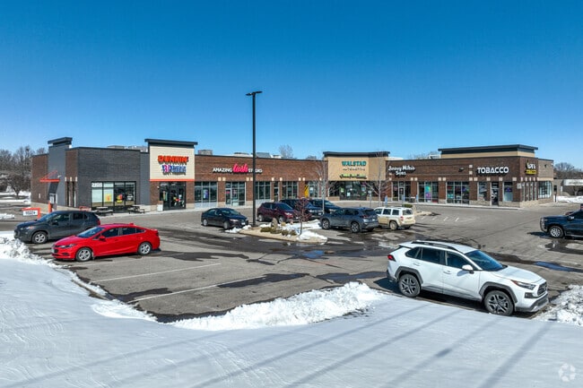
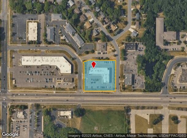
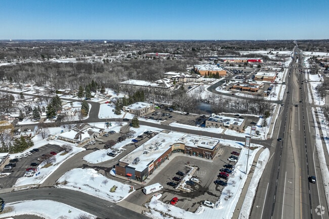
Property Record
2105 Cliff Rd, Saint Paul, MN 55122
NEARBY LISTINGS FOR SALE OR LEASE
Property Detail
2105 Cliff Rd
Minneapolis-St. Paul-Bloomington, MN-WI
Cedar Cliff Commercial Park 4Th Addition
10-16623-01-010
CEDAR CLIFF COMMERCIAL PARK 4TH ADDITION 1 1
Commercialnec
Dakota
X
Minnesota
27053C0500F
10
2024
1.83 AC
2024
Eagan
060735
Minneapolis/St Paul
15,580 SF
DEMOGRAPHICS near 2105 Cliff Rd
1 Mile
3 Mile
5 Mile
2024 Total Population
8,951
68,894
195,174
2029 Population
9,129
70,091
198,075
Pop Growth 2024-2029
+ 1.99%
+ 1.74%
+ 1.49%
Average Age
40
40
40
2024 Total Households
3,499
27,488
78,121
HH Growth 2024-2029
+ 2.11%
+ 1.85%
+ 1.56%
Median Household Inc
$90,703
$94,056
$88,035
Avg Household Size
2.50
2.40
2.40
2024 Avg HH Vehicles
2.00
2.00
2.00
Median Home Value
$311,820
$327,742
$319,909
Median Year Built
1985
1984
1983
Nearby Places
Map Layers
Map Styles
 Street
 Aerial
- Restaurants
- Banks
- Shops
- Fitness
- Groceries
PUBLIC TRANSPORTATION
AIRPORT
Minneapolis-St Paul International/Wold-Chamberlain
DRIVE
WALK
Distance
Minneapolis-St Paul International/Wold-Chamberlain
14 min
7.9 mi
Freight Ports
Port Milwaukee
DRIVE
WALK
Distance
Port Milwaukee
378 min
341.4 mi
SALE & LEASE HISTORY
LISTING DATE
SALE/LEASE

Sep 28, 2020
For Lease
Mar 01, 2017
For Lease
Jun 22, 2021
For Sale
Nearby Properties
Address
Land Use
TOTAL SIZE
Lot Size
Zoning
Address
Land Use
TOTAL SIZE
Lot Size
Zoning
1,341.19 AC
Address
Land Use
TOTAL SIZE
Lot Size
Zoning
752,064 SF
24.03 AC
Address
Land Use
TOTAL SIZE
Lot Size
Zoning
300,663 SF
4.81 AC
Address
Land Use
TOTAL SIZE
Lot Size
Zoning
168,729 SF
19.02 AC
Address
Land Use
TOTAL SIZE
Lot Size
Zoning
282,095 SF
2.71 AC
Address
Land Use
TOTAL SIZE
Lot Size
Zoning
263,460 SF
3.08 AC
Address
Land Use
TOTAL SIZE
Lot Size
Zoning
383,495 SF
15.41 AC
Address
Land Use
TOTAL SIZE
Lot Size
Zoning
192,843 SF
13.32 AC
Address
Land Use
TOTAL SIZE
Lot Size
Zoning
299,435 SF
7.65 AC
Address
Land Use
TOTAL SIZE
Lot Size
Zoning
374,415 SF
20.10 AC
Address
Land Use
TOTAL SIZE
Lot Size
Zoning
201,481 SF
6.69 AC
Address
Land Use
TOTAL SIZE
Lot Size
Zoning
287,255 SF
14.69 AC
Address
Land Use
TOTAL SIZE
Lot Size
Zoning
134,298 SF
16.70 AC
Address
Land Use
TOTAL SIZE
Lot Size
Zoning
260,290 SF
13.28 AC
Address
Land Use
TOTAL SIZE
Lot Size
Zoning
112.48 AC
Address
Land Use
TOTAL SIZE
Lot Size
Zoning
134,140 SF
6.39 AC
Address
Land Use
TOTAL SIZE
Lot Size
Zoning
62,165 SF
13.21 AC
Address
Land Use
TOTAL SIZE
Lot Size
Zoning
281,133 SF
23.21 AC
Address
Land Use
TOTAL SIZE
Lot Size
Zoning
178,425 SF
9.18 AC
Address
Land Use
TOTAL SIZE
Lot Size
Zoning
173,095 SF
9.43 AC
Address
Land Use
TOTAL SIZE
Lot Size
Zoning
239,396 SF
9.68 AC
Address
Land Use
TOTAL SIZE
Lot Size
Zoning
553,312 SF
57.08 AC
Address
Land Use
TOTAL SIZE
Lot Size
Zoning
175,678 SF
7.38 AC
Address
Land Use
TOTAL SIZE
Lot Size
Zoning
191,307 SF
2.31 AC
Address
Land Use
TOTAL SIZE
Lot Size
Zoning
175,702 SF
7.08 AC
Address
Land Use
TOTAL SIZE
Lot Size
Zoning
195,730 SF
12.83 AC
Address
Land Use
TOTAL SIZE
Lot Size
Zoning
124,320 SF
1.90 AC
Address
Land Use
TOTAL SIZE
Lot Size
Zoning
451,103 SF
25.24 AC
Address
Land Use
TOTAL SIZE
Lot Size
Zoning
214,000 SF
28.74 AC
The World's #1 Commercial Real Estate Marketplace
Connect with us
© 2026 CoStar Group
The information above has been obtained from sources believed reliable. While we do not doubt its accuracy we have not verified it and make no guarantee, warranty or representation about it. It is your responsibility to independently confirm its accuracy and completeness. Any projections, opinions, assumptions, or estimates used are for example only and do not represent the current or future performance of the property. The value of this transaction to you depends on tax and other factors which should be evaluated by your tax, financial, and legal advisors. You and your advisors should conduct a careful, independent investigation of the property to determine to your satisfaction the suitability of the property for your needs.