Property Record
2105 Rock Spring Rd, Forest Hill, MD 21050


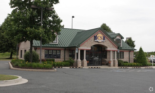
Property Detail
2105 Rock Spring Rd
03-333280
LOT 2 23217 SF 2105 ROCK SPRING ROAD KLEINS TOWER PLZ P 96/43
Financialbuilding
Harford
B2
Maryland
B and X Area of moderate flood hazard, usually the area between the limits of the 100-year and 500-year floods.
2
2025
0.53 AC
2025
Outlying Harford County
303203
Baltimore
2,718 SF
Baltimore-Columbia-Towson, MD
NEARBY LISTINGS FOR SALE OR LEASE
DEMOGRAPHICS near 2105 Rock Spring Rd
1 mile
3 mile
5 mile
2025 Total Population
5,522
34,183
74,567
2030 Population
5,568
34,276
74,898
Pop Growth 2025-2030
+ 0.83%
+ 0.27%
+ 0.44%
Average Age
42
41
42
2025 Total Households
2,075
12,514
27,862
HH Growth 2025-2030
+ 0.82%
+ 0.26%
+ 0.49%
Median Household Inc
$116,220
$120,778
$117,450
Avg Household Size
2.60
2.70
2.60
2025 Avg HH Vehicles
2.00
2.00
2.00
Median Home Value
$439,669
$438,316
$435,763
Median Year Built
1996
1990
1986
Nearby Places
Map Layers
Map Styles
 Street
 Aerial
Transit
 Traffic
 Biking
Places
Listings with unknown addresses are not visible on the map
- Restaurants
- Banks
- Shops
- Fitness
- Groceries
SALE & LEASE HISTORY
LISTING DATE
SALE/LEASE

Jun 15, 2020
For Lease
Nearby Properties
Address
Land Use
TOTAL SIZE
Lot Size
Zoning
Address
Land Use
TOTAL SIZE
Lot Size
Zoning
51,475 SF
7.85 AC
C1
Address
Land Use
TOTAL SIZE
Lot Size
Zoning
12.38 AC
R2
Address
Land Use
TOTAL SIZE
Lot Size
Zoning
6,084 SF
6.03 AC
B2
Address
Land Use
TOTAL SIZE
Lot Size
Zoning
101,236 SF
23.52 AC
R1
Address
Land Use
TOTAL SIZE
Lot Size
Zoning
78,264 SF
16.71 AC
AG
Address
Land Use
TOTAL SIZE
Lot Size
Zoning
52,245 SF
2.43 AC
R3/B1
Address
Land Use
TOTAL SIZE
Lot Size
Zoning
10.73 AC
B2
Address
Land Use
TOTAL SIZE
Lot Size
Zoning
46,247 SF
10.45 AC
R2 B2
Address
Land Use
TOTAL SIZE
Lot Size
Zoning
78,394 SF
24.56 AC
CI
Address
Land Use
TOTAL SIZE
Lot Size
Zoning
7,104 SF
10.95 AC
R2 R3
Address
Land Use
TOTAL SIZE
Lot Size
Zoning
77,649 SF
10.42 AC
GI
Address
Land Use
TOTAL SIZE
Lot Size
Zoning
63,392 SF
8.44 AC
VR
Address
Land Use
TOTAL SIZE
Lot Size
Zoning
9,464 SF
3.51 AC
R3
Address
Land Use
TOTAL SIZE
Lot Size
Zoning
97,060 SF
8.39 AC
B2
Address
Land Use
TOTAL SIZE
Lot Size
Zoning
19,224 SF
6.43 AC
R2
Address
Land Use
TOTAL SIZE
Lot Size
Zoning
84,100 SF
2.58 AC
B3
Address
Land Use
TOTAL SIZE
Lot Size
Zoning
5,690 SF
10.86 AC
R2
Address
Land Use
TOTAL SIZE
Lot Size
Zoning
45,890 SF
20.67 AC
R2
Address
Land Use
TOTAL SIZE
Lot Size
Zoning
49,265 SF
4.30 AC
B3
Address
Land Use
TOTAL SIZE
Lot Size
Zoning
49,700 SF
5.89 AC
B2
Address
Land Use
TOTAL SIZE
Lot Size
Zoning
52,530 SF
5.60 AC
B3
Address
Land Use
TOTAL SIZE
Lot Size
Zoning
67,606 SF
23.04 AC
AG
Address
Land Use
TOTAL SIZE
Lot Size
Zoning
16,000 SF
6.16 AC
GI
Address
Land Use
TOTAL SIZE
Lot Size
Zoning
14,735 SF
2.37 AC
B2
Address
Land Use
TOTAL SIZE
Lot Size
Zoning
2,943 SF
10.30 AC
B3
Address
Land Use
TOTAL SIZE
Lot Size
Zoning
16,157 SF
4.21 AC
B2
Address
Land Use
TOTAL SIZE
Lot Size
Zoning
80,604 SF
5.38 AC
B2
Address
Land Use
TOTAL SIZE
Lot Size
Zoning
58,438 SF
6.74 AC
B2
Address
Land Use
TOTAL SIZE
Lot Size
Zoning
3,450 SF
3.22 AC
CI
Address
Land Use
TOTAL SIZE
Lot Size
Zoning
720 SF
2.38 AC
M1
The World's #1 Commercial Real Estate Marketplace
Connect with us
© 2026 CoStar Group
The information above has been obtained from sources believed reliable. While we do not doubt its accuracy we have not verified it and make no guarantee, warranty or representation about it. It is your responsibility to independently confirm its accuracy and completeness. Any projections, opinions, assumptions, or estimates used are for example only and do not represent the current or future performance of the property. The value of this transaction to you depends on tax and other factors which should be evaluated by your tax, financial, and legal advisors. You and your advisors should conduct a careful, independent investigation of the property to determine to your satisfaction the suitability of the property for your needs.