Property Record
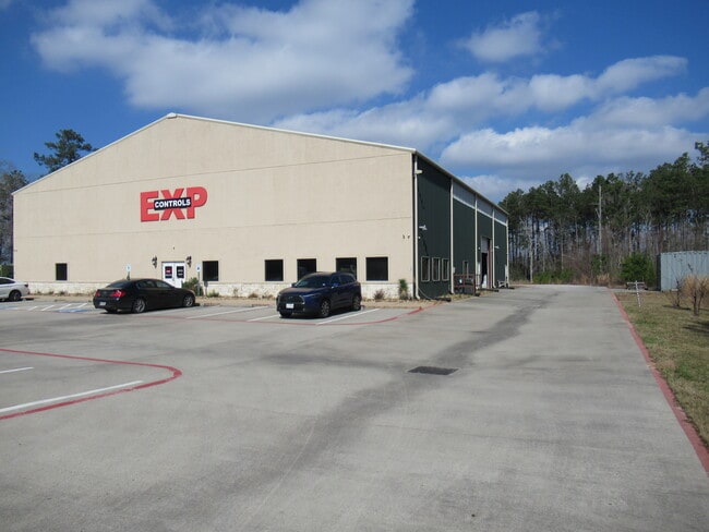
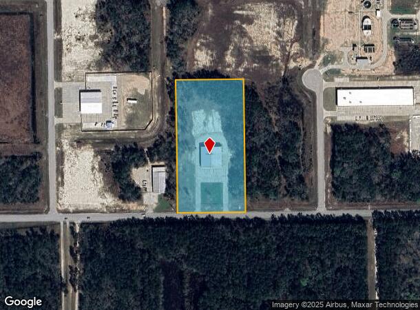
21061 Gene Campbell Blvd, New Caney, TX 77357

NEARBY LISTINGS FOR SALE OR LEASE
Property Detail
21061 Gene Campbell Blvd
4522-03-01400
East Mont Co Imp Dist Industrial Park 03
Commercialnec
S452203 - EAST MONT CO IMP DIST INDUSTRIAL PARK 03, RES M, ACRES 5
X
Montgomery
48339C0575G
Texas
2024
5 AC
2025
The Woodlands/Conroe
692603
Houston
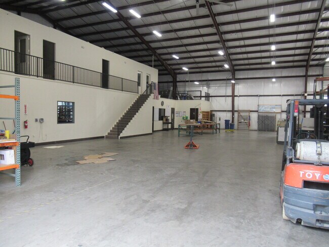
13,000 SF
Houston-The Woodlands-Sugar Land, TX
DEMOGRAPHICS near 21061 Gene Campbell Blvd
1 Mile
3 Mile
5 Mile
2024 Total Population
179
20,161
59,281
2029 Population
218
24,809
73,538
Pop Growth 2024-2029
+ 21.79%
+ 23.05%
+ 24.05%
Average Age
34
34
35
2024 Total Households
57
6,256
18,851
HH Growth 2024-2029
+ 22.81%
+ 23.31%
+ 24.28%
Median Household Inc
$93,749
$62,532
$79,622
Avg Household Size
3.10
3.10
3.10
2024 Avg HH Vehicles
2.00
2.00
2.00
Median Home Value
$192,856
$200,850
$214,220
Median Year Built
2006
2002
2004
Nearby Places
Map Layers
Map Styles
 Street
 Aerial
- Restaurants
- Banks
- Shops
- Fitness
- Groceries
PUBLIC TRANSPORTATION
AIRPORT
George Bush Intcntl/Houston
DRIVE
WALK
Distance
George Bush Intcntl/Houston
32 min
23.3 mi
Freight Ports
Port of Houston
DRIVE
WALK
Distance
Port of Houston
53 min
38.6 mi
SALE & LEASE HISTORY
LISTING DATE
SALE/LEASE

Feb 11, 2025
For Lease
Apr 10, 2025
For Sale
Nearby Properties
Address
Land Use
TOTAL SIZE
Lot Size
Zoning
Address
Land Use
TOTAL SIZE
Lot Size
Zoning
1,500,000 SF
86.90 AC
5
Address
Land Use
TOTAL SIZE
Lot Size
Zoning
430,982 SF
21.50 AC
Address
Land Use
TOTAL SIZE
Lot Size
Zoning
1,014,160 SF
132.38 AC
Address
Land Use
TOTAL SIZE
Lot Size
Zoning
149,963 SF
49.98 AC
Address
Land Use
TOTAL SIZE
Lot Size
Zoning
131,364 SF
4.63 AC
5
Address
Land Use
TOTAL SIZE
Lot Size
Zoning
148,358 SF
16.01 AC
Address
Land Use
TOTAL SIZE
Lot Size
Zoning
29.71 AC
5
Address
Land Use
TOTAL SIZE
Lot Size
Zoning
89,279 SF
23.57 AC
5
Address
Land Use
TOTAL SIZE
Lot Size
Zoning
130,578 SF
11.57 AC
5
Address
Land Use
TOTAL SIZE
Lot Size
Zoning
90,133 SF
11.91 AC
5
Address
Land Use
TOTAL SIZE
Lot Size
Zoning
61,628 SF
30.91 AC
5
Address
Land Use
TOTAL SIZE
Lot Size
Zoning
65,640 SF
9.37 AC
Address
Land Use
TOTAL SIZE
Lot Size
Zoning
86,744 SF
4.54 AC
5
Address
Land Use
TOTAL SIZE
Lot Size
Zoning
38,967 SF
8.22 AC
Address
Land Use
TOTAL SIZE
Lot Size
Zoning
62,684 SF
11.67 AC
Address
Land Use
TOTAL SIZE
Lot Size
Zoning
15,000 SF
1.57 AC
Address
Land Use
TOTAL SIZE
Lot Size
Zoning
62,788 SF
4 AC
Address
Land Use
TOTAL SIZE
Lot Size
Zoning
26.28 AC
Address
Land Use
TOTAL SIZE
Lot Size
Zoning
52,796 SF
6.58 AC
Address
Land Use
TOTAL SIZE
Lot Size
Zoning
48,405 SF
30.58 AC
5
Address
Land Use
TOTAL SIZE
Lot Size
Zoning
6,716 SF
1.21 AC
Address
Land Use
TOTAL SIZE
Lot Size
Zoning
43,820 SF
8.78 AC
Address
Land Use
TOTAL SIZE
Lot Size
Zoning
23.63 AC
5
Address
Land Use
TOTAL SIZE
Lot Size
Zoning
31,428 SF
17.52 AC
Address
Land Use
TOTAL SIZE
Lot Size
Zoning
77,118 SF
5.64 AC
5
Address
Land Use
TOTAL SIZE
Lot Size
Zoning
45,120 SF
9.73 AC
Address
Land Use
TOTAL SIZE
Lot Size
Zoning
8,680 SF
50 AC
5
Address
Land Use
TOTAL SIZE
Lot Size
Zoning
144 SF
19.94 AC
5
Address
Land Use
TOTAL SIZE
Lot Size
Zoning
7,157 SF
27.30 AC
5
Address
Land Use
TOTAL SIZE
Lot Size
Zoning
49,320 SF
3 AC
5
The World's #1 Commercial Real Estate Marketplace
Connect with us
© 2025 CoStar Group
The information above has been obtained from sources believed reliable. While we do not doubt its accuracy we have not verified it and make no guarantee, warranty or representation about it. It is your responsibility to independently confirm its accuracy and completeness. Any projections, opinions, assumptions, or estimates used are for example only and do not represent the current or future performance of the property. The value of this transaction to you depends on tax and other factors which should be evaluated by your tax, financial, and legal advisors. You and your advisors should conduct a careful, independent investigation of the property to determine to your satisfaction the suitability of the property for your needs.