Property Record
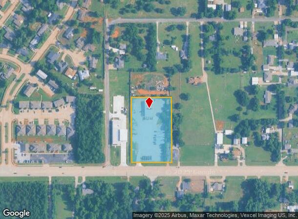
2107 E State Highway 152, Mustang, OK 73064


NEARBY LISTINGS FOR SALE OR LEASE
Property Detail
2107 E State Highway 152
090005341
T11N R05W S25 SE4 A#8 &; A#88 PT SE4; A#8 - BEG 164.61E &; 324.3N OF SW/C, TH E264 N165 W264 S165 TPB &; A#88 - BEG 164.61E &; 60N OF SW/C, TH E263.22 N264.3 W264 S264.3 TPB
Officebuilding
Canadian
X
Oklahoma
40027C0025J
2.63 AC
2024
Canadian County
2025
Oklahoma City
301406
Oklahoma City, OK
5,000 SF
DEMOGRAPHICS near 2107 E State Highway 152
1 mile
3 mile
5 mile
2024 Total Population
3,300
25,663
61,768
2029 Population
3,888
29,769
73,864
Pop Growth 2024-2029
+ 17.82%
+ 16.00%
+ 19.58%
Average Age
40
38
37
2024 Total Households
1,211
8,730
21,839
HH Growth 2024-2029
+ 18.17%
+ 16.88%
+ 20.04%
Median Household Inc
$90,056
$86,847
$85,738
Avg Household Size
2.70
2.80
2.70
2024 Avg HH Vehicles
2.00
2.00
2.00
Median Home Value
$187,890
$208,914
$209,641
Median Year Built
1984
2002
2003
Nearby Places
Map Layers
Map Styles
 Street
 Aerial
Transit
 Traffic
 Biking
Places
Listings with unknown addresses are not visible on the map
- Restaurants
- Banks
- Shops
- Fitness
- Groceries
PUBLIC TRANSPORTATION
AIRPORT
Will Rogers World
Drive
Walk
Distance
Will Rogers World
18 min
8.6 mi
Freight Ports
Port of Shreveport
Drive
Walk
Distance
Port of Shreveport
443 min
405.6 mi
SALE & LEASE HISTORY
LISTING DATE
SALE/LEASE

Oct 29, 2019
For Lease
Oct 05, 2022
For Lease
Mar 03, 2021
For Sale
Nearby Properties
Address
Land Use
TOTAL SIZE
Lot Size
Zoning
Address
Land Use
TOTAL SIZE
Lot Size
Zoning
292,053 SF
18.36 AC
Address
Land Use
TOTAL SIZE
Lot Size
Zoning
51,628 SF
2.38 AC
Address
Land Use
TOTAL SIZE
Lot Size
Zoning
1,636 SF
0.77 AC
Address
Land Use
TOTAL SIZE
Lot Size
Zoning
52,170 SF
14.24 AC
Address
Land Use
TOTAL SIZE
Lot Size
Zoning
2,141,947 SF
98.48 AC
I-2
Address
Land Use
TOTAL SIZE
Lot Size
Zoning
57,121 SF
155.38 AC
Address
Land Use
TOTAL SIZE
Lot Size
Zoning
653,359 SF
142.11 AC
I-2
Address
Land Use
TOTAL SIZE
Lot Size
Zoning
30,650 SF
5 AC
Address
Land Use
TOTAL SIZE
Lot Size
Zoning
43,556 SF
9.08 AC
Address
Land Use
TOTAL SIZE
Lot Size
Zoning
13,728 SF
7.70 AC
Address
Land Use
TOTAL SIZE
Lot Size
Zoning
33,313 SF
9.24 AC
Address
Land Use
TOTAL SIZE
Lot Size
Zoning
30,434 SF
0.45 AC
Address
Land Use
TOTAL SIZE
Lot Size
Zoning
784,972 SF
68.99 AC
I-2
Address
Land Use
TOTAL SIZE
Lot Size
Zoning
17,582 SF
4.34 AC
Address
Land Use
TOTAL SIZE
Lot Size
Zoning
50,402 SF
2.42 AC
Address
Land Use
TOTAL SIZE
Lot Size
Zoning
9,800 SF
4.37 AC
Address
Land Use
TOTAL SIZE
Lot Size
Zoning
212,376 SF
9.93 AC
Address
Land Use
TOTAL SIZE
Lot Size
Zoning
16,100 SF
4.20 AC
Address
Land Use
TOTAL SIZE
Lot Size
Zoning
10,871 SF
3.68 AC
Address
Land Use
TOTAL SIZE
Lot Size
Zoning
143,450 SF
21.45 AC
Address
Land Use
TOTAL SIZE
Lot Size
Zoning
538,787 SF
34.39 AC
I-2
Address
Land Use
TOTAL SIZE
Lot Size
Zoning
9.28 AC
I-2
Address
Land Use
TOTAL SIZE
Lot Size
Zoning
9,928 SF
2.25 AC
Address
Land Use
TOTAL SIZE
Lot Size
Zoning
7,020 SF
0.58 AC
Address
Land Use
TOTAL SIZE
Lot Size
Zoning
2,258 SF
17.93 AC
Address
Land Use
TOTAL SIZE
Lot Size
Zoning
305,154 SF
33.30 AC
I-2
Address
Land Use
TOTAL SIZE
Lot Size
Zoning
504 SF
16.38 AC
Address
Land Use
TOTAL SIZE
Lot Size
Zoning
257,100 SF
33.19 AC
I-2
Address
Land Use
TOTAL SIZE
Lot Size
Zoning
223,600 SF
25.57 AC
I-2
Address
Land Use
TOTAL SIZE
Lot Size
Zoning
14,005 SF
10 AC
The World's #1 Commercial Real Estate Marketplace
Connect with us
© 2026 CoStar Group
The information above has been obtained from sources believed reliable. While we do not doubt its accuracy we have not verified it and make no guarantee, warranty or representation about it. It is your responsibility to independently confirm its accuracy and completeness. Any projections, opinions, assumptions, or estimates used are for example only and do not represent the current or future performance of the property. The value of this transaction to you depends on tax and other factors which should be evaluated by your tax, financial, and legal advisors. You and your advisors should conduct a careful, independent investigation of the property to determine to your satisfaction the suitability of the property for your needs.