Property Record
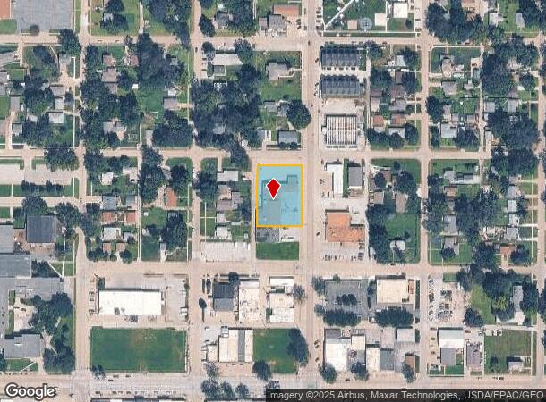
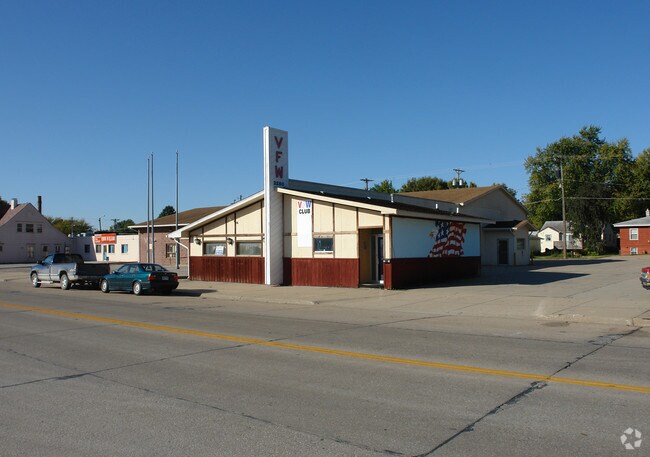
2108 Franklin St, Bellevue, NE 68005

NEARBY LISTINGS FOR SALE OR LEASE
-
-
View all Bellevue listings for sale on LoopNet.com
Property Detail
2108 Franklin St
Omaha-Council Bluffs, NE-IA
Bellevue
010634762
LOTS 7-10 BLOCK 175 BELLEVUE
Charitableorganization
Sarpy
X
Nebraska
31153C0095G
7-10
0
0.83 AC
2025
Southeast Omaha
010106
Omaha/Council Bluffs
8,096 SF
DEMOGRAPHICS near 2108 Franklin St
1 Mile
3 Mile
5 Mile
2024 Total Population
8,473
26,576
73,477
2029 Population
9,121
28,607
78,924
Pop Growth 2024-2029
+ 7.65%
+ 7.64%
+ 7.41%
Average Age
38
39
37
2024 Total Households
3,482
10,718
27,571
HH Growth 2024-2029
+ 7.81%
+ 7.82%
+ 7.64%
Median Household Inc
$49,250
$60,864
$71,595
Avg Household Size
2.30
2.40
2.60
2024 Avg HH Vehicles
2.00
2.00
2.00
Median Home Value
$148,967
$185,645
$223,626
Median Year Built
1964
1972
1984
Nearby Places
Map Layers
Map Styles
 Street
 Aerial
- Restaurants
- Banks
- Shops
- Fitness
- Groceries
PUBLIC TRANSPORTATION
COMMUTER RAIL
Omaha Amtrak Station (California Zephyr - Amtrak)
DRIVE
WALK
Distance
Omaha Amtrak Station (California Zephyr - Amtrak)
16 min
9.1 mi
Omaha Amtrak Station (California Zephyr - Amtrak)
DRIVE
WALK
Distance
Omaha Amtrak Station (California Zephyr - Amtrak)
17 min
9.3 mi
AIRPORT
Eppley Airfield
DRIVE
WALK
Distance
Eppley Airfield
26 min
15.0 mi
Freight Ports
Tulsa Port Of Catoosa
DRIVE
WALK
Distance
Tulsa Port Of Catoosa
453 min
408.0 mi
Nearby Properties
Address
Land Use
TOTAL SIZE
Lot Size
Zoning
Address
Land Use
TOTAL SIZE
Lot Size
Zoning
272,760 SF
2.40 AC
Address
Land Use
TOTAL SIZE
Lot Size
Zoning
17,155 SF
13.11 AC
Address
Land Use
TOTAL SIZE
Lot Size
Zoning
24,969 SF
3.79 AC
RG20
Address
Land Use
TOTAL SIZE
Lot Size
Zoning
10,052 SF
9.38 AC
Address
Land Use
TOTAL SIZE
Lot Size
Zoning
160,000 SF
22.48 AC
Address
Land Use
TOTAL SIZE
Lot Size
Zoning
254,734 SF
18.90 AC
Address
Land Use
TOTAL SIZE
Lot Size
Zoning
18,825 SF
15.18 AC
Address
Land Use
TOTAL SIZE
Lot Size
Zoning
119,396 SF
13.46 AC
Address
Land Use
TOTAL SIZE
Lot Size
Zoning
3.95 AC
Address
Land Use
TOTAL SIZE
Lot Size
Zoning
1,850 SF
8.14 AC
Address
Land Use
TOTAL SIZE
Lot Size
Zoning
400 SF
23.26 AC
Address
Land Use
TOTAL SIZE
Lot Size
Zoning
42,900 SF
16.25 AC
Address
Land Use
TOTAL SIZE
Lot Size
Zoning
2,032 SF
8.67 AC
Address
Land Use
TOTAL SIZE
Lot Size
Zoning
62,735 SF
0.65 AC
Address
Land Use
TOTAL SIZE
Lot Size
Zoning
212,990 SF
8.75 AC
MH
Address
Land Use
TOTAL SIZE
Lot Size
Zoning
1,103 SF
9.27 AC
Address
Land Use
TOTAL SIZE
Lot Size
Zoning
63,669 SF
6.58 AC
Address
Land Use
TOTAL SIZE
Lot Size
Zoning
18,752 SF
7.06 AC
Address
Land Use
TOTAL SIZE
Lot Size
Zoning
2,328 SF
6.18 AC
Address
Land Use
TOTAL SIZE
Lot Size
Zoning
131,549 SF
6.13 AC
Address
Land Use
TOTAL SIZE
Lot Size
Zoning
Address
Land Use
TOTAL SIZE
Lot Size
Zoning
74,586 SF
4.24 AC
Address
Land Use
TOTAL SIZE
Lot Size
Zoning
48,199 SF
2.73 AC
Address
Land Use
TOTAL SIZE
Lot Size
Zoning
24,599 SF
4.36 AC
Address
Land Use
TOTAL SIZE
Lot Size
Zoning
67,107 SF
7.59 AC
Address
Land Use
TOTAL SIZE
Lot Size
Zoning
37,466 SF
3.60 AC
Address
Land Use
TOTAL SIZE
Lot Size
Zoning
79,895 SF
4.81 AC
Address
Land Use
TOTAL SIZE
Lot Size
Zoning
7,778 SF
3.31 AC
Address
Land Use
TOTAL SIZE
Lot Size
Zoning
4,864 SF
7.19 AC
The World's #1 Commercial Real Estate Marketplace
Connect with us
© 2025 CoStar Group
The information above has been obtained from sources believed reliable. While we do not doubt its accuracy we have not verified it and make no guarantee, warranty or representation about it. It is your responsibility to independently confirm its accuracy and completeness. Any projections, opinions, assumptions, or estimates used are for example only and do not represent the current or future performance of the property. The value of this transaction to you depends on tax and other factors which should be evaluated by your tax, financial, and legal advisors. You and your advisors should conduct a careful, independent investigation of the property to determine to your satisfaction the suitability of the property for your needs.